Enable Location

We need your location to show you interesting places around you

Discover nearby places

Find interesting locations and hidden gems around you

Precise directions

Get accurate directions and distances to places

Your location is never shared with other users. It's only used when you tap the location button.

Log in to your account

Start exploring — it's free

Trusted by 68,092 travelers worldwide

Continue with Google
Continue with Apple
or

We will send you a code to connect

By continuing, you accept our Terms and Conditions and our Privacy Policy

Check your inbox

We've sent a pincode in your inbox. Please enter the code below.

Discussion Reviews Photo
3.8k Popularity

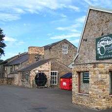
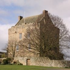
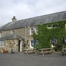
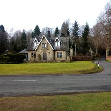
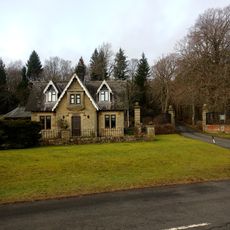
Otterburn Tower, English country house in Otterburn, England.

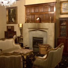
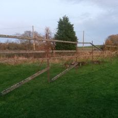
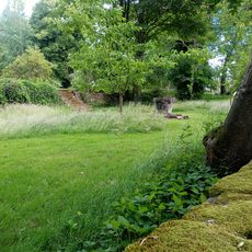
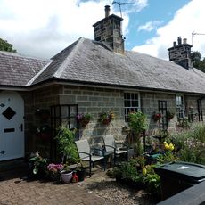
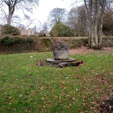
Otterburn Tower is a three-story stone building with distinctive architectural features, surrounded by 32 acres of deer park and woodland. The estate sits within Northumberland National Park and now operates as a country house hotel.

The building was constructed in 1086 by a cousin of William the Conqueror and witnessed the Battle of Otterburn in 1388 between English and Scottish forces. This clash marked a turning point in the region's border conflicts.

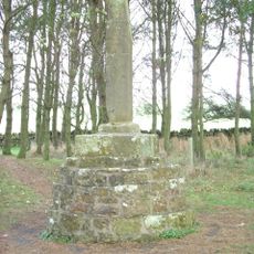
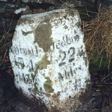
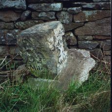
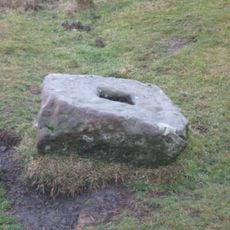
The grounds hold three Roman altar stones from a nearby fort and stone circles marking ancient burial sites. These archaeological finds reveal the long history of settlement in this Northumberland region.

The hotel is easily accessible from major roads and offers guided tours plus fishing opportunities along the River Rede. Visitors can combine accommodation with outdoor activities on the extensive grounds.

The northwestern corner preserves sections of the original castle walls, while initials of Jacobite rebel Mad Jack Hall are carved above a doorway. This carving marks a hidden connection to the Scottish uprising.

The community of curious travelers

AroundUs brings together thousands of curated places, local tips, and hidden gems, enriched daily by 60,000 contributors worldwide.

Start exploring
Location
GPS coordinates
55.23250,-2.17778
Latest update
December 11, 2025 18:07
Around this place
Otterburn Hall
United Kingdom

Otterburn Hall

1.2 km
Elsdon Castle
United Kingdom

Elsdon Castle

5 km
Otterburn Mill
United Kingdom

Otterburn Mill

165 m
Elsdon Tower
United Kingdom

Elsdon Tower

4.8 km
Percy Cross
United Kingdom

Percy Cross

1.2 km
St Cuthbert's Church, Elsdon
United Kingdom

St Cuthbert's Church, Elsdon

4.8 km
St John the Evangelist's Church, Otterburn
United Kingdom

St John the Evangelist's Church, Otterburn

249 m
Church of the Holy Trinity
United Kingdom

Church of the Holy Trinity

6.2 km
Church of St Cuthbert
United Kingdom

Church of St Cuthbert

3.9 km
East Woodburn Bridge
United Kingdom

East Woodburn Bridge

5.7 km
Milestone South West Of Church Of The Holy Trinity At Ngr 842971
United Kingdom

Milestone South West Of Church Of The Holy Trinity At Ngr 842971

6 km
The Redesdale Arms
United Kingdom

The Redesdale Arms

5.7 km
Milestone, East Otterburn
United Kingdom

Milestone, East Otterburn

379 m
Romano-British farmstead 330m west of Rattenraw Farm
United Kingdom

Romano-British farmstead 330m west of Rattenraw Farm

4.5 km
Tenters C.40 Yards South-East Of Otterburn Mill
United Kingdom

Tenters C.40 Yards South-East Of Otterburn Mill

444 m
Fountain Base C.80 Yards South Of Otterburn Tower
United Kingdom

Fountain Base C.80 Yards South Of Otterburn Tower

110 m
Gate And Gateway By South Lodge To Otterburn Hall
United Kingdom

Gate And Gateway By South Lodge To Otterburn Hall

1 km
Milestone South Of Shittleheugh Bridge At Ngr 869943
United Kingdom

Milestone South Of Shittleheugh Bridge At Ngr 869943

2.9 km
4 And 5, Bank Foot
United Kingdom

4 And 5, Bank Foot

284 m
Milestone C.1/2 Mile West-North-West Of Otterburn
United Kingdom

Milestone C.1/2 Mile West-North-West Of Otterburn

1.1 km
Milestone Circa A Quarter Of A Mile West Of Raylees
United Kingdom

Milestone Circa A Quarter Of A Mile West Of Raylees

3.6 km
Bleach House Circa 20 Yards South East Of Otterburn Mills
United Kingdom

Bleach House Circa 20 Yards South East Of Otterburn Mills

389 m
South Lodge to Otterburn Hall
United Kingdom

South Lodge to Otterburn Hall

1 km
Milestone By Bennetsfield Farm
United Kingdom

Milestone By Bennetsfield Farm

4.4 km
Milestone Circa 1000 Yards South Of Blaxter Cottages
United Kingdom

Milestone Circa 1000 Yards South Of Blaxter Cottages

6.3 km
Medieval wayside cross, 200m NNW of Brownrigg
United Kingdom

Medieval wayside cross, 200m NNW of Brownrigg

3.5 km
Sundial C.50 Yards South-East Of Otterburn Tower
United Kingdom

Sundial C.50 Yards South-East Of Otterburn Tower

62 m
Gatepiers, Garden Walls, Railings And Sundial, Circa 30 Yards South Of Overacres
United Kingdom

Gatepiers, Garden Walls, Railings And Sundial, Circa 30 Yards South Of Overacres

2.1 km
Show the full map
Reviews
Share your experience

No review yet

Discussions
Start a discussion...

No discussion yet

« Otterburn Tower - English country house in Otterburn, England » is provided by Around Us (aroundus.com). Images and texts are derived from Wikimedia project under a Creative Commons license. You are allowed to copy, distribute, and modify copies of this page, under the conditions set by the license, as long as this note is clearly visible.

Discover hidden gems everywhere you go!

From secret cafés to breathtaking viewpoints, skip the crowded tourist spots and find places that match your style. Our app makes it easy with voice search, smart filtering, route optimization, and insider tips from travelers worldwide. Download now for the complete mobile experience.

Around Us App Screenshot

A unique approach to discovering new places

Le Figaro

All the places worth exploring

France Info

A tailor-made excursion in just a few clicks

20 Minutes

Around Us
Travel Guide & Maps
Download

Send to your phone

QR Code
1

Open the camera app on your mobile.

2

Point at the QR code with your camera. A notification will appear.

3

Tap the notification to open the link.