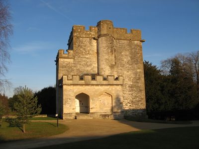
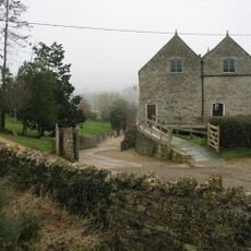
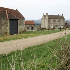
Newton St Loe Castle, Medieval fortified manor house in Newton St Loe, England
Newton St Loe Castle is a medieval fortified manor built around a rectangular courtyard with towers at each corner. The three-story keep and gatehouse remain the most substantially preserved elements of the original structure.
Construction of the castle began around 1350 under the de Paveleys family, establishing it as a significant noble residence. Ownership later transferred through inheritance, including a period held by John de Sancto Laudo.
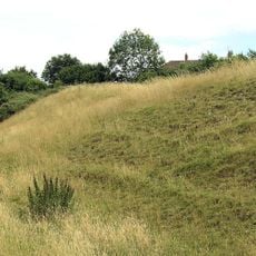
The castle represented wealth and status for the noble families who lived here, with its layout designed to showcase power through hunting grounds and fortified structures. The site still conveys how medieval landowners displayed their importance through architecture and land use.
The ruins are located on Bath Spa University grounds and access is restricted due to ongoing use as educational facilities. It is best to contact the university in advance to arrange a visit and learn about any access limitations.
The gatehouse features one of England's earliest gunports, showing how defensive architecture evolved from medieval to more modern systems. This detail makes the site valuable for understanding the transition in how castles were designed to handle firearms.
Location: Newton St Loe
Inception: 14 century
Floors above the ground: 3
GPS coordinates: 51.37400,-2.44097
Latest update: December 14, 2025 09:45
Alfred Jewel
78 m
Newton Park
260 m
Kelston Park
2.3 km
Stantonbury Camp
2.2 km
Culverhay Castle
2.7 km
Church of the Holy Trinity, Newton St Loe
1.2 km
Church of St Peter, Englishcombe
2.5 km
Newton St Loe SSSI
2.7 km
Church of St Lawrence, Stanton Prior
2 km
Priston Mill And Attached Pond, Dam And Walls
2.4 km
Church of All Saints
1.3 km
New Bridge
2.9 km
The Turnpike
2.6 km
Boundary Post At Ngr St 6967 6527
1.3 km
The Old Rectory And Garden Walls And Gatepiers To The West
1.2 km
Boundary Marker At St 6914 6621
2.3 km
Twerton Wood Tunnel West Portal
2.7 km
Tithe Barn Attached To South End Of Rectory Farmhouse
2.5 km
Milestone At National Grid Reference St 6973 6579
1.8 km
Milestone At National Grid Reference St 7085 6638
2.8 km
Milestone At National Grid Reference St 6924 6520
1.2 km
Barn And Attached Farm Buildings About 30 Metres South East Of Poplar Farm
1.8 km
Manor Farmhouse
1.2 km
Newbridge Railway Bridge
2.9 km
Park Farmhouse
692 m
Poplar Farmhouse
1.8 km
Milestone, eastbound carriageway, between Globe Inn, Corston and jct with A36
2 km
Milestone, E of Stantonbury House and Wheatsheaf PH, W of Corston
1.8 kmVisited this place? Tap the stars to rate it and share your experience / photos with the community! Try now! You can cancel it anytime.
Discover hidden gems everywhere you go!
From secret cafés to breathtaking viewpoints, skip the crowded tourist spots and find places that match your style. Our app makes it easy with voice search, smart filtering, route optimization, and insider tips from travelers worldwide. Download now for the complete mobile experience.
A unique approach to discovering new places❞
— Le Figaro
All the places worth exploring❞
— France Info
A tailor-made excursion in just a few clicks❞
— 20 Minutes