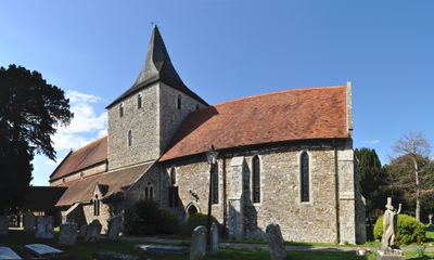
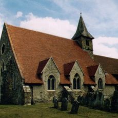
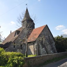
St Mary's Church, Hayling Island, Medieval parish church in Hayling Island, England
St Mary's Church, Hayling Island is a stone church standing at the highest point of the island, around 20 feet (6 meters) above sea level. The building features four sun dials on its exterior walls and contains an open interior fitted with moveable chairs rather than fixed wooden pews.
The building was constructed in the 13th century after flooding destroyed an earlier priory church on the southern edge of the island. It then became the main church for the island and received structural repairs to its supporting pillars during later restoration work.
Inside are two different fonts from different periods: one features interlacing patterns that date to the Saxon era, while another displays simpler geometric designs from the Norman period. These fonts show how the place absorbed different artistic traditions over time.
The churchyard with its ancient trees provides a calm setting to explore, while the interior has been made easier to move through with its modern layout. Visitors should note that as an older building, access arrangements may vary depending on the time of visit.
The churchyard contains an ancient yew tree with a girth of around 9 meters (30 feet) that is estimated to be between one and two thousand years old. This tree is among the oldest living organisms at the site and has stood through countless generations of visitors.
The community of curious travelers
AroundUs brings together thousands of curated places, local tips, and hidden gems, enriched daily by 60,000 contributors worldwide.