Stoke Park, Public park in Bristol, England
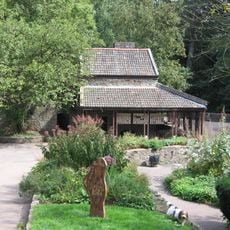
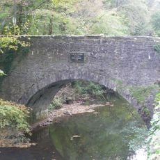
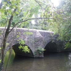
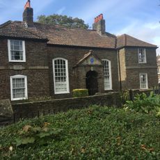
Stoke Park is a large green space in Bristol featuring woodland sections and open lawns connected by walking paths throughout the grounds. The park includes historic structures like the Dower House and multiple distinct areas that vary in character from wooded to more open.
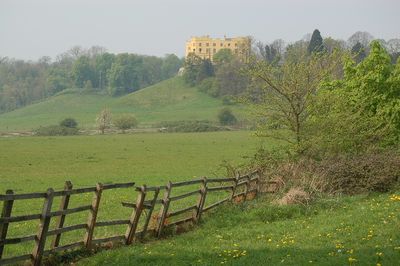
The park was designed as a landscape garden by Thomas Wright in the 1750s and 1760s surrounding a country house. During World War II the grounds served as an anti-aircraft position, a role that left physical traces still visible today.
The park serves as a community gathering space where visitors walk, play, and socialize across its open lawns and distinct sections. People use different areas depending on what they seek, from quiet woodland paths to more active gathering spots.
The park is accessible through multiple entry points that lead to winding paths connecting different areas and woodland sections. The grounds are generally easy to navigate and suitable for most visitors, with plenty of routes to explore at your own pace.
The grounds preserve World War II structures including octagonal gun emplacements and concrete shelters from its time as an anti-aircraft battery. These remnants form an unexpected historical layer within the otherwise peaceful park setting.
Location: City of Bristol
Location: Stoke Gifford
GPS coordinates: 51.49110,-2.55462
Latest update: December 8, 2025 19:40
The Dower House
668 m
MoD Abbey Wood
1.4 km
Snuff Mills
1.1 km
Purdown BT Tower
858 m
Glenside Museum
1.1 km
St Matthias
1.9 km
Frome Valley Walkway
820 m
Oldbury Court Estate
1.9 km
Church of Holy Trinity, Stapleton
1.1 km
St John the Baptist, Frenchay
2.4 km
Church of St Mary
2 km
Frenchay Bridge
2.4 km
Unitarian Chapel
2.4 km
Fishponds War Memorial
2.1 km
Frenchay Manor
2.7 km
Wickham Bridge
1 km
Boundary Marker Located At The Junction Of Thicket Road And High Street
2.9 km
Friends' Meeting House
2.7 km
Group Of Three Tombs Approximately 2 Metres North West Of Church Of St Mary
2 km
Glenside University Campus
1.1 km
Cleeve Wood Lodge
2.9 km
The Old House And Adjoining Coach House And Stables
2.5 km
Drinking Fountain In Fishponds Park
2.1 km
Stapleton Mill, Snuff Mills Park
998 m
Milestone At St 6127 7590, Approximately 40 Metres North East Of South Entrance To Purdown Hospital
1.2 km
Turnpike Boundary Post On Cleeve Road Bridge
2.9 km
Numbers 11, 13 And 15 And Attached Garden Wall
2 km
Milestone, Fishponds Road, N side of park wall
2.1 kmVisited this place? Tap the stars to rate it and share your experience / photos with the community! Try now! You can cancel it anytime.
Discover hidden gems everywhere you go!
From secret cafés to breathtaking viewpoints, skip the crowded tourist spots and find places that match your style. Our app makes it easy with voice search, smart filtering, route optimization, and insider tips from travelers worldwide. Download now for the complete mobile experience.
A unique approach to discovering new places❞
— Le Figaro
All the places worth exploring❞
— France Info
A tailor-made excursion in just a few clicks❞
— 20 Minutes