Frome Valley Walkway

Log in to your account

AroundUs is a community-driven map of interesting places, built by curious explorers like you. It grows with every review, story, and photo you share.
Connect to save your favorite spots, contribute locations, and create personalized routes.
Continue with Google
Continue with Apple
Continue with X
Continue with Facebook
Continue with email
By continuing, you accept our Terms and Conditions and our Privacy Policy
Create an account

Frome Valley Walkway

Add to collection
Map
Suggest a change
Share

Frome Valley Walkway, Riverside trail between Bristol and Cotswold Hills, England.

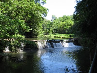
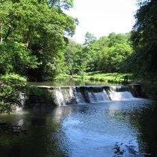
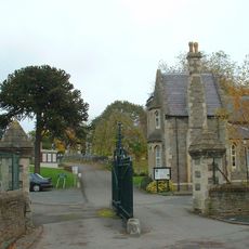
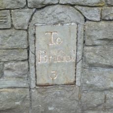
The Frome Valley Walkway is a trail that runs along the River Frome through parks, woodlands, meadows, and residential areas in South Gloucestershire. The route passes by various villages and settlements that sit along the river valley between Bristol and the surrounding countryside.

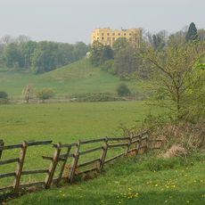
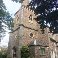
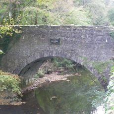
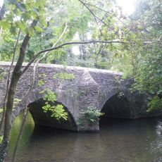
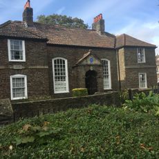
The route follows a river valley that has attracted settlements for centuries, including the medieval town of Chipping Sodbury and other historic villages. These landscapes were shaped over time by communities who built their lives along the water.

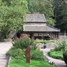
The trail connects different communities along its course, bringing together people from urban Bristol and the surrounding villages who share these green spaces. You will notice families and locals using the path regularly to explore nature near their homes.

The path is easy to walk and suitable for different fitness levels, with clear markings and multiple access points along the route. Detailed maps are available online showing the main path and additional loop options for those wanting to explore further.

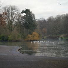
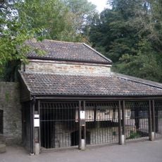
The trail provides habitat for various wildlife including kingfishers, dippers, and several bat species that become active along the river at dusk. Patient observers may spot these creatures in the quieter sections of the valley, especially in warmer months.

GPS coordinates: 51.48500,-2.54800

Latest update: December 12, 2025 12:07

Photos
Around this place
The Dower House
United Kingdom

The Dower House

897 m
MoD Abbey Wood
United Kingdom

MoD Abbey Wood

2.2 km
Stoke Park
United Kingdom

Stoke Park

820 m
Snuff Mills
United Kingdom

Snuff Mills

522 m
Purdown BT Tower
United Kingdom

Purdown BT Tower

1 km
Glenside Museum
United Kingdom

Glenside Museum

347 m
St Matthias
United Kingdom

St Matthias

1.3 km
Oldbury Court Estate
United Kingdom

Oldbury Court Estate

1.5 km
Eastville Park
United Kingdom

Eastville Park

1.3 km
Church of Holy Trinity, Stapleton
United Kingdom

Church of Holy Trinity, Stapleton

618 m
St John the Baptist, Frenchay
United Kingdom

St John the Baptist, Frenchay

2.2 km
Easton Jamia Mosque
United Kingdom

Easton Jamia Mosque

2.3 km
Church of St Mary
United Kingdom

Church of St Mary

1.3 km
Frenchay Bridge
United Kingdom

Frenchay Bridge

2.1 km
Unitarian Chapel
United Kingdom

Unitarian Chapel

2.3 km
Fishponds War Memorial
United Kingdom

Fishponds War Memorial

1.4 km
Greenbank Cemetery Pair Of Attached Mortuary Chapels
United Kingdom

Greenbank Cemetery Pair Of Attached Mortuary Chapels

1.7 km
Wickham Bridge
United Kingdom

Wickham Bridge

343 m
Entrance Gates And Piers To Greenbank Cemetery And Railings To East
United Kingdom

Entrance Gates And Piers To Greenbank Cemetery And Railings To East

1.9 km
Boundary Marker Located At The Junction Of Thicket Road And High Street
United Kingdom

Boundary Marker Located At The Junction Of Thicket Road And High Street

2.3 km
Group Of Three Tombs Approximately 2 Metres North West Of Church Of St Mary
United Kingdom

Group Of Three Tombs Approximately 2 Metres North West Of Church Of St Mary

1.3 km
Drinking Fountain In Fishponds Park
United Kingdom

Drinking Fountain In Fishponds Park

1.4 km
Glenside University Campus
United Kingdom

Glenside University Campus

354 m
Stapleton Mill, Snuff Mills Park
United Kingdom

Stapleton Mill, Snuff Mills Park

417 m
Milestone At St 6127 7590, Approximately 40 Metres North East Of South Entrance To Purdown Hospital
United Kingdom

Milestone At St 6127 7590, Approximately 40 Metres North East Of South Entrance To Purdown Hospital

902 m
Numbers 11, 13 And 15 And Attached Garden Wall
United Kingdom

Numbers 11, 13 And 15 And Attached Garden Wall

1.3 km
Milestone, Fishponds Road, jct with Oakdene Avenue
United Kingdom

Milestone, Fishponds Road, jct with Oakdene Avenue

1.3 km
Milestone, Fishponds Road, N side of park wall
United Kingdom

Milestone, Fishponds Road, N side of park wall

1.4 km
Show the full map
Reviews

Visited this place? Tap the stars to rate it and share your experience / photos with the community! Try now! You can cancel it anytime.

« Frome Valley Walkway - Riverside trail between Bristol and Cotswold Hills, England » is provided by Around Us (aroundus.com). Images and texts are derived from Wikimedia project under a Creative Commons license. You are allowed to copy, distribute, and modify copies of this page, under the conditions set by the license, as long as this note is clearly visible.

Discover hidden gems everywhere you go!

From secret cafés to breathtaking viewpoints, skip the crowded tourist spots and find places that match your style. Our app makes it easy with voice search, smart filtering, route optimization, and insider tips from travelers worldwide. Download now for the complete mobile experience.

Around Us App Screenshot

A unique approach to discovering new places

Le Figaro

All the places worth exploring

France Info

A tailor-made excursion in just a few clicks

20 Minutes