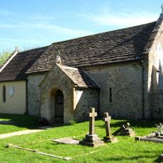
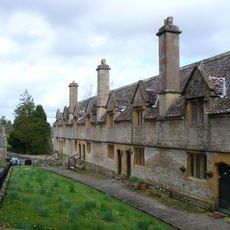
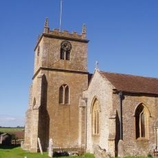
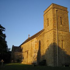
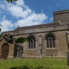
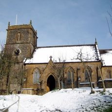
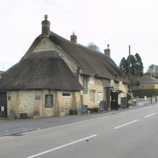
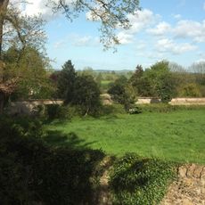
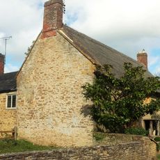
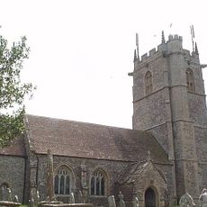
Church of Saint Michael, Medieval parish church in East Coker, England
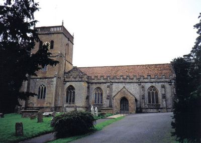
The Church of Saint Michael is a parish building with sections dating to the late 12th century, featuring a northeast tower added in 1791. Inside, eight bells cast between 1770 and 1771 remain in use for services and ringing.
The building was founded in the late 12th century and evolved through subsequent centuries, with the northeast tower added in 1791 marking a significant update. Records show that from the 13th century onward, rectors were appointed by the lord of Coker Court, reflecting how manorial authority shaped church leadership.
The dedication to Saint Michael reflects a common choice for English parish churches, honoring the archangel as a protector and guide. This naming tradition shaped how the building was understood and used within the local community over centuries.
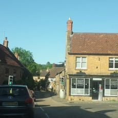
Visitors will find a functioning parish church that remains in active use for worship, so opening hours follow typical service schedules. Access is usually straightforward, though it is wise to check ahead about visiting times, especially on weekdays.
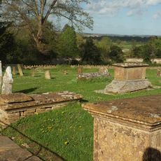
The south transept window displays the coat of arms of the Helyar family, former local landowners whose influence extended to church decorations. The ashes of poet T.S. Eliot rest here, creating a literary connection between his poem 'East Coker' and this actual parish building.
Location: East Coker
Website: http://eastcokerchurch.org.uk
GPS coordinates: 50.90730,-2.65727
Latest update: December 12, 2025 14:24
Naish Priory
1.5 km
Coker Court
141 m
Church of All Saints, Sutton Bingham
1.5 km
Helyar Almshouses
155 m
Hardington Moor
2.5 km
Church of Saint Martin of Tours
2.6 km
Church of Saint Roch
2.5 km
Church of Saint Mary Magdalene
2.5 km
Church of Saint Mary
2.7 km
Church of All Saints, Closworth
3.3 km
Helyar Arms Public House
265 m
Milestone, Built Into Boundary Wall, Four Acres Hotel
2.4 km
The Castle Public House
2.8 km
Silverweed Cottage
271 m
Needle Obelisk At Ngr St 559 129
2.2 km
Jack The Treacle Eater
3.2 km
The Walls To The Kitchen Garden, Approximately 30 Metres North North West Of Coker Court
87 m
Milestone In Boundary Wall
2.7 km
Slade's Farm House
318 m
Goodman Chest Tomb, In The Churchyard 1.5 Metres North Of The North Porch, Church Of Saint Michael
17 m
Barn, 50 Metres North Of Key Farm House
2.1 km
Signpost At Ngr 51871219
2 km
Pavyotts Mill House
1.7 km
Milestone, 83M South-West Of The Junction Between West Coker Road (A30) And Camp Road
2.2 km
1 and 3, East Street
2.5 km
Collins Chest Tomb, 2 Metres South Of The South East Nave Window, Church Of All Saints
3.3 km
Milestone, Stoford village, opp. Garage
3.1 km
Sutton Bingham Reservoir
1.4 kmVisited this place? Tap the stars to rate it and share your experience / photos with the community! Try now! You can cancel it anytime.
Discover hidden gems everywhere you go!
From secret cafés to breathtaking viewpoints, skip the crowded tourist spots and find places that match your style. Our app makes it easy with voice search, smart filtering, route optimization, and insider tips from travelers worldwide. Download now for the complete mobile experience.
A unique approach to discovering new places❞
— Le Figaro
All the places worth exploring❞
— France Info
A tailor-made excursion in just a few clicks❞
— 20 Minutes