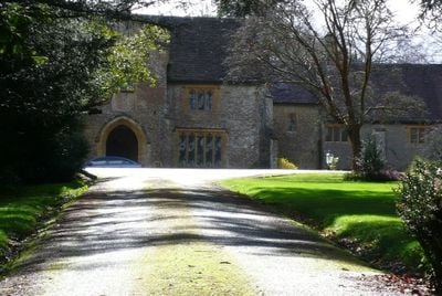
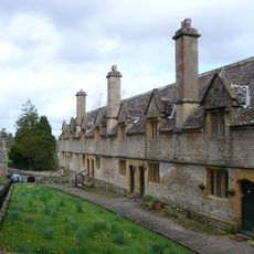
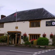
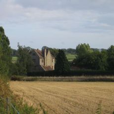
Coker Court, Manor house in East Coker, England.
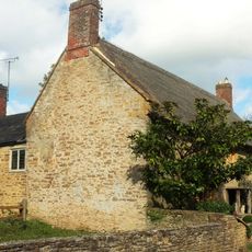
Coker Court is a substantial manor house in East Coker built from local Hamstone stone with ashlar dressings and stone tile roofs throughout its structure. The building extends across seven bays and displays carefully executed craftsmanship in its architectural details.
The manor was originally built by the Courtenay family in the early 1400s. Archdeacon Helyar acquired it in 1616 and made substantial alterations that significantly changed its appearance.
The manor displays Chinese wallpaper and lacquerwork in certain interior rooms, blending English architectural traditions with international decorative influences. Visitors can observe this unusual mix of styles while moving through the spaces.
The manor is currently divided into separate residential units and continues to function as a private residence. Visitors should note that the property is privately owned and may not be accessible without prior arrangement.
The manor served as a filming location for the 1996 film adaptation of Jane Austen's Emma, showcasing its historic architecture on screen. This connection to cinema history has placed the building in popular memory.
Location: East Coker
GPS coordinates: 50.90690,-2.65917
Latest update: December 14, 2025 09:42
Naish Priory
1.5 km
Church of Saint Michael
141 m
Church of All Saints, Sutton Bingham
1.5 km
Helyar Almshouses
267 m
Hardington Moor
2.4 km
Church of Saint Martin of Tours
2.5 km
Church of Saint Roch
2.4 km
Church of Saint Mary Magdalene
2.7 km
Church of Saint Mary
2.5 km
Church of All Saints, Closworth
3.4 km
Helyar Arms Public House
402 m
Milestone, Built Into Boundary Wall, Four Acres Hotel
2.4 km
Needle Obelisk At Ngr St 559 129
2.3 km
Silverweed Cottage
411 m
The Castle Public House
2.7 km
Jack The Treacle Eater
3.3 km
Milestone In Boundary Wall
2.8 km
The Walls To The Kitchen Garden, Approximately 30 Metres North North West Of Coker Court
220 m
Slade's Farm House
458 m
Goodman Chest Tomb, In The Churchyard 1.5 Metres North Of The North Porch, Church Of Saint Michael
146 m
Barn, 50 Metres North Of Key Farm House
2.3 km
Signpost At Ngr 51871219
1.9 km
Pavyotts Mill House
1.8 km
Milestone, 83M South-West Of The Junction Between West Coker Road (A30) And Camp Road
2.2 km
1 and 3, East Street
2.4 km
Collins Chest Tomb, 2 Metres South Of The South East Nave Window, Church Of All Saints
3.4 km
Milestone, Stoford village, opp. Garage
3.3 km
Sutton Bingham Reservoir
1.5 kmVisited this place? Tap the stars to rate it and share your experience / photos with the community! Try now! You can cancel it anytime.
Discover hidden gems everywhere you go!
From secret cafés to breathtaking viewpoints, skip the crowded tourist spots and find places that match your style. Our app makes it easy with voice search, smart filtering, route optimization, and insider tips from travelers worldwide. Download now for the complete mobile experience.
A unique approach to discovering new places❞
— Le Figaro
All the places worth exploring❞
— France Info
A tailor-made excursion in just a few clicks❞
— 20 Minutes