Enable Location

We need your location to show you interesting places around you

Discover nearby places

Find interesting locations and hidden gems around you

Precise directions

Get accurate directions and distances to places

Your location is never shared with other users. It's only used when you tap the location button.

Hardington Moor

Log in to your account

Start exploring — it's free

Trusted by 63,023 travelers worldwide

Continue with Google
Continue with Apple
or

We will send you a code to connect

By continuing, you accept our Terms and Conditions and our Privacy Policy

Check your inbox

We've sent a pincode in your inbox. Please enter the code below.

Discussion Reviews 1 Photos
1.1k Popularity

Hardington Moor

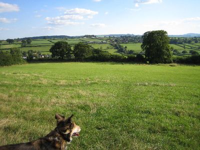
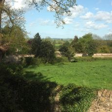
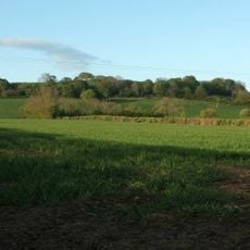
Hardington Moor is a protected nature site in Somerset covering about 8.7 hectares of open meadows where many wild grasses and flowers grow. The land slopes gently with clay soil, and it is known for rare plants like French oat-grass and green-winged orchids that bloom in late spring.

The site was officially designated as a Site of Special Scientific Interest in 1994 to protect its natural plants and wildlife. Historically, the moor was used for grazing sheep and cattle like similar lands in the region, but it was never converted to intensive farming, allowing its original character to remain intact.

The name comes from the nearby village, and today it is cared for by conservation groups who keep the traditional farming methods that allowed wild plants to thrive. The site shows how the land can be shaped by human activity while remaining a home for countless species.

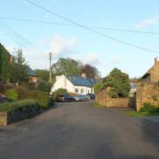
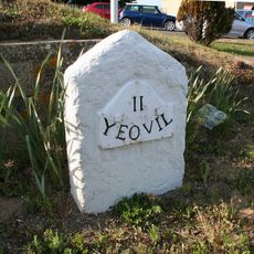
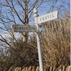
The site can be reached by car via small country roads, with the nearest train station about 2 kilometers away in Yeovil. Visitors should stay on marked paths to avoid damaging the delicate plants and disturbing wildlife.

French oat-grass grows in large numbers here, even though it is very rare in other parts of England. This special plant shows how the meadow has preserved a unique piece of natural landscape.

The community of curious travelers

AroundUs brings together thousands of curated places, local tips, and hidden gems, enriched daily by 60,000 contributors worldwide.

Start exploring
Location
GPS coordinates
50.91440,-2.69127
Latest update
February 9, 2026 07:44
Around this place
Stable block about 70 metres west of Brympton House
United Kingdom

Stable block about 70 metres west of Brympton House

2.5 km
Naish Priory
United Kingdom

Naish Priory

2.2 km
Church of Saint Michael
United Kingdom

Church of Saint Michael

2.5 km
Coker Court
United Kingdom

Coker Court

2.4 km
Helyar Almshouses
United Kingdom

Helyar Almshouses

2.5 km
Church of Saint Martin of Tours
United Kingdom

Church of Saint Martin of Tours

596 m
St Andrew's Church
United Kingdom

St Andrew's Church

2.4 km
Church of St Peter and St Paul
United Kingdom

Church of St Peter and St Paul

2.6 km
Church of Saint Roch
United Kingdom

Church of Saint Roch

2.7 km
Church of Saint Mary
United Kingdom

Church of Saint Mary

1.1 km
Church of Saint Mary
United Kingdom

Church of Saint Mary

1.6 km
Odcombe War Memorial
United Kingdom

Odcombe War Memorial

2.6 km
Brympton House
United Kingdom

Brympton House

2.5 km
Helyar Arms Public House
United Kingdom

Helyar Arms Public House

2.7 km
Milestone, Built Into Boundary Wall, Four Acres Hotel
United Kingdom

Milestone, Built Into Boundary Wall, Four Acres Hotel

693 m
The Castle Public House
United Kingdom

The Castle Public House

571 m
Silverweed Cottage
United Kingdom

Silverweed Cottage

2.7 km
The Walls To The Kitchen Garden, Approximately 30 Metres North North West Of Coker Court
United Kingdom

The Walls To The Kitchen Garden, Approximately 30 Metres North North West Of Coker Court

2.5 km
Stone At Ngr St 5082 1501
United Kingdom

Stone At Ngr St 5082 1501

2.1 km
Milestone At Ngr 49151268
United Kingdom

Milestone At Ngr 49151268

2.4 km
Goodman Chest Tomb, In The Churchyard 1.5 Metres North Of The North Porch, Church Of Saint Michael
United Kingdom

Goodman Chest Tomb, In The Churchyard 1.5 Metres North Of The North Porch, Church Of Saint Michael

2.5 km
The Chantry House The Dower House
United Kingdom

The Chantry House The Dower House

2.4 km
The Pinnacles
United Kingdom

The Pinnacles

2.1 km
Milestone, 83M South-West Of The Junction Between West Coker Road (A30) And Camp Road
United Kingdom

Milestone, 83M South-West Of The Junction Between West Coker Road (A30) And Camp Road

2.1 km
Milestone, Approximately 30M South-West Of Coker Hill Bridge
United Kingdom

Milestone, Approximately 30M South-West Of Coker Hill Bridge

1.2 km
Signpost At Ngr 51871219
United Kingdom

Signpost At Ngr 51871219

893 m
Weston House
United Kingdom

Weston House

2.3 km
1 and 3, East Street
United Kingdom

1 and 3, East Street

628 m
Show the full map
Reviews
Share your experience

No review yet

Discussions
Start a discussion...

No discussion yet

« Hardington Moor » is provided by Around Us (aroundus.com). Images and texts are derived from Wikimedia project under a Creative Commons license. You are allowed to copy, distribute, and modify copies of this page, under the conditions set by the license, as long as this note is clearly visible.

Discover hidden gems everywhere you go!

From secret cafés to breathtaking viewpoints, skip the crowded tourist spots and find places that match your style. Our app makes it easy with voice search, smart filtering, route optimization, and insider tips from travelers worldwide. Download now for the complete mobile experience.

Around Us App Screenshot

A unique approach to discovering new places

Le Figaro

All the places worth exploring

France Info

A tailor-made excursion in just a few clicks

20 Minutes

Around Us
Travel Guide & Maps
Download

Send to your phone

QR Code
1

Open the camera app on your mobile.

2

Point at the QR code with your camera. A notification will appear.

3

Tap the notification to open the link.