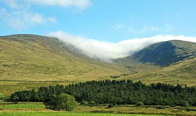
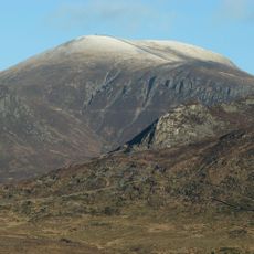
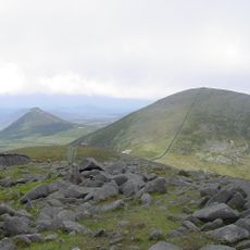
Slieve Meelmore, Mountain summit in the Mourne Mountains, Northern Ireland.
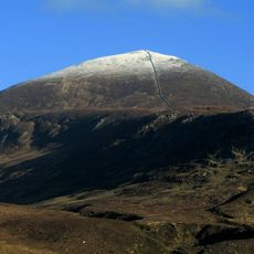
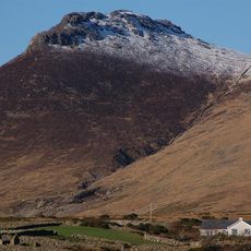
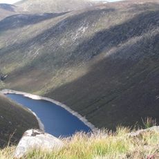
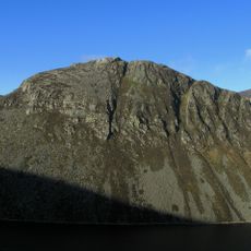
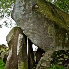
Slieve Meelmore is a mountain summit in Northern Ireland's Mourne Mountains that rises to about 704 meters. Steep slopes and granite formations shape the terrain and make it a distinctive peak in this mountain range.
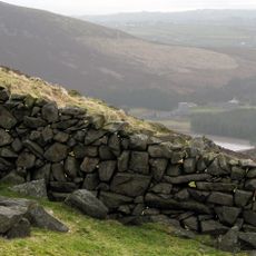
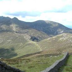
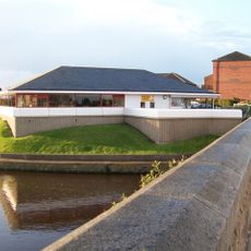
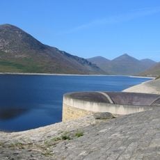
The mountain was crossed by the Mourne Wall between 1904 and 1922, a stone barrier built to mark Belfast's water catchment area. This structure connects the peak to the region's infrastructure and resource management history.
The name combines the Irish word Slieve meaning mountain with Meelmore, reflecting Gaelic tradition in the region's geography. Visitors walking here encounter this linguistic connection to local heritage and storytelling.
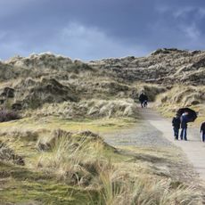
Multiple hiking trails provide access to the summit with starting points near Hilltown to the west of the mountain. The climb is best attempted in dry weather since granite slopes can become slippery when wet.
The peak was removed from the Mourne Sevens challenge list when mapping errors were corrected and its actual height proved to be just below 700 meters. This revision shows how mountain records are revised over time as surveying methods improve.
Elevation above the sea: 704 m
GPS coordinates: 54.18961,-6.00054
Latest update: December 14, 2025 14:23
Slieve Donard
5.3 km
Tollymore Forest Park
6.2 km
Royal County Down Golf Club
8.3 km
Mourne Wall
5.6 km
Slieve Binnian
5.5 km
Castlewellan Forest Park
8.9 km
Slieve Commedagh
4 km
Legananny Dolmen
14.9 km
Slieve Bearnagh
979 m
Murlough Nature Reserve
10.8 km
Ben Crom Reservoir
3.8 km
Ben Crom
2.7 km
Donard Park
6.6 km
Goward Dolmen
6.6 km
Burrenwood
7.3 km
Slieve Meelbeg
818 m
Rathfriland Castle
11.6 km
Castlewellan Castle Castlewellan Co.down
8.8 km
Annalong Cornmill
11.3 km
Peace Maze at Castlewellan Forest Park
8.3 km
Kilcoo C Of I Parish Church Bryansford Village Ballyhafry Newcastle Co Down Bt33 0pt
6.1 km
Clough Non-subscribing Presbyterian Church Castlewellan Road Clough Downpatrick Co Down Bt30 8rd
15.3 km
Newcastle Library
7.5 km
Slidderyford Bridge (the Twelve Arches) Old Ballynahinch Road Wateresk Dundrum Newcastle Co.down
10.5 km
Overflow Pipe Silent Valley Reservoir Head Road Kilkeel Newry Co Down Bt34 4pu
6.8 km
Annalong Corn Mill The Harbour Annalong Newry Co Down Bt34 4as
11.3 km
Silent Valley Reservoir
6.3 km
Spelga Reservoir
4.3 kmVisited this place? Tap the stars to rate it and share your experience / photos with the community! Try now! You can cancel it anytime.
Discover hidden gems everywhere you go!
From secret cafés to breathtaking viewpoints, skip the crowded tourist spots and find places that match your style. Our app makes it easy with voice search, smart filtering, route optimization, and insider tips from travelers worldwide. Download now for the complete mobile experience.
A unique approach to discovering new places❞
— Le Figaro
All the places worth exploring❞
— France Info
A tailor-made excursion in just a few clicks❞
— 20 Minutes