Chest opened
+${chestReward.xp} XP
Explorer
NOUVEAU ×${chestReward.collectible.quantity}
tapez pour fermer
Chest locked

Open chests in the app

Around Us is built for your phone — chests unlock when you walk, explore and capture nearby places.

Enable Location

We need your location to show you interesting places around you

Discover nearby places

Find interesting locations and hidden gems around you

Precise directions

Get accurate directions and distances to places

Your location is never shared with other users. It's only used when you tap the location button.

Blytheville

Log in to your account

Start exploring — it's free

Trusted by 72,902 travelers worldwide

Continue with Google
Continue with Apple
or

We will send you a code to connect

By continuing, you accept our Terms and Conditions and our Privacy Policy

Check your inbox

We've sent a pincode in your inbox. Please enter the code below.

Discussion Reviews 1 Photos
37.7k Popularity

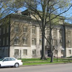
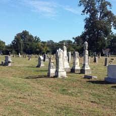
Blytheville, County seat in Mississippi County, Arkansas, United States.

Blytheville is a city in northeastern Arkansas that serves as the administrative center for Mississippi County. It sits at the heart of a rural region and functions as the main hub for local government services and community activities.

The town was founded in 1879 by Methodist minister Henry T. Blythe, after whom it is named. It received its post office in 1880 and became officially incorporated as a city in 1889.

The National Cold War Center, currently under development until 2027, will present exhibits about military operations at the former Blytheville Air Force Base.

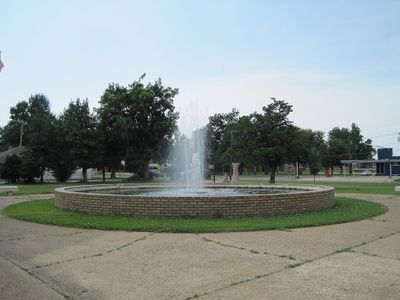
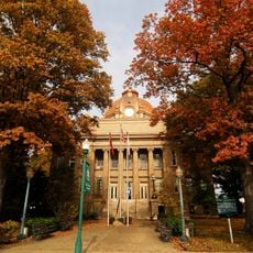
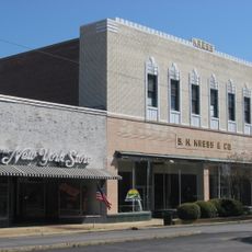
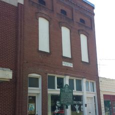
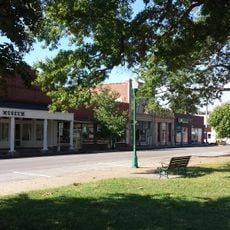
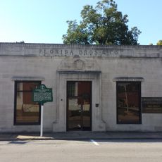
Most city services and government offices are concentrated downtown along West Main Street where visitors can find local amenities. The city offers basic facilities and services for those passing through or staying briefly.

Since 1987 the city has been home to a major Nucor steel production facility that significantly shapes local employment and industry. This industrial presence transformed what was once primarily an agricultural community into a manufacturing center.

The community of curious travelers

AroundUs brings together thousands of curated places, local tips, and hidden gems, enriched daily by 60,000 contributors worldwide.

Start exploring
Inception
1879
Elevation above the sea
78 m
GPS coordinates
35.93083,-89.91389
Latest update
December 17, 2025 10:07
Around this place
Big Lake National Wildlife Refuge
United States of America

Big Lake National Wildlife Refuge

18.4 km
Eaker Site
United States of America

Eaker Site

4.1 km
Campbell Archeological Site
United States of America

Campbell Archeological Site

16.5 km
United States of America

Chickasaw National Wildlife Refuge

26.2 km
United States Highway 61 Arch
United States of America

United States Highway 61 Arch

7.8 km
Herman Davis State Park
United States of America

Herman Davis State Park

23.6 km
Mississippi County Courthouse
United States of America

Mississippi County Courthouse

25.8 km
Mississippi County Courthouse
United States of America

Mississippi County Courthouse

891 m
United States of America

Blytheville Air Force Base Capehart Housing Historic District

5.8 km
Kress Building
United States of America

Kress Building

1.9 km
Bank of Osceola
United States of America

Bank of Osceola

25.8 km
City Hall
United States of America

City Hall

25.9 km
Violet Cemetery
United States of America

Violet Cemetery

25.7 km
Osceola Times Building
United States of America

Osceola Times Building

25.8 km
United States of America

Planters Bank Building

25.9 km
Hale Avenue Historic District
United States of America

Hale Avenue Historic District

25.9 km
West Main Street Residential Historic District
United States of America

West Main Street Residential Historic District

374 m
United States of America

Old Bell Telephone Building

25.8 km
Florida Brothers Building
United States of America

Florida Brothers Building

25.9 km
United States of America

Burdette School Complex Historic District

13.3 km
United States of America

Three States Lumber Company Mill Powerhouse

12.9 km
Chris Tompkins House
United States of America

Chris Tompkins House

13 km
United States of America

Widner-Magers Farm Historic District

13.1 km
United States of America

Half-Moon Lake

27.9 km
United States of America

Murr Theater

25.8 km
Jonesboro, Lake City & Eastern Railroad Steam Locomotive #34 and Associated Rolling Stock
United States of America

Jonesboro, Lake City & Eastern Railroad Steam Locomotive #34 and Associated Rolling Stock

23.3 km
United States of America

Mallard Lake

17.2 km
United States of America

Big Lake Country Club

23.5 km
Show the full map
Reviews
Share your experience

No review yet

Discussions
Start a discussion...

No discussion yet

« Blytheville - County seat in Mississippi County, Arkansas, United States » is provided by Around Us (aroundus.com). Images and texts are derived from Wikimedia project under a Creative Commons license. You are allowed to copy, distribute, and modify copies of this page, under the conditions set by the license, as long as this note is clearly visible.

Discover hidden gems everywhere you go!

From secret cafés to breathtaking viewpoints, skip the crowded tourist spots and find places that match your style. Our app makes it easy with voice search, smart filtering, route optimization, and insider tips from travelers worldwide. Download now for the complete mobile experience.

Around Us App Screenshot

A unique approach to discovering new places

Le Figaro

All the places worth exploring

France Info

A tailor-made excursion in just a few clicks

20 Minutes

Around Us
Travel Guide & Maps
Download

Send to your phone

QR Code
1

Open the camera app on your mobile.

2

Point at the QR code with your camera. A notification will appear.

3

Tap the notification to open the link.