Enable Location

We need your location to show you interesting places around you

Discover nearby places

Find interesting locations and hidden gems around you

Precise directions

Get accurate directions and distances to places

Your location is never shared with other users. It's only used when you tap the location button.

Log in to your account

Start exploring — it's free

Trusted by 61,983 travelers worldwide

Continue with Google
Continue with Apple
or

We will send you a code to connect

By continuing, you accept our Terms and Conditions and our Privacy Policy

Check your inbox

We've sent a pincode in your inbox. Please enter the code below.

Chickasaw National Wildlife Refuge

Chickasaw National Wildlife Refuge, National Wildlife Refuge in western Tennessee, United States

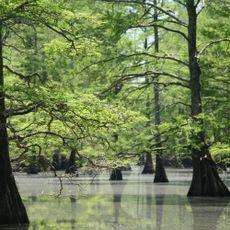
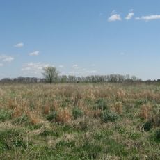
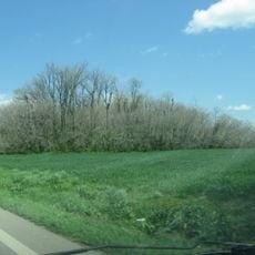
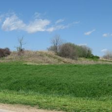
Chickasaw National Wildlife Refuge is a conservation area in western Tennessee featuring bottomland hardwood forests in the Mississippi River floodplain. The refuge includes observation towers, nature trails, and facilities for wildlife viewing and study.

The refuge was established in 1985 by the U.S. Fish and Wildlife Service on land that was previously used for timber operations. This conversion of private land into a protected area has enabled long-term conservation of this ecologically important region.

The name honors the Chickasaw, who lived in this region of Tennessee before European settlement. Today, interpretive signs and displays at the refuge tell the story of their presence in this landscape.

Access is from 1505 Sandbluff Road in Ripley with marked trails and observation areas throughout the property. Wear sturdy shoes and be aware that conditions can be muddy during wet seasons.

During spring and fall migration, the refuge becomes a stopping point for tens of thousands of waterfowl traveling between their breeding and wintering grounds. These seasonal movements create ideal viewing windows for birdwatchers throughout the year.

The community of curious travelers

AroundUs brings together thousands of curated places, local tips, and hidden gems, enriched daily by 60,000 contributors worldwide.

Start exploring
Location
Inception
1985
GPS coordinates
35.83330,-89.65000
Latest update
December 13, 2025 12:21
Around this place
West Tennessee
United States of America

West Tennessee

43.3 km
Fort Pillow State Park
United States of America

Fort Pillow State Park

28 km
Caruthersville Bridge
United States of America

Caruthersville Bridge

31.5 km
Nodena Site
United States of America

Nodena Site

41.3 km
Alex Haley House and Museum
United States of America

Alex Haley House and Museum

19 km
Big Lake National Wildlife Refuge
United States of America

Big Lake National Wildlife Refuge

43.1 km
Eaker Site
United States of America

Eaker Site

29.5 km
Murphy Mound Archeological Site
United States of America

Murphy Mound Archeological Site

35.8 km
Campbell Archeological Site
United States of America

Campbell Archeological Site

27.1 km
United States Highway 61 Arch
United States of America

United States Highway 61 Arch

29 km
Mississippi County Courthouse
United States of America

Mississippi County Courthouse

32.3 km
Edward Moody King House
United States of America

Edward Moody King House

32.3 km
Mississippi County Courthouse
United States of America

Mississippi County Courthouse

25.3 km
Caruthersville Water Tower
United States of America

Caruthersville Water Tower

40.2 km
Kress Building
United States of America

Kress Building

24.4 km
Hotel Lindo
United States of America

Hotel Lindo

29.9 km
Bank of Osceola
United States of America

Bank of Osceola

32.1 km
City Hall
United States of America

City Hall

32.4 km
Lauderdale County Courthouse
United States of America

Lauderdale County Courthouse

14.5 km
Osceola Times Building
United States of America

Osceola Times Building

32.2 km
Bank of Dyersburg
United States of America

Bank of Dyersburg

32.6 km
Hale Avenue Historic District
United States of America

Hale Avenue Historic District

32.3 km
West Main Street Residential Historic District
United States of America

West Main Street Residential Historic District

26 km
Florida Brothers Building
United States of America

Florida Brothers Building

32.4 km
Chris Tompkins House
United States of America

Chris Tompkins House

26.1 km
Fort Pillow State Historic Park
United States of America

Fort Pillow State Historic Park

28.8 km
Trinity United Methodist Church
United States of America

Trinity United Methodist Church

27.1 km
River City Adventure Park
United States of America

River City Adventure Park

42 km
Show the full map
« Chickasaw National Wildlife Refuge - National Wildlife Refuge in western Tennessee, United States » is provided by Around Us (aroundus.com). Images and texts are derived from Wikimedia project under a Creative Commons license. You are allowed to copy, distribute, and modify copies of this page, under the conditions set by the license, as long as this note is clearly visible.

Discover hidden gems everywhere you go!

From secret cafés to breathtaking viewpoints, skip the crowded tourist spots and find places that match your style. Our app makes it easy with voice search, smart filtering, route optimization, and insider tips from travelers worldwide. Download now for the complete mobile experience.

Around Us App Screenshot

A unique approach to discovering new places

Le Figaro

All the places worth exploring

France Info

A tailor-made excursion in just a few clicks

20 Minutes

Around Us
Travel Guide & Maps
Download

Send to your phone

QR Code
1

Open the camera app on your mobile.

2

Point at the QR code with your camera. A notification will appear.

3

Tap the notification to open the link.