Mount Davis

Log in to your account

AroundUs is a community-driven map of interesting places, built by curious explorers like you. It grows with every review, story, and photo you share.
Connect to save your favorite spots, contribute locations, and create personalized routes.
By continuing, you accept our Terms and Conditions and our Privacy Policy
Add to collection
Map
Suggest a change
Share

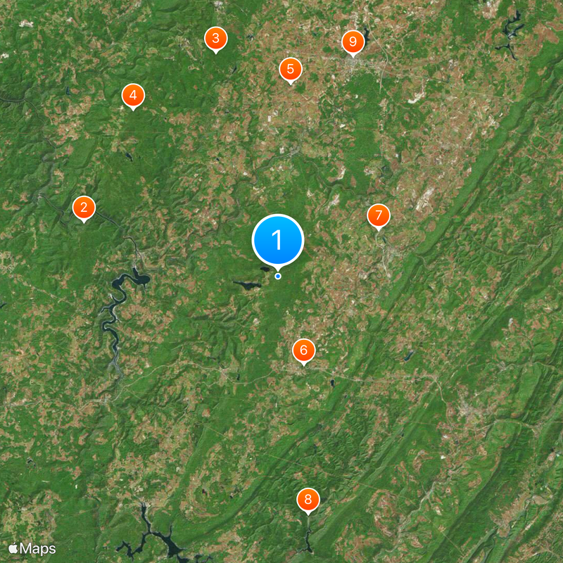
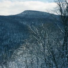
Mount Davis, Mountain summit in Elk Lick Township, Pennsylvania, US.

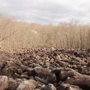
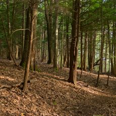
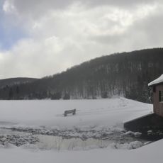
Mount Davis is a mountain summit in Elk Lick Township that rises to 979 meters (3,212 feet) and features multiple walking paths. These trails wind through dense forest sections with diverse plant species.

The mountain was named after John Nelson Davis, a local surveyor who mapped the territory in the early 1800s. This naming reflects his contribution to the geographical understanding of the region.

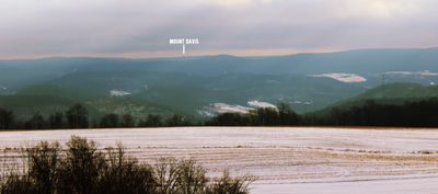
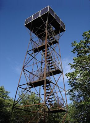
The summit includes an observation tower where visitors can gaze across three states. Photographers and nature observers gather here to capture these expansive views.

The trails remain open throughout the year, though winter visits require extra preparation due to snow and cold temperatures. Visitors should bring weather-appropriate clothing and sturdy footwear.

This mountain stands as Pennsylvania's highest point and forms part of a ridge system that extends into Maryland. Its border location makes it a notable geographical feature of the eastern Appalachians.

Location: Elk Lick Township

Elevation above the sea: 979 m

GPS coordinates: 39.78599,-79.17675

Latest update: December 14, 2025 19:28

Photos
Pennsylvania : waterfalls, coal mines, colonial architecture

Pennsylvania offers visitors a notable mix of stories from the past and natural sights. You will see waterfalls tumbling down the sides of the Pocono Mountains, underground museums in old coal mines, and colonial houses that tell the story of the first settlers. Many parks, lakes, and forests invite...

Around this place
Ohiopyle State Park
United States of America

Ohiopyle State Park

22.9 km
Laurel Hill State Park
United States of America

Laurel Hill State Park

26.3 km
Laurel Ridge State Park
United States of America

Laurel Ridge State Park

25 km
Pennsylvania Railroad 3750
United States of America

Pennsylvania Railroad 3750

21.9 km
Casselman Bridge
United States of America

Casselman Bridge

10.3 km
Salisbury Viaduct
United States of America

Salisbury Viaduct

12.5 km
Big Run State Park
United States of America

Big Run State Park

27 km
Somerset County Courthouse
United States of America

Somerset County Courthouse

26.3 km
Wills Creek Bollman Bridge
United States of America

Wills Creek Bollman Bridge

16 km
Daniel B. Zimmerman Mansion
United States of America

Daniel B. Zimmerman Mansion

27.6 km
Petersburg Tollhouse
United States of America

Petersburg Tollhouse

14.2 km
Sugarloaf Knob
United States of America

Sugarloaf Knob

25.1 km
Lower Humbert Covered Bridge
United States of America

Lower Humbert Covered Bridge

13.9 km
Beechdale Bridge
United States of America

Beechdale Bridge

16.2 km
Barronvale Bridge
United States of America

Barronvale Bridge

20.2 km
Uptown Somerset Historic District
United States of America

Uptown Somerset Historic District

26.3 km
King's Bridge
United States of America

King's Bridge

18.7 km
Fuller-Baker Log House
United States of America

Fuller-Baker Log House

10 km
Mount Savage Historic District
United States of America

Mount Savage Historic District

27.3 km
Stanton's Mill
United States of America

Stanton's Mill

10.5 km
Second National Bank of Meyersdale
United States of America

Second National Bank of Meyersdale

13.2 km
Penrose Wolf Building
United States of America

Penrose Wolf Building

14.3 km
New Germany State Park
United States of America

New Germany State Park

17.6 km
Mercy Chapel at Mill Run
United States of America

Mercy Chapel at Mill Run

17.9 km
James Drane House
United States of America

James Drane House

21 km
Frostburg Cinemas 1-2-3
United States of America

Frostburg Cinemas 1-2-3

27.6 km
Laurel Hill RDA
United States of America

Laurel Hill RDA

24.4 km
Deer Valley Kissing Bridge
United States of America

Deer Valley Kissing Bridge

2.5 km
Show the full map
Reviews

Visited this place? Tap the stars to rate it and share your experience / photos with the community! Try now! You can cancel it anytime.

« Mount Davis - Mountain summit in Elk Lick Township, Pennsylvania, US » is provided by Around Us (aroundus.com). Images and texts are derived from Wikimedia project under a Creative Commons license. You are allowed to copy, distribute, and modify copies of this page, under the conditions set by the license, as long as this note is clearly visible.

Discover hidden gems everywhere you go!

From secret cafés to breathtaking viewpoints, skip the crowded tourist spots and find places that match your style. Our app makes it easy with voice search, smart filtering, route optimization, and insider tips from travelers worldwide. Download now for the complete mobile experience.

Around Us App Screenshot

A unique approach to discovering new places

Le Figaro

All the places worth exploring

France Info

A tailor-made excursion in just a few clicks

20 Minutes