Enable Location

We need your location to show you interesting places around you

Discover nearby places

Find interesting locations and hidden gems around you

Precise directions

Get accurate directions and distances to places

Your location is never shared with other users. It's only used when you tap the location button.

Shawnee County

Log in to your account

Start exploring — it's free

Trusted by 61,505 travelers worldwide

Continue with Google
Continue with Apple
or

We will send you a code to connect

By continuing, you accept our Terms and Conditions and our Privacy Policy

Check your inbox

We've sent a pincode in your inbox. Please enter the code below.

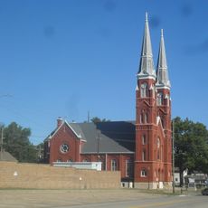
Shawnee County, Administrative county division in Kansas, United States.

Description

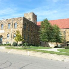
Shawnee County is an administrative county covering northeastern Kansas with Topeka as its county seat. The area includes urban, suburban, and rural sections serving as a governmental and residential hub for the region.

History

The county was established on August 25, 1855, during the territorial organization of pre-statehood Kansas. This creation reflected the systematic expansion of regional governance structures.

Culture

The county administration maintains multiple departments serving local communities, from emergency management to parks and recreation facilities for residents.

Practical

Visitors can access information about county administration and local services through offices located in Topeka during business hours. Most public facilities and services remain accessible to residents and travelers seeking assistance.

Did you know?

The county clerk's office manages comprehensive payroll operations for all county employees while simultaneously overseeing voter registration and electoral processes.

Location
Inception
August 25, 1855
Capital city
Topeka
Shares border with
Jackson County, Osage County, Jefferson County, Douglas County, Pottawatomie County, Wabaunsee County
Website
GPS coordinates
38.90333,-95.83139
Latest update
December 20, 2025 15:21

AroundUs brings together thousands of curated places, local tips, and hidden gems, enriched daily by 60,000 contributors worldwide. Discover all places nearby (Kansas).

Around this place
Equality House
United States of America

Equality House

18.5 km
Kansas State Capitol
United States of America

Kansas State Capitol

20.9 km
Topeka High School
United States of America

Topeka High School

20.6 km
Cedar Crest
United States of America

Cedar Crest

19.5 km
Gage Park
United States of America

Gage Park

19 km
Topeka Zoo
United States of America

Topeka Zoo

19.4 km
Brown v. Board of Education National Historical Park
United States of America

Brown v. Board of Education National Historical Park

20.1 km
Combat Air Museum
United States of America

Combat Air Museum

13.6 km
Topeka & Shawnee County Public Library
United States of America

Topeka & Shawnee County Public Library

20.1 km
Kansas Museum of History
United States of America

Kansas Museum of History

17.7 km
Great Overland Station
United States of America

Great Overland Station

22.9 km
Reinisch Rose Garden and Doran Rock Garden
United States of America

Reinisch Rose Garden and Doran Rock Garden

18.9 km
Yager Stadium
United States of America

Yager Stadium

18.4 km
Constitution Hall
United States of America

Constitution Hall

21.7 km
Truckhenge
United States of America

Truckhenge

27.7 km
United States of America

Kanza Bowl

20.2 km
St. Joseph's Catholic Church
United States of America

St. Joseph's Catholic Church

21.8 km
Ward-Meade House
United States of America

Ward-Meade House

22.1 km
Church of the Assumption and Rectory
United States of America

Church of the Assumption and Rectory

21.3 km
Memorial Building
United States of America

Memorial Building

20.8 km
Evel Knievel Museum
United States of America

Evel Knievel Museum

19.1 km
Topeka Council of Colored Women's Clubs Building
United States of America

Topeka Council of Colored Women's Clubs Building

20 km
Hopkins House
United States of America

Hopkins House

28.5 km
Pottawatomie Baptist Mission Building
United States of America

Pottawatomie Baptist Mission Building

17.7 km
Discovery Center of Kansas
United States of America

Discovery Center of Kansas

18.6 km
St. John's Lutheran School
United States of America

St. John's Lutheran School

21.6 km
St. John African Methodist Episcopal Church
United States of America

St. John African Methodist Episcopal Church

21.1 km
Westminster Presbyterian Church of Topeka
United States of America

Westminster Presbyterian Church of Topeka

19.2 km
Show the full map
Administrative divisions
« Shawnee County - Administrative county division in Kansas, United States » is provided by Around Us (aroundus.com). Images and texts are derived from Wikimedia project under a Creative Commons license. You are allowed to copy, distribute, and modify copies of this page, under the conditions set by the license, as long as this note is clearly visible.

Discover hidden gems everywhere you go!

From secret cafés to breathtaking viewpoints, skip the crowded tourist spots and find places that match your style. Our app makes it easy with voice search, smart filtering, route optimization, and insider tips from travelers worldwide. Download now for the complete mobile experience.

Around Us App Screenshot

A unique approach to discovering new places

Le Figaro

All the places worth exploring

France Info

A tailor-made excursion in just a few clicks

20 Minutes

Around Us
Travel Guide & Maps
Download

Send to your phone

QR Code
1

Open the camera app on your mobile.

2

Point at the QR code with your camera. A notification will appear.

3

Tap the notification to open the link.