Enable Location

We need your location to show you interesting places around you

Discover nearby places

Find interesting locations and hidden gems around you

Precise directions

Get accurate directions and distances to places

Your location is never shared with other users. It's only used when you tap the location button.

Jewell County

Log in to your account

Start exploring — it's free

Trusted by 61,508 travelers worldwide

Continue with Google
Continue with Apple
or

We will send you a code to connect

By continuing, you accept our Terms and Conditions and our Privacy Policy

Check your inbox

We've sent a pincode in your inbox. Please enter the code below.

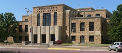
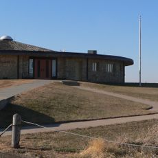
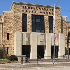
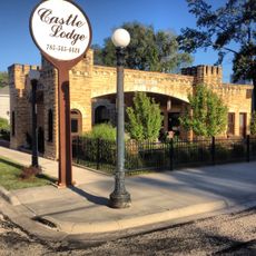
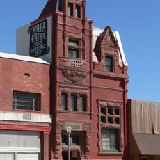
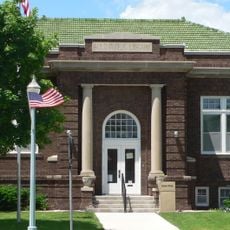
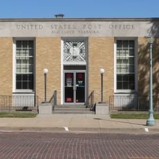
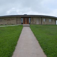
Jewell County, County administration center in Mankato, Kansas, US.

Description

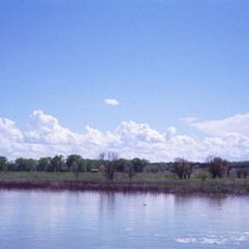
Jewell County is an administrative division in north-central Kansas with its main office in Mankato. The territory includes farmland and various townships that together form the county's structure.

History

The county was established in 1887 and named after a Union Army officer from the Civil War. This creation was part of administrative expansion in western Kansas during that era.

Culture

The county carries the name of a Civil War officer, shaping local identity and pride in the region. Communities here maintain connection to that historical heritage in their daily lives.

Practical

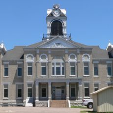
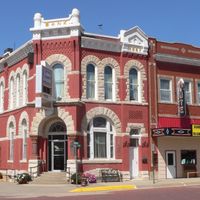
The county courthouse in Mankato is the main location for official business and basic government services. The various townships offer additional support and local services to their residents.

Did you know?

The area is divided into 25 different townships, including Buffalo and Burr Oak, creating a complex local governance structure. This decentralized organization allows each community to manage its own local affairs.

Location
Inception
February 26, 1887
Capital city
Mankato
Shares border with
Webster County, Mitchell County, Nuckolls County, Republic County, Cloud County, Osborne County, Smith County
GPS coordinates
39.61250,-97.99667
Latest update
December 10, 2025 15:54

AroundUs brings together thousands of curated places, local tips, and hidden gems, enriched daily by 60,000 contributors worldwide. Discover all places nearby (Kansas).

Around this place
Geographic center of the contiguous United States
United States of America

Geographic center of the contiguous United States

55.4 km
United States of America

Waconda Lake

35 km
Willa Cather House
United States of America

Willa Cather House

69.3 km
William Ducker House
United States of America

William Ducker House

70.2 km
Pawnee Indian Museum State Historic Site
United States of America

Pawnee Indian Museum State Historic Site

34.9 km
St. John the Baptist Catholic Church
United States of America

St. John the Baptist Catholic Church

19.4 km
Wallace Warren and Lillian Genevieve Bradshaw Kendall House
United States of America

Wallace Warren and Lillian Genevieve Bradshaw Kendall House

46.1 km
Starke Round Barn
United States of America

Starke Round Barn

64.7 km
Jamestown (Kansas) Wildlife Area
United States of America

Jamestown (Kansas) Wildlife Area

9.9 km
Jewell County Courthouse
United States of America

Jewell County Courthouse

26.8 km
Burr Oak United Methodist Church
United States of America

Burr Oak United Methodist Church

38.8 km
Mitchell County Courthouse
United States of America

Mitchell County Courthouse

19.6 km
E. W. Norris Service Station
United States of America

E. W. Norris Service Station

29.5 km
Old Cawker City Library
United States of America

Old Cawker City Library

39.1 km
Downs Carnegie Library
United States of America

Downs Carnegie Library

48.7 km
Nuckolls County Courthouse
United States of America

Nuckolls County Courthouse

66.1 km
Farmer's and Merchant's Bank Building
United States of America

Farmer's and Merchant's Bank Building

69.3 km
Auld Public Library
United States of America

Auld Public Library

69.5 km
Matthew R. Bentley House
United States of America

Matthew R. Bentley House

69.8 km
Miner House
United States of America

Miner House

69.4 km
Red Cloud United States Post Office
United States of America

Red Cloud United States Post Office

69.2 km
Warner-Cather House
United States of America

Warner-Cather House

69.6 km
Nelson Cemetery Walk
United States of America

Nelson Cemetery Walk

66.4 km
Dr. Gilbert McKeeby House
United States of America

Dr. Gilbert McKeeby House

69.9 km
Pawnee Indian Museum State Historic Site
United States of America

Pawnee Indian Museum State Historic Site

34.9 km
Cather Childhood Home
United States of America

Cather Childhood Home

69.3 km
Red Cloud Bridge
United States of America

Red Cloud Bridge

67.1 km
O.W. Francis House
United States of America

O.W. Francis House

39.9 km
Show the full map
Administrative divisions
« Jewell County - County administration center in Mankato, Kansas, US » is provided by Around Us (aroundus.com). Images and texts are derived from Wikimedia project under a Creative Commons license. You are allowed to copy, distribute, and modify copies of this page, under the conditions set by the license, as long as this note is clearly visible.

Discover hidden gems everywhere you go!

From secret cafés to breathtaking viewpoints, skip the crowded tourist spots and find places that match your style. Our app makes it easy with voice search, smart filtering, route optimization, and insider tips from travelers worldwide. Download now for the complete mobile experience.

Around Us App Screenshot

A unique approach to discovering new places

Le Figaro

All the places worth exploring

France Info

A tailor-made excursion in just a few clicks

20 Minutes

Around Us
Travel Guide & Maps
Download

Send to your phone

QR Code
1

Open the camera app on your mobile.

2

Point at the QR code with your camera. A notification will appear.

3

Tap the notification to open the link.