Enable Location

We need your location to show you interesting places around you

Discover nearby places

Find interesting locations and hidden gems around you

Precise directions

Get accurate directions and distances to places

Your location is never shared with other users. It's only used when you tap the location button.

Daviess County

Log in to your account

Start exploring — it's free

Trusted by 62,994 travelers worldwide

Continue with Google
Continue with Apple
or

We will send you a code to connect

By continuing, you accept our Terms and Conditions and our Privacy Policy

Check your inbox

We've sent a pincode in your inbox. Please enter the code below.

Discussion Reviews 1 Photos
21.1k Popularity

Daviess County, Administrative county in Kentucky, US

Daviess County is an administrative county in western Kentucky with Owensboro serving as its main urban center. The county encompasses multiple smaller towns and communities that function together as a regional area.

The county was established in 1815 during Kentucky's period of territorial expansion in the early 1800s. Its creation reflected the growing need for organized administration in western regions of the state.

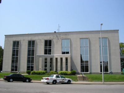
The Daviess County Sheriff's Office maintains strong connections with local communities through specialized units, task forces, and collaborative law enforcement programs.

Visitors should familiarize themselves with local government offices and public services in the area. Advance planning helps when accessing administrative services or exploring different communities within the county.

The county operates with separate elected positions for Sheriff and County Jailer, demonstrating Kentucky's distinct approach to law enforcement administration.

The community of curious travelers

AroundUs brings together thousands of curated places, local tips, and hidden gems, enriched daily by 60,000 contributors worldwide.

Start exploring
Location
Inception
January 14, 1815
Capital city
Owensboro
Shares border with
Henderson County, McLean County, Ohio County, Hancock County, Spencer County, Warrick County
GPS coordinates
37.73000,-87.09000
Latest update
December 24, 2025 14:19
Around this place
United States of America

International Bluegrass Music Museum

5.3 km
William H. Natcher Bridge
United States of America

William H. Natcher Bridge

19.7 km
Glover Cary Bridge
United States of America

Glover Cary Bridge

5.7 km
United States of America

Kentucky Motor Speedway

17 km
St. Stephen's Cathedral
United States of America

St. Stephen's Cathedral

5 km
Temple Adath Israel
United States of America

Temple Adath Israel

4.9 km
Newburgh Lock and Dam
United States of America

Newburgh Lock and Dam

33.4 km
Yankeetown Site
United States of America

Yankeetown Site

26.8 km
Western Kentucky Botanical Garden
United States of America

Western Kentucky Botanical Garden

7.1 km
United States of America

Ben Hawes Golf Course and Park

11.4 km
Haphazard
United States of America

Haphazard

6 km
Confederate Monument in Owensboro
United States of America

Confederate Monument in Owensboro

5.3 km
Thompson and Powell Martyrs Monument
United States of America

Thompson and Powell Martyrs Monument

21.1 km
St. Joseph's Catholic Church
United States of America

St. Joseph's Catholic Church

4.9 km
Mathias Sharp House
United States of America

Mathias Sharp House

17.2 km
Odd Fellows Building
United States of America

Odd Fellows Building

5.2 km
Trinity Episcopal Church
United States of America

Trinity Episcopal Church

5.2 km
Spencer County Courthouse
United States of America

Spencer County Courthouse

17.4 km
Felix Grimes House
United States of America

Felix Grimes House

3.9 km
Le Vega Clements House
United States of America

Le Vega Clements House

4.9 km
Yewell House
United States of America

Yewell House

4.7 km
United States of America

Fish and Game Farm Lake

21.2 km
United States of America

Shaw Bluff

21.3 km
United States of America

Hogg Heaven

22 km
United States of America

Owensboro Country Club

1.3 km
United States of America

The Pearl Club

11.5 km
United States of America

Hillcrest

1.1 km
United States of America

Work of art

5.6 km
Show the full map
Reviews
Share your experience

No review yet

Discussions
Start a discussion...

No discussion yet

« Daviess County - Administrative county in Kentucky, US » is provided by Around Us (aroundus.com). Images and texts are derived from Wikimedia project under a Creative Commons license. You are allowed to copy, distribute, and modify copies of this page, under the conditions set by the license, as long as this note is clearly visible.

Discover hidden gems everywhere you go!

From secret cafés to breathtaking viewpoints, skip the crowded tourist spots and find places that match your style. Our app makes it easy with voice search, smart filtering, route optimization, and insider tips from travelers worldwide. Download now for the complete mobile experience.

Around Us App Screenshot

A unique approach to discovering new places

Le Figaro

All the places worth exploring

France Info

A tailor-made excursion in just a few clicks

20 Minutes

Around Us
Travel Guide & Maps
Download

Send to your phone

QR Code
1

Open the camera app on your mobile.

2

Point at the QR code with your camera. A notification will appear.

3

Tap the notification to open the link.