Enable Location

We need your location to show you interesting places around you

Discover nearby places

Find interesting locations and hidden gems around you

Precise directions

Get accurate directions and distances to places

Your location is never shared with other users. It's only used when you tap the location button.

Noble County

Log in to your account

Start exploring — it's free

Trusted by 62,526 travelers worldwide

Continue with Google
Continue with Apple
or

We will send you a code to connect

By continuing, you accept our Terms and Conditions and our Privacy Policy

Check your inbox

We've sent a pincode in your inbox. Please enter the code below.

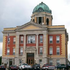
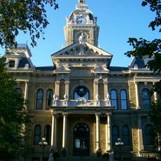
Noble County, County seat in southeastern Ohio, United States

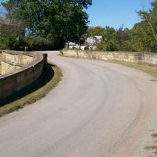
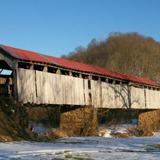
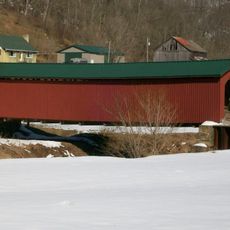
Noble County is a county in southeastern Ohio that spans rolling hills, forests, and waterways while being bordered by six neighboring counties. Interstate 77 runs through the region, providing a major transportation corridor.

This county was established in 1851 from parts of four neighboring counties and was the last of Ohio's 88 counties to form. Its late founding reflects the historical patterns of settlement in the region.

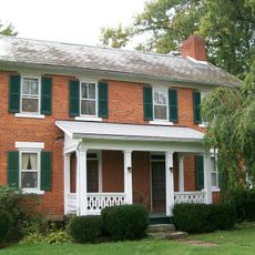
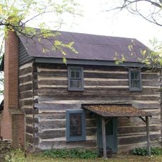
The rural communities here maintain agricultural traditions through family farms and local markets that shape daily life. This connection to farming is visible in how residents interact with their land and each other.

Visitors should expect rural terrain with hilly roads and allow time for exploration. The area is best accessed by car, and it is wise to stock up on supplies before heading to more remote areas.

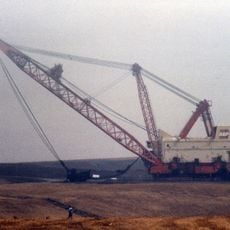
An oil well discovered here in 1814 was North America's first, predating the more famous Pennsylvania discoveries by decades. This early connection to oil production represents a lesser-known chapter in the region's industrial past.

The community of curious travelers

AroundUs brings together thousands of curated places, local tips, and hidden gems, enriched daily by 60,000 contributors worldwide.

Start exploring
Location
Inception
March 11, 1851
Capital city
Caldwell
Shares border with
Guernsey County, Washington County, Belmont County, Monroe County, Morgan County, Muskingum County
GPS coordinates
39.77000,-81.45000
Latest update
December 7, 2025 19:23
Around this place
Big Muskie
United States of America

Big Muskie

25.3 km
The Wilds
United States of America

The Wilds

25.1 km
Barnesville Petroglyph
United States of America

Barnesville Petroglyph

29.9 km
William C. Mooney House
United States of America

William C. Mooney House

28.9 km
Colonel Joseph Barker House
United States of America

Colonel Joseph Barker House

31.7 km
S Bridge, National Road
United States of America

S Bridge, National Road

31.3 km
Monroe County Courthouse
United States of America

Monroe County Courthouse

28.6 km
Guernsey County Courthouse
United States of America

Guernsey County Courthouse

32.6 km
St. Henry Roman Catholic Church and Rectory
United States of America

St. Henry Roman Catholic Church and Rectory

18.3 km
Knowlton Covered Bridge
United States of America

Knowlton Covered Bridge

31.3 km
Noble County Courthouse
United States of America

Noble County Courthouse

6.3 km
Colonel Joseph Taylor House
United States of America

Colonel Joseph Taylor House

31.8 km
Monroe Bank
United States of America

Monroe Bank

28.6 km
Jonathan Sprague House
United States of America

Jonathan Sprague House

25.6 km
Bethel Methodist Episcopal Church
United States of America

Bethel Methodist Episcopal Church

18.5 km
Samuel Danford Farm
United States of America

Samuel Danford Farm

13.1 km
Young-Shaw House
United States of America

Young-Shaw House

3.9 km
McCracken-McFarland House
United States of America

McCracken-McFarland House

31 km
Foreaker Covered Bridge
United States of America

Foreaker Covered Bridge

30.9 km
Broom Building
United States of America

Broom Building

30.9 km
Hollister-Parry House
United States of America

Hollister-Parry House

28.9 km
Samuel Caldwell House
United States of America

Samuel Caldwell House

6.1 km
Abner Williams Log House
United States of America

Abner Williams Log House

21 km
Barnett-Criss House
United States of America

Barnett-Criss House

32.9 km
Warner Community Church
United States of America

Warner Community Church

23.3 km
Mason House
United States of America

Mason House

25.7 km
Guernsey County District Public Library
United States of America

Guernsey County District Public Library

30.9 km
Wolf Run Lake
United States of America

Wolf Run Lake

8.3 km
Show the full map
« Noble County - County seat in southeastern Ohio, United States » is provided by Around Us (aroundus.com). Images and texts are derived from Wikimedia project under a Creative Commons license. You are allowed to copy, distribute, and modify copies of this page, under the conditions set by the license, as long as this note is clearly visible.

Discover hidden gems everywhere you go!

From secret cafés to breathtaking viewpoints, skip the crowded tourist spots and find places that match your style. Our app makes it easy with voice search, smart filtering, route optimization, and insider tips from travelers worldwide. Download now for the complete mobile experience.

Around Us App Screenshot

A unique approach to discovering new places

Le Figaro

All the places worth exploring

France Info

A tailor-made excursion in just a few clicks

20 Minutes

Around Us
Travel Guide & Maps
Download

Send to your phone

QR Code
1

Open the camera app on your mobile.

2

Point at the QR code with your camera. A notification will appear.

3

Tap the notification to open the link.