Barnesville Petroglyph, Archaeological site with indigenous rock carvings near Barnesville, United States
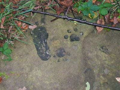
Barnesville Petroglyph is an archaeological site in Ohio featuring a large sandstone boulder covered with ancient rock carvings. The carved surface displays numerous designs including animal figures, footprints, and human representations created by hands long before European contact.
The site became known in the 1850s when people first documented its carvings. It later gained official protection in 1974 when it was registered as a historic place, recognizing its importance to the region.
The rock carvings represent images that indigenous groups created to capture animals, human forms, and symbols tied to their daily lives and spiritual beliefs. Walking around the boulder, you can observe how the pecked surfaces still convey these meaningful connections to the natural world.
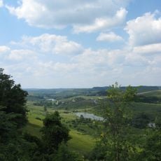
The site sits roughly 3 miles southwest of Barnesville and can be reached by car, though the final approach involves walking across open terrain. Wear sturdy shoes and be prepared for outdoor conditions, as the boulder sits fully exposed without shade or shelter.
In the early 1900s, one of the larger boulders vanished when people pretending to represent a museum removed it from the site. This incident highlights how vulnerable such ancient locations have been throughout modern times.
The community of curious travelers
AroundUs brings together thousands of curated places, local tips, and hidden gems, enriched daily by 60,000 contributors worldwide.