Barnesville Historic District

Log in to your account

AroundUs is a community-driven map of interesting places, built by curious explorers like you. It grows with every review, story, and photo you share.
Connect to save your favorite spots, contribute locations, and create personalized routes.
Continue with Google
Continue with Apple
Continue with X
Continue with Facebook
Continue with email
By continuing, you accept our Terms and Conditions and our Privacy Policy
Create an account
Add to collection
Map
Suggest a change
Share

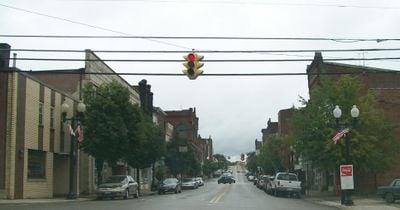
Barnesville Historic District, Historic district in Barnesville, Ohio.

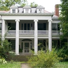
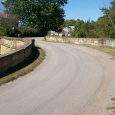
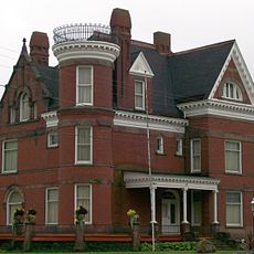
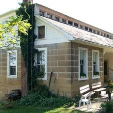
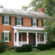
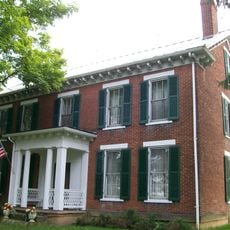
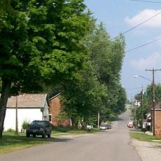
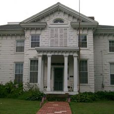
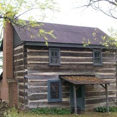
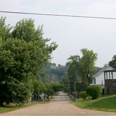
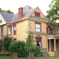
Barnesville Historic District is a neighborhood in Ohio with historical buildings that display various architectural styles from the early 1800s. The structures are arranged across several blocks and continue to define the appearance of this town.

James Barnes founded the settlement in 1808 as a Quaker community and planned its roads and plots. This early arrangement still forms the basis of the town's layout today.

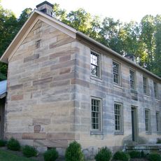
The neighborhood shows traces of Quaker settlers from Maryland, Pennsylvania, and southern states who built their community here and left their mark on local architecture. These buildings still tell stories about the values and lifestyle of those early residents.

You can walk through the neighborhood and view various houses and streets. Most buildings are visible from the outside, and the area is easy to navigate on foot.

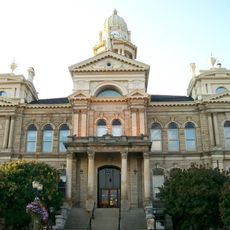
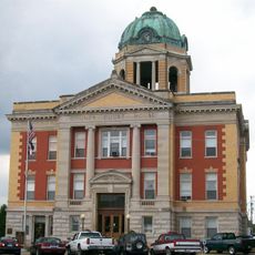
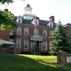
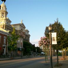
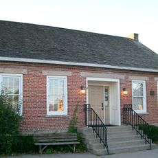
The Barnesville Municipal Building, one of the town's most important structures, stands outside the main district boundaries yet received protection status anyway. This makes it an unusual case in the district's preservation system.

Location: Ohio

GPS coordinates: 39.99444,-81.17722

Latest update: December 14, 2025 18:04

Photos
Around this place
Salt Fork State Park
United States of America

Salt Fork State Park

29.9 km
Egypt Valley Wildlife Area
United States of America

Egypt Valley Wildlife Area

14.5 km
Dysart Woods
United States of America

Dysart Woods

15.4 km
Barkcamp State Park
United States of America

Barkcamp State Park

14.9 km
Barnesville Petroglyph
United States of America

Barnesville Petroglyph

4.9 km
William C. Mooney House
United States of America

William C. Mooney House

26.2 km
Belmont County Courthouse
United States of America

Belmont County Courthouse

25.4 km
S Bridge, National Road
United States of America

S Bridge, National Road

17.7 km
Monroe County Courthouse
United States of America

Monroe County Courthouse

26.3 km
Belmont County Victorian Mansion Museum
United States of America

Belmont County Victorian Mansion Museum

725 m
Frederick Kindleberger Stone House and Barn
United States of America

Frederick Kindleberger Stone House and Barn

29.5 km
Shaeffer Campbell Covered Bridge
United States of America

Shaeffer Campbell Covered Bridge

19.7 km
Great Western Schoolhouse
United States of America

Great Western Schoolhouse

18.9 km
Monroe Bank
United States of America

Monroe Bank

26.3 km
Opatrny Village Site
United States of America

Opatrny Village Site

21.8 km
Samuel Danford Farm
United States of America

Samuel Danford Farm

21.1 km
Franklin College Building No. 5
United States of America

Franklin College Building No. 5

26.4 km
James Kinney Farmstead
United States of America

James Kinney Farmstead

15.7 km
St. Clairsville Public Library
United States of America

St. Clairsville Public Library

25.4 km
Morristown Historic District
United States of America

Morristown Historic District

11.8 km
Hollister-Parry House
United States of America

Hollister-Parry House

26.6 km
Abner Williams Log House
United States of America

Abner Williams Log House

16.5 km
St. Clairsville Historic District
United States of America

St. Clairsville Historic District

25.4 km
Belmont Historic District
United States of America

Belmont Historic District

12.2 km
Dr. Lindley Schooley House and Office
United States of America

Dr. Lindley Schooley House and Office

12.2 km
Piedmont Lake
United States of America

Piedmont Lake

16.1 km
John Reaves House
United States of America

John Reaves House

25.2 km
Skull Fork Covered Bridge
United States of America

Skull Fork Covered Bridge

22.3 km
Show the full map
Reviews

Visited this place? Tap the stars to rate it and share your experience / photos with the community! Try now! You can cancel it anytime.

« Barnesville Historic District - Historic district in Barnesville, Ohio » is provided by Around Us (aroundus.com). Images and texts are derived from Wikimedia project under a Creative Commons license. You are allowed to copy, distribute, and modify copies of this page, under the conditions set by the license, as long as this note is clearly visible.

Discover hidden gems everywhere you go!

From secret cafés to breathtaking viewpoints, skip the crowded tourist spots and find places that match your style. Our app makes it easy with voice search, smart filtering, route optimization, and insider tips from travelers worldwide. Download now for the complete mobile experience.

Around Us App Screenshot

A unique approach to discovering new places

Le Figaro

All the places worth exploring

France Info

A tailor-made excursion in just a few clicks

20 Minutes