Enable Location

We need your location to show you interesting places around you

Discover nearby places

Find interesting locations and hidden gems around you

Precise directions

Get accurate directions and distances to places

Your location is never shared with other users. It's only used when you tap the location button.

Marion County

Log in to your account

Start exploring — it's free

Trusted by 61,976 travelers worldwide

Continue with Google
Continue with Apple
or

We will send you a code to connect

By continuing, you accept our Terms and Conditions and our Privacy Policy

Check your inbox

We've sent a pincode in your inbox. Please enter the code below.

Marion County, Administrative county in northeastern Missouri, United States.

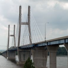
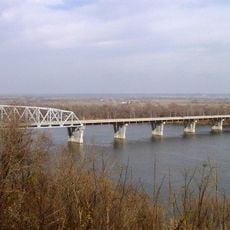
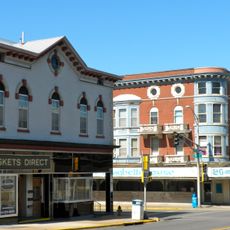
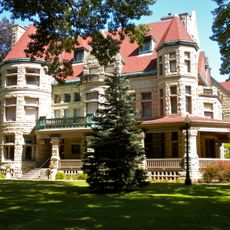
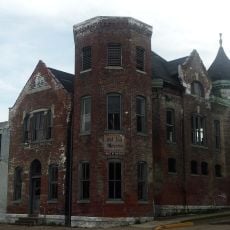
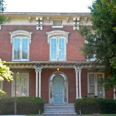
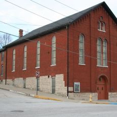
Marion County is an administrative county in northeastern Missouri stretching along the Mississippi River, combining farmland, open spaces, and settled areas. The territory includes the towns of Hannibal and Palmyra alongside several smaller communities, creating a mix of rural and urban character.

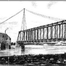
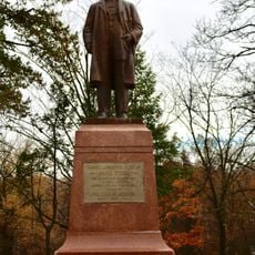
The county was established in 1826 and named after General Francis Marion, a leader during the American Revolutionary War. This founding reflects the early expansion of American settlements into the Mississippi Valley during the nation's early decades.

The area maintains strong ties to farming traditions, especially in towns like Hannibal and Palmyra, where harvest celebrations reflect how much these practices matter to residents. You can sense this rural identity as you move through the landscape and see how local gatherings shape community life.

The main transportation routes are Interstate I-72 and US Highways 24, 36, and 61, which run through the county and connect to larger cities. Most travel between communities requires a car since distances can be significant and public transportation is limited.

The territory is home to Hannibal, the birthplace of Mark Twain, whose writings shaped literature and continue to draw visitors today. This literary connection has given the region cultural importance that extends well beyond its function as an administrative area.

The community of curious travelers

AroundUs brings together thousands of curated places, local tips, and hidden gems, enriched daily by 60,000 contributors worldwide.

Start exploring
Location
Inception
1826
Capital city
Palmyra
Shares border with
Lewis County, Adams County, Pike County, Ralls County, Monroe County, Shelby County
GPS coordinates
39.81000,-91.62000
Latest update
December 7, 2025 20:43
Around this place
Mark Twain Cave
United States of America

Mark Twain Cave

28.1 km
Mark Twain Boyhood Home & Museum
United States of America

Mark Twain Boyhood Home & Museum

25 km
Bayview Bridge
United States of America

Bayview Bridge

21.8 km
Rockcliffe Mansion
United States of America

Rockcliffe Mansion

24.5 km
Mark Twain Memorial Bridge
United States of America

Mark Twain Memorial Bridge

24.5 km
Quincy Memorial Bridge
United States of America

Quincy Memorial Bridge

21.7 km
Downtown Quincy Historic District
United States of America

Downtown Quincy Historic District

22.6 km
Villa Kathrine
United States of America

Villa Kathrine

21.9 km
South Side German Historic District
United States of America

South Side German Historic District

22.6 km
Mark Twain Memorial Bridge
United States of America

Mark Twain Memorial Bridge

25.1 km
John Wood Mansion
United States of America

John Wood Mansion

23.1 km
Wabash Bridge
United States of America

Wabash Bridge

24 km
Lock and Dam No. 21
United States of America

Lock and Dam No. 21

19.3 km
Quincy Rail Bridge
United States of America

Quincy Rail Bridge

21.8 km
Walker-Woodward-Schaffer House
United States of America

Walker-Woodward-Schaffer House

8.7 km
United States of America

Adams County Courthouse

22.9 km
Robert W. Gardner House
United States of America

Robert W. Gardner House

23 km
Richard F. Newcomb House
United States of America

Richard F. Newcomb House

23.9 km
Quincy National Cemetery
United States of America

Quincy National Cemetery

26.3 km
Hannibal Old Police Station and Jail
United States of America

Hannibal Old Police Station and Jail

25.2 km
Culbertson-Head Farmstead
United States of America

Culbertson-Head Farmstead

9.6 km
Morgan-Wells House
United States of America

Morgan-Wells House

22.5 km
Mark Twain Historic District
United States of America

Mark Twain Historic District

25 km
Buildings at 207–209 South Main St.
United States of America

Buildings at 207–209 South Main St.

25.4 km
Riverview Park (Hannibal, Missouri)
United States of America

Riverview Park (Hannibal, Missouri)

23.3 km
Eighth and Center Streets Baptist Church
United States of America

Eighth and Center Streets Baptist Church

24.7 km
United States Post Office and Courthouse
United States of America

United States Post Office and Courthouse

23.1 km
Standard Printing Company
United States of America

Standard Printing Company

25.1 km
Show the full map
Administrative divisions
« Marion County - Administrative county in northeastern Missouri, United States » is provided by Around Us (aroundus.com). Images and texts are derived from Wikimedia project under a Creative Commons license. You are allowed to copy, distribute, and modify copies of this page, under the conditions set by the license, as long as this note is clearly visible.

Discover hidden gems everywhere you go!

From secret cafés to breathtaking viewpoints, skip the crowded tourist spots and find places that match your style. Our app makes it easy with voice search, smart filtering, route optimization, and insider tips from travelers worldwide. Download now for the complete mobile experience.

Around Us App Screenshot

A unique approach to discovering new places

Le Figaro

All the places worth exploring

France Info

A tailor-made excursion in just a few clicks

20 Minutes

Around Us
Travel Guide & Maps
Download

Send to your phone

QR Code
1

Open the camera app on your mobile.

2

Point at the QR code with your camera. A notification will appear.

3

Tap the notification to open the link.