Guernsey County

Log in to your account

AroundUs is a community-driven map of interesting places, built by curious explorers like you. It grows with every review, story, and photo you share.
Connect to save your favorite spots, contribute locations, and create personalized routes.
Continue with Google
Continue with Apple
Continue with X
Continue with Facebook
Continue with email
By continuing, you accept our Terms and Conditions and our Privacy Policy
Create an account
Add to collection
Map
Suggest a change
Share

Guernsey County, Administrative county in eastern Ohio, United States

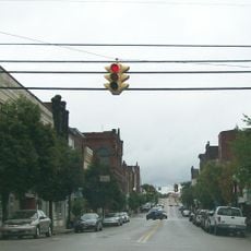
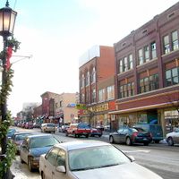
Guernsey County is an administrative area in eastern Ohio that encompasses both Cambridge, its largest city, and numerous smaller communities spread across the landscape. The territory includes a mix of urban services centered downtown and rural areas that form much of the county's character.

The area was established in 1810 when settlers from the Isle of Guernsey arrived and shaped the region's identity. This creation emerged from the division of existing counties and marked the start of organized county governance in eastern Ohio.

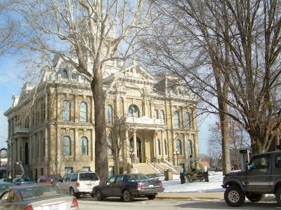
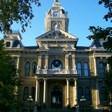
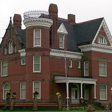
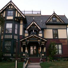
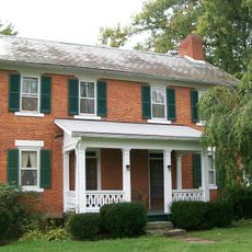
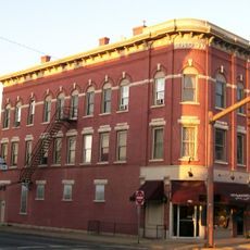
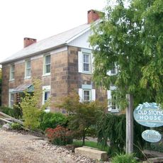
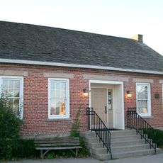
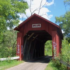
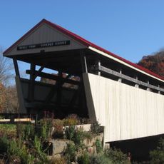
The courthouse in downtown Cambridge stands as a focal point where locals and visitors encounter the region's built heritage and civic life. Historic buildings throughout the county reflect the character of early settlement and remain part of the community's daily fabric.

Visitors can find information and services through the county's official website, where property records and other practical documents are accessible. Most amenities and services cluster around downtown Cambridge, while rural areas may require longer travel distances.

The county belongs to a larger metropolitan statistical area while also maintaining its own separate micropolitan designation, reflecting a dual economic and social connection. This arrangement shows how the area links to bigger urban centers while keeping its distinct local identity and economy.

Location: Ohio

Inception: January 31, 1810

Capital city: Cambridge

Shares border with: Tuscarawas County, Noble County, Harrison County, Belmont County, Muskingum County, Coshocton County

Website: http://guernseycounty.org

GPS coordinates: 40.05000,-81.50000

Latest update: December 7, 2025 10:06

Photos
Around this place
Salt Fork State Park
United States of America

Salt Fork State Park

5.8 km
John and Annie Glenn Museum
United States of America

John and Annie Glenn Museum

21.1 km
Barnesville Petroglyph
United States of America

Barnesville Petroglyph

24.2 km
Kennedy Stone House
United States of America

Kennedy Stone House

8.7 km
S Bridge, National Road
United States of America

S Bridge, National Road

10.7 km
William Rainey Harper Log House
United States of America

William Rainey Harper Log House

21 km
Guernsey County Courthouse
United States of America

Guernsey County Courthouse

12 km
Belmont County Victorian Mansion Museum
United States of America

Belmont County Victorian Mansion Museum

28.5 km
Barnesville Historic District
United States of America

Barnesville Historic District

28.2 km
Colonel Joseph Taylor House
United States of America

Colonel Joseph Taylor House

8.1 km
S Bridge II
United States of America

S Bridge II

22 km
Bethel Methodist Episcopal Church
United States of America

Bethel Methodist Episcopal Church

18 km
Booth Homestead
United States of America

Booth Homestead

18.6 km
Samuel Danford Farm
United States of America

Samuel Danford Farm

24.9 km
Young-Shaw House
United States of America

Young-Shaw House

28.1 km
Broom-Braden Stone House
United States of America

Broom-Braden Stone House

5.5 km
McCracken-McFarland House
United States of America

McCracken-McFarland House

8.1 km
Broom Building
United States of America

Broom Building

8.3 km
Ralph Hardesty Stone House
United States of America

Ralph Hardesty Stone House

25.7 km
Samuel Harper Stone House
United States of America

Samuel Harper Stone House

18.8 km
Abner Williams Log House
United States of America

Abner Williams Log House

16.6 km
Barnett-Criss House
United States of America

Barnett-Criss House

17.3 km
Piedmont Lake
United States of America

Piedmont Lake

28.4 km
John Reaves House
United States of America

John Reaves House

26.6 km
Guernsey County District Public Library
United States of America

Guernsey County District Public Library

8.1 km
Indian Camp Covered Bridge
United States of America

Indian Camp Covered Bridge

14.5 km
Skull Fork Covered Bridge
United States of America

Skull Fork Covered Bridge

24.7 km
Wolf Run Lake
United States of America

Wolf Run Lake

28.6 km
Show the full map
Reviews

Visited this place? Tap the stars to rate it and share your experience / photos with the community! Try now! You can cancel it anytime.

Administrative divisions
« Guernsey County - Administrative county in eastern Ohio, United States » is provided by Around Us (aroundus.com). Images and texts are derived from Wikimedia project under a Creative Commons license. You are allowed to copy, distribute, and modify copies of this page, under the conditions set by the license, as long as this note is clearly visible.

Discover hidden gems everywhere you go!

From secret cafés to breathtaking viewpoints, skip the crowded tourist spots and find places that match your style. Our app makes it easy with voice search, smart filtering, route optimization, and insider tips from travelers worldwide. Download now for the complete mobile experience.

Around Us App Screenshot

A unique approach to discovering new places

Le Figaro

All the places worth exploring

France Info

A tailor-made excursion in just a few clicks

20 Minutes