Enable Location

We need your location to show you interesting places around you

Discover nearby places

Find interesting locations and hidden gems around you

Precise directions

Get accurate directions and distances to places

Your location is never shared with other users. It's only used when you tap the location button.

Roanoke County

Log in to your account

Start exploring — it's free

Trusted by 61,918 travelers worldwide

Continue with Google
Continue with Apple
or

We will send you a code to connect

By continuing, you accept our Terms and Conditions and our Privacy Policy

Check your inbox

We've sent a pincode in your inbox. Please enter the code below.

Roanoke County, Administrative county in western Virginia, United States

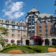
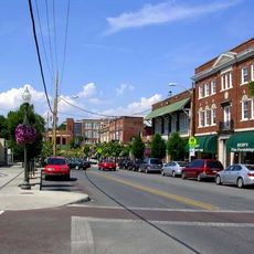
Roanoke County is a county in western Virginia containing residential communities, commercial areas, and natural landscapes near the Blue Ridge Mountains. The region encompasses several interconnected communities with different characters and functions.

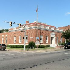
The county was established in 1838 by the Virginia General Assembly with Salem designated as its administrative seat. This creation was part of administrative expansion in western Virginia during the 1800s.

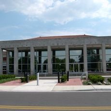
The county maintains numerous public libraries, including the Hollins branch, which provides educational resources and community programs for local residents.

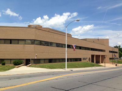
The county provides an alert system to keep residents informed about weather and safety warnings. A mobile app is also available for accessing government services and information directly from your phone.

The county administration created an application called RoCo that lets citizens access government services straight from their smartphones. This digital tool reduces the need to visit government offices in person for many routine requests.

The community of curious travelers

AroundUs brings together thousands of curated places, local tips, and hidden gems, enriched daily by 60,000 contributors worldwide.

Start exploring
Location
Inception
1838
Capital city
Salem
Shares border with
Botetourt County, Bedford County, Franklin County, Floyd County, Montgomery County, Craig County, Roanoke, Salem
GPS coordinates
37.27000,-80.08000
Latest update
December 20, 2025 15:41
Around this place
Roanoke College
United States of America

Roanoke College

3.6 km
Hollins University
United States of America

Hollins University

15.5 km
Norfolk and Western Railway 611
United States of America

Norfolk and Western Railway 611

11.8 km
Roanoke Star
United States of America

Roanoke Star

13.2 km
Roanoke Civic Center
United States of America

Roanoke Civic Center

12.8 km
Hotel Roanoke
United States of America

Hotel Roanoke

12.5 km
Virginia Museum of Transportation
United States of America

Virginia Museum of Transportation

11.8 km
United States of America

Lakeside Amusement Park

5.4 km
Taubman Museum of Art
United States of America

Taubman Museum of Art

12.6 km
Salem Football Stadium
United States of America

Salem Football Stadium

4.3 km
Dixie Caverns
United States of America

Dixie Caverns

8.7 km
Mill Mountain Zoo
United States of America

Mill Mountain Zoo

12.9 km
United States of America

Poor Mountain

10.3 km
O. Winston Link Museum
United States of America

O. Winston Link Museum

12.6 km
Virginia's Explore Park
United States of America

Virginia's Explore Park

20.5 km
The Coffee Pot
United States of America

The Coffee Pot

8.4 km
Wells Fargo Tower
United States of America

Wells Fargo Tower

12.4 km
Salem Veterans Affairs Medical Center
United States of America

Salem Veterans Affairs Medical Center

5.4 km
Grandin Road Commercial Historic District
United States of America

Grandin Road Commercial Historic District

9.1 km
United States of America

Mill Mountain Theatre

12.5 km
United States of America

Poor Mountain Natural Area Preserve

3.9 km
United States of America

Carvins Cove Natural Reserve

17.4 km
United States of America

McAfee Knob

14.2 km
United States of America

Fort Lewis Mountain

8.3 km
United States of America

Roanoke Mountain

14.5 km
Salem Post Office
United States of America

Salem Post Office

3.3 km
United States of America

Pedlar Hills Natural Area Preserve

15.3 km
Cahas Mountain Rural Historic District
United States of America

Cahas Mountain Rural Historic District

17.5 km
Show the full map
« Roanoke County - Administrative county in western Virginia, United States » is provided by Around Us (aroundus.com). Images and texts are derived from Wikimedia project under a Creative Commons license. You are allowed to copy, distribute, and modify copies of this page, under the conditions set by the license, as long as this note is clearly visible.

Discover hidden gems everywhere you go!

From secret cafés to breathtaking viewpoints, skip the crowded tourist spots and find places that match your style. Our app makes it easy with voice search, smart filtering, route optimization, and insider tips from travelers worldwide. Download now for the complete mobile experience.

Around Us App Screenshot

A unique approach to discovering new places

Le Figaro

All the places worth exploring

France Info

A tailor-made excursion in just a few clicks

20 Minutes

Around Us
Travel Guide & Maps
Download

Send to your phone

QR Code
1

Open the camera app on your mobile.

2

Point at the QR code with your camera. A notification will appear.

3

Tap the notification to open the link.