Enable Location

We need your location to show you interesting places around you

Discover nearby places

Find interesting locations and hidden gems around you

Precise directions

Get accurate directions and distances to places

Your location is never shared with other users. It's only used when you tap the location button.

Bayfield

Log in to your account

Start exploring — it's free

Trusted by 65,374 travelers worldwide

Continue with Google
Continue with Apple
or

We will send you a code to connect

By continuing, you accept our Terms and Conditions and our Privacy Policy

Check your inbox

We've sent a pincode in your inbox. Please enter the code below.

Discussion Reviews 1 Photos
22.5k Popularity

Bayfield, fourth-class city in Bayfield County, Wisconsin

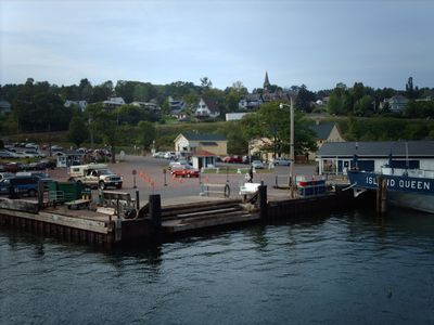
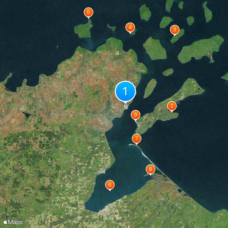
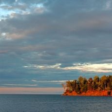
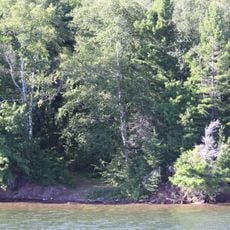
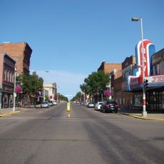
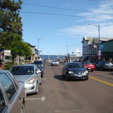
Bayfield is a small city on the southern shore of Lake Superior in northern Wisconsin, sitting directly on the waterfront with a view toward the Apostle Islands. Its downtown is compact, centered on a short strip of streets running along the water, with a marina at the edge of town.

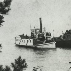
Bayfield was founded in the mid-1800s as a port town built around the lumber trade, taking advantage of its position on Lake Superior to ship timber from the surrounding forests. When the logging industry declined, the town slowly shifted toward fishing and tourism, a direction that has continued ever since.

Bayfield is known for its apple orchards, which draw visitors every fall during the harvest season and give the town a distinct rhythm tied to the land. Farm stands and local markets appear along the roads at that time, offering fresh fruit and homemade products.

The downtown area is small enough to cover on foot, with most shops and restaurants sitting within a short walk of each other along the waterfront. The weather on Lake Superior can change fast, so it is worth carrying an extra layer even in summer.

In some winters, the ice on Lake Superior grows thick enough for people to walk or even drive out to the Apostle Islands, a crossing that is only possible for a short window of weeks. This ice road, when it forms, follows the same route the ferry takes in warmer months.

The community of curious travelers

AroundUs brings together thousands of curated places, local tips, and hidden gems, enriched daily by 60,000 contributors worldwide.

Start exploring
Location
GPS coordinates
46.81167,-90.82000
Latest update
March 3, 2026 10:13
Around this place
Big Bay State Park
United States of America

Big Bay State Park

11.3 km
Gaylord Nelson Wilderness
United States of America

Gaylord Nelson Wilderness

20.8 km
Raspberry Island Light
United States of America

Raspberry Island Light

17.7 km
Sand Island Light
United States of America

Sand Island Light

23.1 km
Ashland Harbor Breakwater Light
United States of America

Ashland Harbor Breakwater Light

20.8 km
La Pointe Light
United States of America

La Pointe Light

9.6 km
United States of America

Kakagon Sloughs

17.7 km
Madeline Island Historical Museum
United States of America

Madeline Island Historical Museum

4.2 km
Bass Island Brownstone Company Quarry
United States of America

Bass Island Brownstone Company Quarry

5.4 km
Chequamegon Point Light
United States of America

Chequamegon Point Light

9.3 km
Manitou Camp
United States of America

Manitou Camp

19.4 km
Frank Boutin, Jr. House
United States of America

Frank Boutin, Jr. House

462 m
Bayfield Fish Hatchery
United States of America

Bayfield Fish Hatchery

4.4 km
Christ Episcopal Church
United States of America

Christ Episcopal Church

171 m
Ellis School
United States of America

Ellis School

25 km
Bayfield County Courthouse
United States of America

Bayfield County Courthouse

16 km
City of Ashland
United States of America

City of Ashland

14.1 km
Security Savings Bank
United States of America

Security Savings Bank

25.1 km
Ashland County Courthouse
United States of America

Ashland County Courthouse

25.1 km
Grand Opera House
United States of America

Grand Opera House

25.2 km
Sevona Cabin
United States of America

Sevona Cabin

19.1 km
West Second Street Historic District
United States of America

West Second Street Historic District

25.2 km
Washburn Public Library
United States of America

Washburn Public Library

16.5 km
East Third Street Residential Historic District
United States of America

East Third Street Residential Historic District

16.1 km
Bayfield Historic District
United States of America

Bayfield Historic District

332 m
Apostle Islands Ice Caves
United States of America

Apostle Islands Ice Caves

19.2 km
Madeline Island
United States of America

Madeline Island

4.2 km
Madeline Island Public Library
United States of America

Madeline Island Public Library

4.2 km
Show the full map
Reviews
Share your experience

No review yet

Discussions
Start a discussion...

No discussion yet

« Bayfield - fourth-class city in Bayfield County, Wisconsin » is provided by Around Us (aroundus.com). Images and texts are derived from Wikimedia project under a Creative Commons license. You are allowed to copy, distribute, and modify copies of this page, under the conditions set by the license, as long as this note is clearly visible.

Discover hidden gems everywhere you go!

From secret cafés to breathtaking viewpoints, skip the crowded tourist spots and find places that match your style. Our app makes it easy with voice search, smart filtering, route optimization, and insider tips from travelers worldwide. Download now for the complete mobile experience.

Around Us App Screenshot

A unique approach to discovering new places

Le Figaro

All the places worth exploring

France Info

A tailor-made excursion in just a few clicks

20 Minutes

Around Us
Travel Guide & Maps
Download

Send to your phone

QR Code
1

Open the camera app on your mobile.

2

Point at the QR code with your camera. A notification will appear.

3

Tap the notification to open the link.