Chest opened
+${chestReward.xp} XP
Explorer
NOUVEAU ×${chestReward.collectible.quantity}
tapez pour fermer
Chest locked

Open chests in the app

Around Us is built for your phone — chests unlock when you walk, explore and capture nearby places.

Enable Location

We need your location to show you interesting places around you

Discover nearby places

Find interesting locations and hidden gems around you

Precise directions

Get accurate directions and distances to places

Your location is never shared with other users. It's only used when you tap the location button.

Davis-Besse Nuclear Power Station

Log in to your account

Start exploring — it's free

Trusted by 73,021 travelers worldwide

Continue with Google
Continue with Apple
or

We will send you a code to connect

By continuing, you accept our Terms and Conditions and our Privacy Policy

Check your inbox

We've sent a pincode in your inbox. Please enter the code below.

Davis-Besse Nuclear Power Station
Discussion Reviews 1 Photos
37.9k Popularity

Davis-Besse Nuclear Power Station, Nuclear power station in Ottawa County, United States.

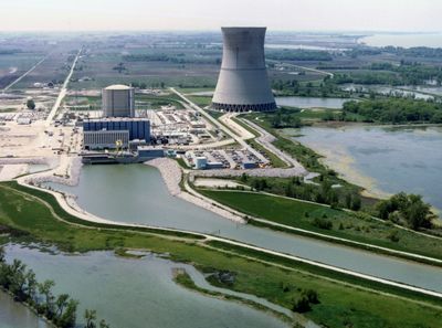
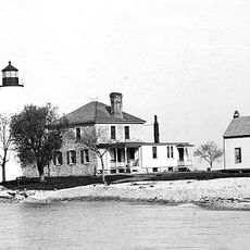
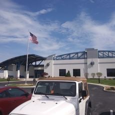
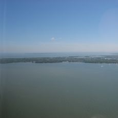
Davis-Besse is a nuclear power station situated on Lake Erie's southwestern shore in Ohio, generating electricity through a pressurized water reactor. The facility operates as a major power source for the region while sharing its location with protected natural areas.

Construction began in the early 1970s and the station started producing power in the mid-1970s, becoming part of the region's energy infrastructure. The location was selected as a strategic point for supplying electricity to the Midwest.

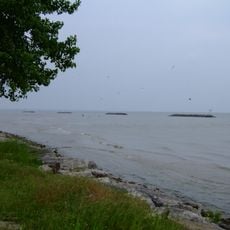
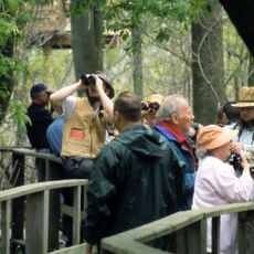
The power station shares its land with the Ottawa National Wildlife Refuge, dedicating 733 acres to natural habitat preservation.

The site is not open to the general public due to its high-security nature as a power generation facility. Visitors can explore the surrounding area and adjacent wildlife refuges that offer accessible trails and outdoor activities.

The location shares its land with a wildlife refuge that preserves hundreds of acres for natural habitats and animal life. This coexistence demonstrates how modern energy production can operate alongside environmental conservation efforts.

The community of curious travelers

AroundUs brings together thousands of curated places, local tips, and hidden gems, enriched daily by 60,000 contributors worldwide.

Start exploring
Location
GPS coordinates
41.59692,-83.08900
Latest update
December 17, 2025 09:59
Around this place
Perry's Victory and International Peace Memorial
United States of America

Perry's Victory and International Peace Memorial

24 km
Crystal Cave
United States of America

Crystal Cave

22.4 km
Maumee Bay State Park
United States of America

Maumee Bay State Park

26.3 km
West Sister Island
United States of America

West Sister Island

16 km
East Harbor State Park
United States of America

East Harbor State Park

23.9 km
African Safari Wildlife Park
United States of America

African Safari Wildlife Park

21.6 km
Ottawa National Wildlife Refuge
United States of America

Ottawa National Wildlife Refuge

10.8 km
Toledo Harbor Light
United States of America

Toledo Harbor Light

27.1 km
Edison Bridge
United States of America

Edison Bridge

24.7 km
Green Island
United States of America

Green Island

19.4 km
South Bass Island Light
United States of America

South Bass Island Light

20.9 km
Jay Cooke House
United States of America

Jay Cooke House

23.3 km
Fort Stephenson
United States of America

Fort Stephenson

28 km
Cedar Point National Wildlife Refuge
United States of America

Cedar Point National Wildlife Refuge

21.8 km
Sandusky County Jail and Sheriff's House
United States of America

Sandusky County Jail and Sheriff's House

27.9 km
Liberty Aviation Museum
United States of America

Liberty Aviation Museum

21.1 km
Catawba Island State Park
United States of America

Catawba Island State Park

19.5 km
Magee Marsh Wildlife Area
United States of America

Magee Marsh Wildlife Area

6.5 km
Erie Proving Ground
United States of America

Erie Proving Ground

7.9 km
Port Clinton Light
United States of America

Port Clinton Light

15.8 km
Green Island Light
United States of America

Green Island Light

19.2 km
Old School Privy
United States of America

Old School Privy

24.3 km
The Watering Hole Safari and Waterpark
United States of America

The Watering Hole Safari and Waterpark

23.7 km
Overmyer–Waggoner–Roush Farm
United States of America

Overmyer–Waggoner–Roush Farm

23.7 km
Frederick Fabing House
United States of America

Frederick Fabing House

28.1 km
Sandusky County Courthouse
United States of America

Sandusky County Courthouse

27.9 km
Perry's memorial lighthouse
United States of America

Perry's memorial lighthouse

24 km
West Sister Island Light
United States of America

West Sister Island Light

15.7 km
Show the full map
Reviews
Share your experience

No review yet

Discussions
Start a discussion...

No discussion yet

« Davis-Besse Nuclear Power Station - Nuclear power station in Ottawa County, United States » is provided by Around Us (aroundus.com). Images and texts are derived from Wikimedia project under a Creative Commons license. You are allowed to copy, distribute, and modify copies of this page, under the conditions set by the license, as long as this note is clearly visible.

Discover hidden gems everywhere you go!

From secret cafés to breathtaking viewpoints, skip the crowded tourist spots and find places that match your style. Our app makes it easy with voice search, smart filtering, route optimization, and insider tips from travelers worldwide. Download now for the complete mobile experience.

Around Us App Screenshot

A unique approach to discovering new places

Le Figaro

All the places worth exploring

France Info

A tailor-made excursion in just a few clicks

20 Minutes

Around Us
Travel Guide & Maps
Download

Send to your phone

QR Code
1

Open the camera app on your mobile.

2

Point at the QR code with your camera. A notification will appear.

3

Tap the notification to open the link.