Chest opened
+${chestReward.xp} XP
Explorer
NOUVEAU ×${chestReward.collectible.quantity}
tapez pour fermer
Chest locked

Open chests in the app

Around Us is built for your phone — chests unlock when you walk, explore and capture nearby places.

Enable Location

We need your location to show you interesting places around you

Discover nearby places

Find interesting locations and hidden gems around you

Precise directions

Get accurate directions and distances to places

Your location is never shared with other users. It's only used when you tap the location button.

White House

Log in to your account

Start exploring — it's free

Trusted by 72,886 travelers worldwide

Continue with Google
Continue with Apple
or

We will send you a code to connect

By continuing, you accept our Terms and Conditions and our Privacy Policy

Check your inbox

We've sent a pincode in your inbox. Please enter the code below.

White House
Discussion Reviews 1 Photos
17.3k Popularity

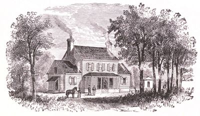
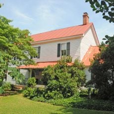
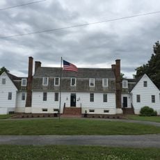
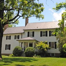
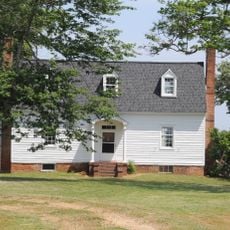
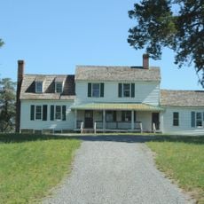
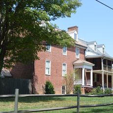
White House, 18th-century plantation on the Pamunkey River near White House in New Kent County, Virginia

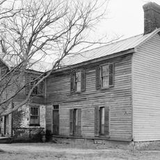
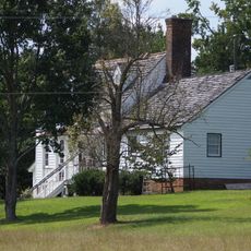
White House is a plantation in eastern Virginia built in the late 1600s with Georgian architectural style, located near the Pamunkey River. The ruins visible today include the foundations of the main house and outbuildings that once supported daily work with crops and livestock.

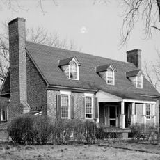
The plantation was founded around 1700 by Colonel John Lightfoot III and later became the residence of the Custis family, including Martha who married George Washington. Union troops burned the buildings in 1862 during the Civil War, ending centuries of occupation on the site.

The name reflects the Washington family's long connection to this place, a lineage that shaped the region for generations. Walking through the ruins, visitors encounter physical reminders of the colonial way of life that once centered on this plantation.

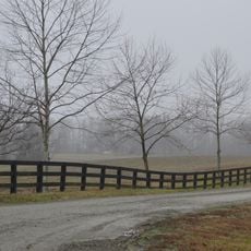
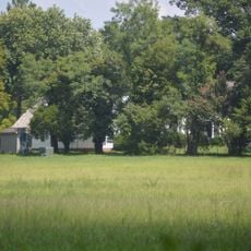
The site consists mostly of ruins and open ground that is walkable and offers direct views of the historical remains. Wear sturdy shoes since the terrain is uneven and some building foundations are sunken into the ground.

Archaeological digs in 1935 revealed traces of three different houses built at the same location, with bricks from before 1700 showing the earliest settlement. This layering of history lies hidden beneath the current ground and tells of repeated destruction and rebuilding.

The community of curious travelers

AroundUs brings together thousands of curated places, local tips, and hidden gems, enriched daily by 60,000 contributors worldwide.

Start exploring
Location
Architectural style
Georgian architecture
GPS coordinates
37.52520,-77.07730
Latest update
February 17, 2026 01:00
Around this place
Greenway Plantation
United States of America

Greenway Plantation

19.2 km
Elsing Green
United States of America

Elsing Green

8.9 km
King William County Courthouse
United States of America

King William County Courthouse

19 km
Piney Grove at Southall's Plantation
United States of America

Piney Grove at Southall's Plantation

19 km
Criss Cross
United States of America

Criss Cross

5.1 km
Glendale National Cemetery
United States of America

Glendale National Cemetery

17.1 km
Pamunkey Indian Tribe Museum
United States of America

Pamunkey Indian Tribe Museum

8.7 km
Chericoke
United States of America

Chericoke

12.7 km
Woodburn
United States of America

Woodburn

19.1 km
United States of America

Immanuel Episcopal Church

18 km
Sweet Hall
United States of America

Sweet Hall

16.2 km
George W. Watkins Elementary School
United States of America

George W. Watkins Elementary School

1.9 km
Emmaus Baptist Church
United States of America

Emmaus Baptist Church

3.2 km
Windsor Shades
United States of America

Windsor Shades

15.6 km
Former New Kent High School
United States of America

Former New Kent High School

5.7 km
Olivet Presbyterian Church
United States of America

Olivet Presbyterian Church

5.2 km
Spring Hill (Providence Forge, Virginia)
United States of America

Spring Hill (Providence Forge, Virginia)

3.2 km
Cumberland
United States of America

Cumberland

9 km
United States of America

Lott Cary Birth Site

15.7 km
Spring Green (Mechanicsville, Virginia)
United States of America

Spring Green (Mechanicsville, Virginia)

14.4 km
Clover Lea
United States of America

Clover Lea

16.2 km
Marl Hill
United States of America

Marl Hill

3.6 km
Poplar Springs
United States of America

Poplar Springs

18.9 km
Glebe of Westover Parish
United States of America

Glebe of Westover Parish

18.3 km
Cedar Lane
United States of America

Cedar Lane

3.1 km
The Tavern at Old Church
United States of America

The Tavern at Old Church

18.4 km
Lanesville Christadelphian Church
United States of America

Lanesville Christadelphian Church

13.2 km
Royal New Kent Golf Club
United States of America

Royal New Kent Golf Club

7.7 km
Show the full map
Reviews
Share your experience

No review yet

Discussions
Start a discussion...

No discussion yet

« White House - 18th-century plantation on the Pamunkey River near White House in New Kent County, Virginia » is provided by Around Us (aroundus.com). Images and texts are derived from Wikimedia project under a Creative Commons license. You are allowed to copy, distribute, and modify copies of this page, under the conditions set by the license, as long as this note is clearly visible.

Discover hidden gems everywhere you go!

From secret cafés to breathtaking viewpoints, skip the crowded tourist spots and find places that match your style. Our app makes it easy with voice search, smart filtering, route optimization, and insider tips from travelers worldwide. Download now for the complete mobile experience.

Around Us App Screenshot

A unique approach to discovering new places

Le Figaro

All the places worth exploring

France Info

A tailor-made excursion in just a few clicks

20 Minutes

Around Us
Travel Guide & Maps
Download

Send to your phone

QR Code
1

Open the camera app on your mobile.

2

Point at the QR code with your camera. A notification will appear.

3

Tap the notification to open the link.