Chest opened
+${chestReward.xp} XP
Explorer
NOUVEAU ×${chestReward.collectible.quantity}
tapez pour fermer
Chest locked

Open chests in the app

Around Us is built for your phone — chests unlock when you walk, explore and capture nearby places.

Enable Location

We need your location to show you interesting places around you

Discover nearby places

Find interesting locations and hidden gems around you

Precise directions

Get accurate directions and distances to places

Your location is never shared with other users. It's only used when you tap the location button.

Log in to your account

Start exploring — it's free

Trusted by 72,880 travelers worldwide

Continue with Google
Continue with Apple
or

We will send you a code to connect

By continuing, you accept our Terms and Conditions and our Privacy Policy

Check your inbox

We've sent a pincode in your inbox. Please enter the code below.

Brown's Ferry, Tennessee
Discussion Reviews Photo
1.2k Popularity

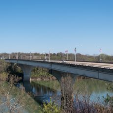
Brown's Ferry, Tennessee, Ferry crossing point near Lookout Valley, Chattanooga, United States.

Brown's Ferry is a river crossing on the Tennessee River between Lookout Valley and Moccasin Bend near Chattanooga. The site is now part of the Chickamauga and Chattanooga National Military Park with visitor access from the park's main areas.

The crossing became the scene of a key military operation in 1863 when Union forces broke through Confederate siege lines. This successful maneuver opened a new supply route and shifted the war's direction in the region.

The crossing served as a lifeline for trapped soldiers, showing how a simple river passage became central to survival and strategy. Visitors can see how this modest location held meaning far beyond its appearance.

The location lies at the edge of the main park area and is reachable on foot via marked trails. Wear sturdy shoes as some paths cross uneven ground near the river.

The supply route it served became known as the Cracker Line, named after the simple hardtack biscuits delivered there. This humble name points to the larger logistics network that emerged during the conflict.

The community of curious travelers

AroundUs brings together thousands of curated places, local tips, and hidden gems, enriched daily by 60,000 contributors worldwide.

Start exploring
Location
GPS coordinates
35.05620,-85.34500
Latest update
December 14, 2025 18:43
Around this place
Ruby Falls
United States of America

Ruby Falls

4.2 km
Delta Queen
United States of America

Delta Queen

3.3 km
Tennessee Aquarium
United States of America

Tennessee Aquarium

3.1 km
Walnut Street Bridge
United States of America

Walnut Street Bridge

3.6 km
Finley Stadium
United States of America

Finley Stadium

3.5 km
Hunter Museum of American Art
United States of America

Hunter Museum of American Art

3.5 km
The Read House Hotel
United States of America

The Read House Hotel

3.3 km
Tivoli Theatre
United States of America

Tivoli Theatre

3.3 km
Songbirds Guitar Museum
United States of America

Songbirds Guitar Museum

4.2 km
Ross's Landing
United States of America

Ross's Landing

3.3 km
Market Street Bridge
United States of America

Market Street Bridge

3.3 km
Soldiers and Sailors Memorial Auditorium
United States of America

Soldiers and Sailors Memorial Auditorium

3.7 km
Chattanooga Market
United States of America

Chattanooga Market

3.3 km
International Towing and Recovery Hall of Fame and Museum
United States of America

International Towing and Recovery Hall of Fame and Museum

4.8 km
Veterans Memorial Bridge
United States of America

Veterans Memorial Bridge

3.9 km
P. R. Olgiati Bridge
United States of America

P. R. Olgiati Bridge

2.6 km
Joel W. Solomon Federal Building and United States Courthouse
United States of America

Joel W. Solomon Federal Building and United States Courthouse

3.6 km
St. Paul's Episcopal Church
United States of America

St. Paul's Episcopal Church

3 km
Hamilton County Courthouse
United States of America

Hamilton County Courthouse

3.5 km
United States of America

Chattanooga State Office Building

4 km
Second Presbyterian Church
United States of America

Second Presbyterian Church

3.1 km
First Baptist Church
United States of America

First Baptist Church

4 km
Old Library Building
United States of America

Old Library Building

3.6 km
Trinity Methodist Episcopal Church
United States of America

Trinity Methodist Episcopal Church

4.9 km
First Baptist Church Education Building
United States of America

First Baptist Church Education Building

3.7 km
Ochs Memorial Museum
United States of America

Ochs Memorial Museum

4.9 km
The Coker Museum
United States of America

The Coker Museum

3.5 km
Classic Arcade Pinball Museum
United States of America

Classic Arcade Pinball Museum

3.1 km
Show the full map
Reviews
Share your experience

No review yet

Discussions
Start a discussion...

No discussion yet

« Brown's Ferry, Tennessee - Ferry crossing point near Lookout Valley, Chattanooga, United States » is provided by Around Us (aroundus.com). Images and texts are derived from Wikimedia project under a Creative Commons license. You are allowed to copy, distribute, and modify copies of this page, under the conditions set by the license, as long as this note is clearly visible.

Discover hidden gems everywhere you go!

From secret cafés to breathtaking viewpoints, skip the crowded tourist spots and find places that match your style. Our app makes it easy with voice search, smart filtering, route optimization, and insider tips from travelers worldwide. Download now for the complete mobile experience.

Around Us App Screenshot

A unique approach to discovering new places

Le Figaro

All the places worth exploring

France Info

A tailor-made excursion in just a few clicks

20 Minutes

Around Us
Travel Guide & Maps
Download

Send to your phone

QR Code
1

Open the camera app on your mobile.

2

Point at the QR code with your camera. A notification will appear.

3

Tap the notification to open the link.