Chest opened
+${chestReward.xp} XP
Explorer
NOUVEAU ×${chestReward.collectible.quantity}
tapez pour fermer

See the monuments around you in AR Open chests in the app

Around Us is built for your phone — point your camera at the streets and discover the monuments and places around you in augmented reality. Around Us is built for your phone — chests unlock when you walk, explore and capture nearby places.

Enable Location

We need your location to show you interesting places around you

Discover nearby places

Find interesting locations and hidden gems around you

Precise directions

Get accurate directions and distances to places

Your location is never shared with other users. It's only used when you tap the location button.

Log in to your account

Start exploring — it's free

Trusted by 87,006 travelers worldwide

Continue with Google
Continue with Apple
or

We will send you a code to connect

By continuing, you accept our Terms and Conditions and our Privacy Policy

Check your inbox

We've sent a pincode in your inbox. Please enter the code below.

Discussion Reviews Photo
1.4k Popularity

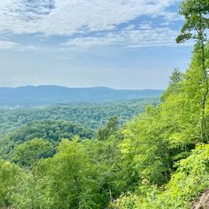
Cannon Creek Lake, reservoir in Kentucky, US

Cannon Creek Lake is a water supply reservoir in Bell County, located about 6 miles south of Pineville and situated just west of US Route 25E. The lake covers approximately 218 acres with a shoreline stretching about 7.5 miles, reaching depths of 95 feet (29 meters) at its deepest point.

The lake was completed in 1972 and opened to visitors in 1975 to supply water to the Pineville Water System. In 1988, authorities made a landmark decision prohibiting surface mining in its drainage area, marking the first such protection measure in Kentucky.

Motorboats and off-road vehicles are prohibited, keeping the water calm and making it ideal for fishing and quiet moments. The shoreline is accessible for short walks and offers natural settings suitable for relaxation without crowds.

The lake is known for morning fog that often covers the water, attracting photographers drawn to soft light and reflections on the surface. The quiet conditions also make it easier for visitors to spot birds and wildlife throughout the day.

The community of curious travelers

AroundUs brings together thousands of curated places, local tips, and hidden gems, enriched daily by 60,000 contributors worldwide.

Start exploring
Location
GPS coordinates
36.68310,-83.69565
Latest update
September 13, 2026 18:56
Around this place
Cumberland Gap
United States of America

Cumberland Gap

5.6 mi
Cumberland Gap National Historical Park
United States of America

Cumberland Gap National Historical Park

5.5 mi
Pine Mountain State Resort Park
United States of America

Pine Mountain State Resort Park

4.4 mi
Hensley Settlement
United States of America

Hensley Settlement

9.3 mi
Wilderness Road State Park
United States of America

Wilderness Road State Park

10 mi
Tri-State Peak
United States of America

Tri-State Peak

5.8 mi
Gap Cave
United States of America

Gap Cave

5.8 mi
Dr. Thomas Walker State Historic Site
United States of America

Dr. Thomas Walker State Historic Site

16.4 mi
Kincaid-Ausmus House
United States of America

Kincaid-Ausmus House

14.3 mi
Kincaid House
United States of America

Kincaid House

16.5 mi
James Weir House
United States of America

James Weir House

17.3 mi
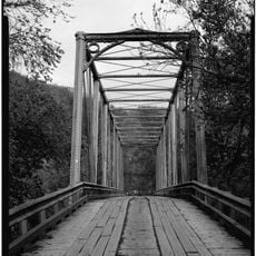
Kentucky Route 2014 Bridge
United States of America

Kentucky Route 2014 Bridge

8 mi
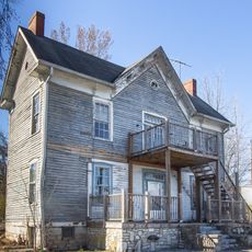
Smith-Little-Mars House
United States of America

Smith-Little-Mars House

21 mi
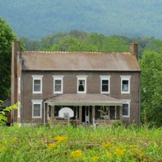
Graham-Kivett House
United States of America

Graham-Kivett House

17.4 mi
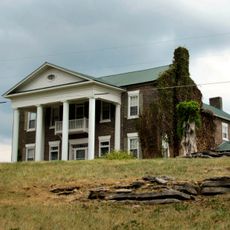
William Sayers Homestead
United States of America

William Sayers Homestead

8.5 mi
Pineville Courthouse Square Historic District
United States of America

Pineville Courthouse Square Historic District

5.4 mi
McClain-Ellison House
United States of America

McClain-Ellison House

20.4 mi
Mitchell Building-First State Bank Building
United States of America

Mitchell Building-First State Bank Building

16.5 mi
Middlesboro Downtown Commercial District
United States of America

Middlesboro Downtown Commercial District

5.3 mi
Barbourville Commercial District
United States of America

Barbourville Commercial District

16.6 mi
Wilderness Road State Park
United States of America

Wilderness Road State Park

10.1 mi
Kesterson-Watkins House
United States of America

Kesterson-Watkins House

17.3 mi
Ewing Trail
United States of America

Ewing Trail

14.6 mi
Abraham Lincoln Library and Museum
United States of America

Abraham Lincoln Library and Museum

7.4 mi
Cumberland Gap Historic District
United States of America

Cumberland Gap Historic District

5.6 mi
United States of America

Tri-State Point

5.8 mi
United States of America

Ewing Trail (Horseback)

14.7 mi
United States of America

Pinnacle Overlook

5.6 mi
Show the full map
Reviews
Share your experience

No review yet

Discussions
Start a discussion...

No discussion yet

« Cannon Creek Lake - reservoir in Kentucky, US » is provided by Around Us (aroundus.com). Images and texts are derived from Wikimedia project under a Creative Commons license. You are allowed to copy, distribute, and modify copies of this page, under the conditions set by the license, as long as this note is clearly visible.

Discover hidden gems everywhere you go!

From secret cafés to breathtaking viewpoints, skip the crowded tourist spots and find places that match your style. Our app makes it easy with voice search, smart filtering, route optimization, and insider tips from travelers worldwide. Download now for the complete mobile experience.

Around Us App Screenshot

A unique approach to discovering new places

Le Figaro

All the places worth exploring

France Info

A tailor-made excursion in just a few clicks

20 Minutes

Around Us
Travel Guide & Maps
Download

Send to your phone

QR Code
1

Open the camera app on your mobile.

2

Point at the QR code with your camera. A notification will appear.

3

Tap the notification to open the link.