Enable Location

We need your location to show you interesting places around you

Discover nearby places

Find interesting locations and hidden gems around you

Precise directions

Get accurate directions and distances to places

Your location is never shared with other users. It's only used when you tap the location button.

Log in to your account

Start exploring — it's free

Trusted by 63,009 travelers worldwide

Continue with Google
Continue with Apple
or

We will send you a code to connect

By continuing, you accept our Terms and Conditions and our Privacy Policy

Check your inbox

We've sent a pincode in your inbox. Please enter the code below.

Tri-State Peak
Discussion Reviews Photo
4.2k Popularity

Tri-State Peak, Mountain summit at Cumberland Gap National Historical Park, United States.

Tri-State Peak is a mountain summit in the Cumberland Mountains marking the exact point where Kentucky, Tennessee, and Virginia meet. The elevation reaches approximately 1,990 feet above sea level and forms a clear boundary intersection between the three states.

This peak gained military importance during the Civil War when Union forces fortified the area to control movement through the mountain passage. The fortifications represented a strategic effort to secure the Cumberland Gap region during the conflict.

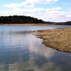
This peak stands where a historic passage through the mountains shaped how people traveled and settled across regions. The location reflects centuries of movement and crossing that made it a meaningful reference point.

The summit is accessible via a hiking trail that takes roughly 4 kilometers round trip to complete. The route passes through Cumberland Gap National Historical Park and offers a moderate walk to the three-state boundary point.

A boundary marker from 1665 identifies the exact spot where the three states converge. This surveying landmark was documented and officially recognized by engineering societies.

The community of curious travelers

AroundUs brings together thousands of curated places, local tips, and hidden gems, enriched daily by 60,000 contributors worldwide.

Start exploring
Location
Location
Location
GPS coordinates
36.60136,-83.67525
Latest update
December 11, 2025 11:04
Around this place
Cumberland Gap
United States of America

Cumberland Gap

333 m
Norris Lake
United States of America

Norris Lake

38 km
Cumberland Gap National Historical Park
United States of America

Cumberland Gap National Historical Park

1.1 km
Pine Mountain State Resort Park
United States of America

Pine Mountain State Resort Park

16.9 km
Hensley Settlement
United States of America

Hensley Settlement

15.2 km
United States of America

Wilderness Road State Park

14 km
Dr. Thomas Walker State Historic Site
United States of America

Dr. Thomas Walker State Historic Site

34.3 km
Kincaid-Ausmus House
United States of America

Kincaid-Ausmus House

16.5 km
Kincaid House
United States of America

Kincaid House

19.9 km
James Weir House
United States of America

James Weir House

19 km
Kentucky Route 2014 Bridge
United States of America

Kentucky Route 2014 Bridge

22.1 km
Smith-Little-Mars House
United States of America

Smith-Little-Mars House

28.6 km
Graham-Kivett House
United States of America

Graham-Kivett House

19 km
Old Classroom Building, Union College
United States of America

Old Classroom Building, Union College

33.9 km
Speed Hall
United States of America

Speed Hall

35.5 km
William Sayers Homestead
United States of America

William Sayers Homestead

9.4 km
Pineville Courthouse Square Historic District
United States of America

Pineville Courthouse Square Historic District

17.9 km
Grant-Lee Hall
United States of America

Grant-Lee Hall

2.6 km
McClain-Ellison House
United States of America

McClain-Ellison House

27.9 km
Mitchell Building-First State Bank Building
United States of America

Mitchell Building-First State Bank Building

35.1 km
American Association, Limited, Office Building
United States of America

American Association, Limited, Office Building

3.9 km
Middlesboro Downtown Commercial District
United States of America

Middlesboro Downtown Commercial District

3.5 km
Barbourville Commercial District
United States of America

Barbourville Commercial District

35.1 km
Wilderness Road State Park
United States of America

Wilderness Road State Park

13.7 km
Soldiers and Sailors Memorial Gymnasium
United States of America

Soldiers and Sailors Memorial Gymnasium

35.5 km
Kesterson-Watkins House
United States of America

Kesterson-Watkins House

20.2 km
Abraham Lincoln Library and Museum
United States of America

Abraham Lincoln Library and Museum

2.8 km
Cumberland Gap Historic District
United States of America

Cumberland Gap Historic District

291 m
Show the full map
Reviews
Share your experience

No review yet

Discussions
Start a discussion...

No discussion yet

« Tri-State Peak - Mountain summit at Cumberland Gap National Historical Park, United States » is provided by Around Us (aroundus.com). Images and texts are derived from Wikimedia project under a Creative Commons license. You are allowed to copy, distribute, and modify copies of this page, under the conditions set by the license, as long as this note is clearly visible.

Discover hidden gems everywhere you go!

From secret cafés to breathtaking viewpoints, skip the crowded tourist spots and find places that match your style. Our app makes it easy with voice search, smart filtering, route optimization, and insider tips from travelers worldwide. Download now for the complete mobile experience.

Around Us App Screenshot

A unique approach to discovering new places

Le Figaro

All the places worth exploring

France Info

A tailor-made excursion in just a few clicks

20 Minutes

Around Us
Travel Guide & Maps
Download

Send to your phone

QR Code
1

Open the camera app on your mobile.

2

Point at the QR code with your camera. A notification will appear.

3

Tap the notification to open the link.