Chest opened
+${chestReward.xp} XP
Explorer
NOUVEAU ×${chestReward.collectible.quantity}
tapez pour fermer
Chest locked

Open chests in the app

Around Us is built for your phone — chests unlock when you walk, explore and capture nearby places.

Enable Location

We need your location to show you interesting places around you

Discover nearby places

Find interesting locations and hidden gems around you

Precise directions

Get accurate directions and distances to places

Your location is never shared with other users. It's only used when you tap the location button.

Cherry Hill

Log in to your account

Start exploring — it's free

Trusted by 72,880 travelers worldwide

Continue with Google
Continue with Apple
or

We will send you a code to connect

By continuing, you accept our Terms and Conditions and our Privacy Policy

Check your inbox

We've sent a pincode in your inbox. Please enter the code below.

Discussion Reviews 1 Photos
12.1k Popularity

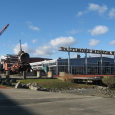
Cherry Hill, Residential district in South Baltimore, US.

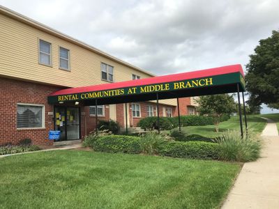
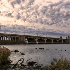
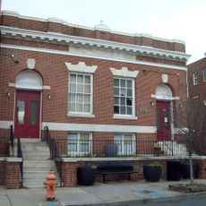
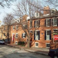
Cherry Hill is a residential neighborhood in South Baltimore that stretches along the Middle Branch of the Patapsco River and is characterized by rowhomes and public housing developments. The streets are lined with these typical row houses that define the neighborhood's appearance.

The neighborhood developed after World War II as housing for African-American military veterans returning from service. This founding period shaped the community from its beginning.

Local community organizations actively participate in neighborhood initiatives, organizing events and programs for residents throughout the year.

The area connects to downtown Baltimore through Light Rail service at Cherry Hill station and bus lines 26 and 71. These transportation options provide convenient access in and around the neighborhood.

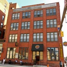
DeBaufre Bakeries, a maker of Baltimore's traditional Berger Cookies, operates its production facility within the neighborhood. This bakery has been a local landmark for many years.

The community of curious travelers

AroundUs brings together thousands of curated places, local tips, and hidden gems, enriched daily by 60,000 contributors worldwide.

Start exploring
Location
Elevation above the sea
6 m
GPS coordinates
39.24940,-76.62350
Latest update
March 5, 2026 21:06
Around this place
Oriole Park at Camden Yards
United States of America

Oriole Park at Camden Yards

3.8 km
M&T Bank Stadium
United States of America

M&T Bank Stadium

3.2 km
B&O Railroad Museum
United States of America

B&O Railroad Museum

4.1 km
Maryland Science Center
United States of America

Maryland Science Center

3.7 km
Horseshoe Casino Baltimore
United States of America

Horseshoe Casino Baltimore

3.5 km
American Visionary Art Museum
United States of America

American Visionary Art Museum

3.7 km
Mount Clare
United States of America

Mount Clare

3.7 km
Baltimore Museum of Industry
United States of America

Baltimore Museum of Industry

3.3 km
Hanover Street Bridge
United States of America

Hanover Street Bridge

1.1 km
Montgomery Park
United States of America

Montgomery Park

3.5 km
Baltimore
United States of America

Baltimore

3.4 km
Sports Legends Museum at Camden Yards
United States of America

Sports Legends Museum at Camden Yards

3.9 km
Pennsylvania Railroad 4876
United States of America

Pennsylvania Railroad 4876

3.9 km
Carrollton Viaduct
United States of America

Carrollton Viaduct

4 km
HarborView Condominium
United States of America

HarborView Condominium

3.5 km
B&O Railroad Museum
United States of America

B&O Railroad Museum

4.1 km
Christ United Church of Christ
United States of America

Christ United Church of Christ

3.6 km
Walters Bath No. 2
United States of America

Walters Bath No. 2

3.8 km
Towers at Harbor Court
United States of America

Towers at Harbor Court

3.8 km
Lansdowne Christian Church
United States of America

Lansdowne Christian Church

3.5 km
Riverside Historic District
United States of America

Riverside Historic District

2.6 km
Loft Historic District South
United States of America

Loft Historic District South

4.1 km
414 Light Street
United States of America

414 Light Street

3.9 km
Little Montgomery Street Historic District
United States of America

Little Montgomery Street Historic District

3.5 km
Cherry Hill Branch
United States of America

Cherry Hill Branch

162 m
Curtis Bay Water Tank
United States of America

Curtis Bay Water Tank

3.8 km
Broening Park
United States of America

Broening Park

845 m
I-895 Curtis Bay Steel Bridge
United States of America

I-895 Curtis Bay Steel Bridge

2.5 km
Show the full map
Reviews
Share your experience

No review yet

Discussions
Start a discussion...

No discussion yet

« Cherry Hill - Residential district in South Baltimore, US » is provided by Around Us (aroundus.com). Images and texts are derived from Wikimedia project under a Creative Commons license. You are allowed to copy, distribute, and modify copies of this page, under the conditions set by the license, as long as this note is clearly visible.

Discover hidden gems everywhere you go!

From secret cafés to breathtaking viewpoints, skip the crowded tourist spots and find places that match your style. Our app makes it easy with voice search, smart filtering, route optimization, and insider tips from travelers worldwide. Download now for the complete mobile experience.

Around Us App Screenshot

A unique approach to discovering new places

Le Figaro

All the places worth exploring

France Info

A tailor-made excursion in just a few clicks

20 Minutes

Around Us
Travel Guide & Maps
Download

Send to your phone

QR Code
1

Open the camera app on your mobile.

2

Point at the QR code with your camera. A notification will appear.

3

Tap the notification to open the link.