Enable Location

We need your location to show you interesting places around you

Discover nearby places

Find interesting locations and hidden gems around you

Precise directions

Get accurate directions and distances to places

Your location is never shared with other users. It's only used when you tap the location button.

Curwensville Lake

Log in to your account

Start exploring — it's free

Trusted by 62,490 travelers worldwide

Continue with Google
Continue with Apple
or

We will send you a code to connect

By continuing, you accept our Terms and Conditions and our Privacy Policy

Check your inbox

We've sent a pincode in your inbox. Please enter the code below.

Curwensville Lake

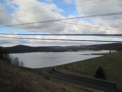
Curwensville Lake, body of water

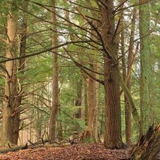
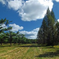
Curwensville Lake is a reservoir in Pennsylvania covering about 790 acres of water, surrounded by forest and featuring a sandy beach for visitors. The lake was created by the U.S. Army Corps of Engineers through a dam and provides space for boating, fishing, and water activities of all kinds.

The lake was built by the U.S. Army Corps of Engineers and has served flood control and water storage purposes for the community for many years. The project has become an established recreation destination that continues to be operated and maintained by the county.

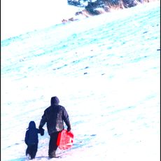
The lake serves as a gathering place where locals and visitors spend time with family and friends throughout the year. The facilities around the water reflect how people in the region enjoy outdoor recreation together, from picnics to group celebrations.

The lake is easily reached from I-80 at Exit 120 and offers parking plus multiple camping spots with electrical hookups for RVs and tents. Visitors should note that children and people in small boats must wear life jackets, and all motorboats need to be registered.

The area is home to a family of Bald Eagles that can often be seen soaring above the water and catching fish from the surface. These birds make the lake a special destination for bird watchers interested in observing these large raptors in their natural habitat.

The community of curious travelers

AroundUs brings together thousands of curated places, local tips, and hidden gems, enriched daily by 60,000 contributors worldwide.

Start exploring
Location
GPS coordinates
40.95417,-78.52667
Latest update
February 9, 2026 08:20
Around this place
Prince Gallitzin State Park
United States of America

Prince Gallitzin State Park

31.1 km
Parker Dam State Park
United States of America

Parker Dam State Park

27.6 km
Bilger's Rocks
United States of America

Bilger's Rocks

7.1 km
Moshannon State Forest
United States of America

Moshannon State Forest

28.6 km
Rowland Theater
United States of America

Rowland Theater

26.3 km
Clearfield County Courthouse
United States of America

Clearfield County Courthouse

10.6 km
St. Severin's Old Log Church
United States of America

St. Severin's Old Log Church

36 km
Irvin-Patchin House
United States of America

Irvin-Patchin House

26.9 km
McGees Mills Covered Bridge
United States of America

McGees Mills Covered Bridge

21.7 km
Philipsburg Historic District
United States of America

Philipsburg Historic District

26.8 km
Hardman Philips House
United States of America

Hardman Philips House

26.9 km
Old Town Historic District
United States of America

Old Town Historic District

10.5 km
DuBois Historic District
United States of America

DuBois Historic District

27 km
Hogback Bridge
United States of America

Hogback Bridge

3.7 km
Thomas Murray House
United States of America

Thomas Murray House

10.4 km
Coalport Historic District
United States of America

Coalport Historic District

23 km
Sen. Joseph O. Clark House
United States of America

Sen. Joseph O. Clark House

29.5 km
Bridge in Greenwood Township
United States of America

Bridge in Greenwood Township

11.2 km
S. B. Elliott State Park
United States of America

S. B. Elliott State Park

17.2 km
Bridge in Westover Borough
United States of America

Bridge in Westover Borough

25.4 km
Market Street Bridge
United States of America

Market Street Bridge

10.4 km
DuBois Lanes
United States of America

DuBois Lanes

26.2 km
Parker Dam State Park Family Cabin District
United States of America

Parker Dam State Park Family Cabin District

27.1 km
S. B. Elliott State Park Family Cabin District
United States of America

S. B. Elliott State Park Family Cabin District

17.6 km
S. B. Elliott State Park Day Use District
United States of America

S. B. Elliott State Park Day Use District

17.7 km
Clearfield Lanes
United States of America

Clearfield Lanes

10.1 km
Laurel Mountain Winery
United States of America

Laurel Mountain Winery

35.3 km
Clearfield Presbyterian Church
United States of America

Clearfield Presbyterian Church

10.8 km
Show the full map
« Curwensville Lake - body of water » is provided by Around Us (aroundus.com). Images and texts are derived from Wikimedia project under a Creative Commons license. You are allowed to copy, distribute, and modify copies of this page, under the conditions set by the license, as long as this note is clearly visible.

Discover hidden gems everywhere you go!

From secret cafés to breathtaking viewpoints, skip the crowded tourist spots and find places that match your style. Our app makes it easy with voice search, smart filtering, route optimization, and insider tips from travelers worldwide. Download now for the complete mobile experience.

Around Us App Screenshot

A unique approach to discovering new places

Le Figaro

All the places worth exploring

France Info

A tailor-made excursion in just a few clicks

20 Minutes

Around Us
Travel Guide & Maps
Download

Send to your phone

QR Code
1

Open the camera app on your mobile.

2

Point at the QR code with your camera. A notification will appear.

3

Tap the notification to open the link.