Enable Location

We need your location to show you interesting places around you

Discover nearby places

Find interesting locations and hidden gems around you

Precise directions

Get accurate directions and distances to places

Your location is never shared with other users. It's only used when you tap the location button.

Fink-Type Truss Bridge

Log in to your account

Start exploring — it's free

Trusted by 63,069 travelers worldwide

Continue with Google
Continue with Apple
or

We will send you a code to connect

By continuing, you accept our Terms and Conditions and our Privacy Policy

Check your inbox

We've sent a pincode in your inbox. Please enter the code below.

Discussion Reviews 1 Photos
1.9k Popularity

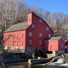
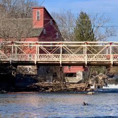
Fink-Type Truss Bridge, Iron truss bridge in Hunterdon County, United States.

The Fink-Type Truss Bridge is an iron through truss structure that once crossed the South Branch Raritan River in Hunterdon County. This single-span bridge measured roughly 100 feet in length and 15 feet in width, connecting communities on either side of the waterway.

The Trenton Locomotive and Machine Manufacturing Company built this structure in 1857 using Albert Fink's patented design from 1854. It represented the kind of iron bridge technology that enabled railroad networks to expand across the nation during the industrial age.

The structure represented a major advancement in American engineering, as iron truss bridges enabled the rapid expansion of railways across the United States.

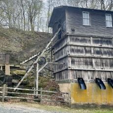
The bridge collapsed in 1978, after which its remains were relocated to the Hunterdon County Government Center for safekeeping and study. Today, visitors can view the preserved sections and learn about the original structure through historical documentation at this location.

The design employed multiple diagonal members that extended downward from the upper posts at different angles, eliminating the need for a lower supporting chord. This unconventional bracing system made it a notable example of practical engineering innovation during its time.

The community of curious travelers

AroundUs brings together thousands of curated places, local tips, and hidden gems, enriched daily by 60,000 contributors worldwide.

Start exploring
Location
GPS coordinates
40.60390,-74.90280
Latest update
December 14, 2025 11:23
Around this place
United States of America

Round Valley Reservoir

6.9 km
Spruce Run Recreation Area
United States of America

Spruce Run Recreation Area

7.2 km
Red Mill
United States of America

Red Mill

3.7 km
Pennsylvania Railroad 4877
United States of America

Pennsylvania Railroad 4877

6.7 km
Hunterdon Art Museum
United States of America

Hunterdon Art Museum

3.7 km
Mount Salem Vineyards
United States of America

Mount Salem Vineyards

7.4 km
Clinton Historic District
United States of America

Clinton Historic District

3.9 km
Main Street Bridge
United States of America

Main Street Bridge

3.7 km
Perryville Tavern
United States of America

Perryville Tavern

6.5 km
Dunham's Mill
United States of America

Dunham's Mill

3.7 km
M. C. Mulligan & Sons Quarry
United States of America

M. C. Mulligan & Sons Quarry

3.8 km
Quaker Meeting House
United States of America

Quaker Meeting House

5.4 km
Red Mill Museum Village
United States of America

Red Mill Museum Village

3.7 km
Mount Salem Methodist Episcopal Church
United States of America

Mount Salem Methodist Episcopal Church

6.8 km
Christoffel Vought Farmstead
United States of America

Christoffel Vought Farmstead

4.4 km
Lansdown
United States of America

Lansdown

409 m
Old Grandin Library
United States of America

Old Grandin Library

3.7 km
Mechlin's Corner Tavern
United States of America

Mechlin's Corner Tavern

7.2 km
Rockhill Agricultural Historic District
United States of America

Rockhill Agricultural Historic District

4.3 km
Music Hall
United States of America

Music Hall

3.4 km
Bethlehem United Presbyterian Church
United States of America

Bethlehem United Presbyterian Church

3.1 km
Union Forge Bridge
United States of America

Union Forge Bridge

7.4 km
Spruce Run Reservoir
United States of America

Spruce Run Reservoir

6 km
Quakertown Methodist Episcopal Church
United States of America

Quakertown Methodist Episcopal Church

5.5 km
Quakertown Historic District
United States of America

Quakertown Historic District

5.6 km
Lebanon Historic District
United States of America

Lebanon Historic District

7.1 km
Annandale Historic District
United States of America

Annandale Historic District

4.7 km
Pittstown Historic District
United States of America

Pittstown Historic District

5.4 km
Show the full map
Reviews
Share your experience

No review yet

Discussions
Start a discussion...

No discussion yet

« Fink-Type Truss Bridge - Iron truss bridge in Hunterdon County, United States » is provided by Around Us (aroundus.com). Images and texts are derived from Wikimedia project under a Creative Commons license. You are allowed to copy, distribute, and modify copies of this page, under the conditions set by the license, as long as this note is clearly visible.

Discover hidden gems everywhere you go!

From secret cafés to breathtaking viewpoints, skip the crowded tourist spots and find places that match your style. Our app makes it easy with voice search, smart filtering, route optimization, and insider tips from travelers worldwide. Download now for the complete mobile experience.

Around Us App Screenshot

A unique approach to discovering new places

Le Figaro

All the places worth exploring

France Info

A tailor-made excursion in just a few clicks

20 Minutes

Around Us
Travel Guide & Maps
Download

Send to your phone

QR Code
1

Open the camera app on your mobile.

2

Point at the QR code with your camera. A notification will appear.

3

Tap the notification to open the link.