Enable Location

We need your location to show you interesting places around you

Discover nearby places

Find interesting locations and hidden gems around you

Precise directions

Get accurate directions and distances to places

Your location is never shared with other users. It's only used when you tap the location button.

Fort Washington Avenue

Log in to your account

Start exploring — it's free

Trusted by 65,040 travelers worldwide

Continue with Google
Continue with Apple
or

We will send you a code to connect

By continuing, you accept our Terms and Conditions and our Privacy Policy

Check your inbox

We've sent a pincode in your inbox. Please enter the code below.

Fort Washington Avenue
Discussion Reviews 1 Photos
4.6k Popularity

Fort Washington Avenue, North-south avenue in Washington Heights, Manhattan, US

Fort Washington Avenue is a north-south street in Washington Heights, Manhattan, running from the area near Fort Tryon Park down to around 159th Street where it meets Broadway. The road follows a rocky ridge, which gives it one of the highest natural elevations on the island.

The avenue takes its name from Fort Washington, an American fortification built during the Revolutionary War that stood near the northern end of Manhattan. British forces captured it in 1776, and the loss was one of the most costly defeats for the Continental Army in the entire war.

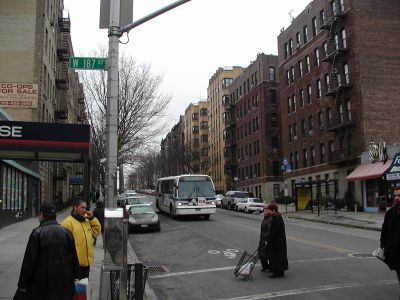
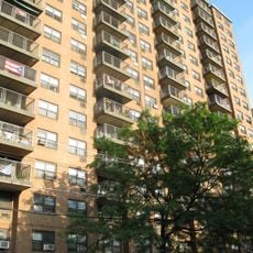
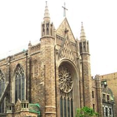
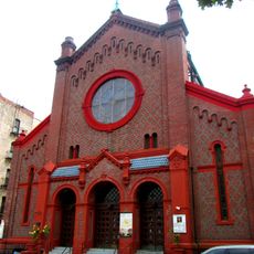
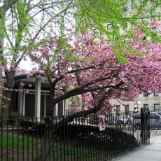
The avenue runs through Washington Heights, a neighborhood shaped largely by its Dominican community. Street vendors, bodegas, and social clubs line the sidewalks, giving the area a feel that sets it apart from much of Manhattan.

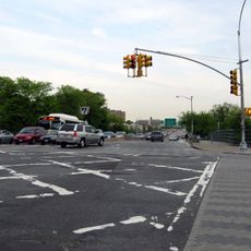
The A subway line runs nearby and provides easy access to several points along the avenue, making it straightforward to move between the northern and southern ends. The terrain is hilly in parts, so comfortable shoes are a good idea if you plan to walk a long stretch.

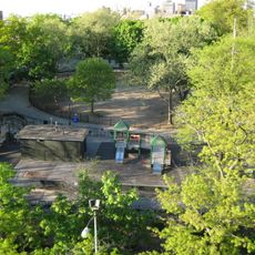
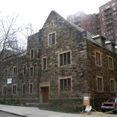
Bennett Park, which sits just off the avenue, is marked by an outline on the ground showing the original footprint of the fort that gave the street its name. Most visitors walk through it without realizing they are standing on the site of one of the war's turning points.

The community of curious travelers

AroundUs brings together thousands of curated places, local tips, and hidden gems, enriched daily by 60,000 contributors worldwide.

Start exploring
Location
Length
2,837 m
GPS coordinates
40.84830,-73.93930
Latest update
March 3, 2026 08:12
Around this place
George Washington Bridge
United States of America

George Washington Bridge

1.2 km
Audubon Ballroom
United States of America

Audubon Ballroom

1 km
High Bridge
United States of America

High Bridge

1 km
1520 Sedgwick Avenue
United States of America

1520 Sedgwick Avenue

1.3 km
Jeffrey's Hook Light
United States of America

Jeffrey's Hook Light

680 m
United Palace
United States of America

United Palace

237 m
Washington Bridge
United States of America

Washington Bridge

976 m
Alexander Hamilton Bridge
United States of America

Alexander Hamilton Bridge

945 m
Malcolm X and Dr. Betty Shabazz Memorial and Educational Center
United States of America

Malcolm X and Dr. Betty Shabazz Memorial and Educational Center

1 km
Highbridge Park
United States of America

Highbridge Park

798 m
United States of America

Bridge Apartments

379 m
Bennett Park
United States of America

Bennett Park

509 m
St. Elizabeth's Church
United States of America

St. Elizabeth's Church

802 m
United States of America

Manhattan Prong

1.2 km
Church of the Incarnation, Roman Catholic
United States of America

Church of the Incarnation, Roman Catholic

417 m
United States of America

Gorman Park

1 km
181st Street
United States of America

181st Street

884 m
Evangelical Lutheran Church of St. Matthew
United States of America

Evangelical Lutheran Church of St. Matthew

951 m
St. Rose of Lima's Church
United States of America

St. Rose of Lima's Church

1.1 km
Mount Sinai Jewish Center
United States of America

Mount Sinai Jewish Center

817 m
Fort Washington Presbyterian Church
United States of America

Fort Washington Presbyterian Church

347 m
Our Saviour's Atonement Lutheran Church
United States of America

Our Saviour's Atonement Lutheran Church

882 m
Holyrood Episcopal Church
United States of America

Holyrood Episcopal Church

147 m
Mitchell Square Park
United States of America

Mitchell Square Park

915 m
Coliseum Theatre
United States of America

Coliseum Theatre

381 m
Fort Washington Library
United States of America

Fort Washington Library

491 m
250 Cabrini Boulevard
United States of America

250 Cabrini Boulevard

826 m
Highbridge Reservoir
United States of America

Highbridge Reservoir

804 m
Show the full map
Reviews
Share your experience

No review yet

Discussions
Start a discussion...

No discussion yet

« Fort Washington Avenue - North-south avenue in Washington Heights, Manhattan, US » is provided by Around Us (aroundus.com). Images and texts are derived from Wikimedia project under a Creative Commons license. You are allowed to copy, distribute, and modify copies of this page, under the conditions set by the license, as long as this note is clearly visible.

Discover hidden gems everywhere you go!

From secret cafés to breathtaking viewpoints, skip the crowded tourist spots and find places that match your style. Our app makes it easy with voice search, smart filtering, route optimization, and insider tips from travelers worldwide. Download now for the complete mobile experience.

Around Us App Screenshot

A unique approach to discovering new places

Le Figaro

All the places worth exploring

France Info

A tailor-made excursion in just a few clicks

20 Minutes

Around Us
Travel Guide & Maps
Download

Send to your phone

QR Code
1

Open the camera app on your mobile.

2

Point at the QR code with your camera. A notification will appear.

3

Tap the notification to open the link.