Enable Location

We need your location to show you interesting places around you

Discover nearby places

Find interesting locations and hidden gems around you

Precise directions

Get accurate directions and distances to places

Your location is never shared with other users. It's only used when you tap the location button.

Fort Reno Park

Log in to your account

Start exploring — it's free

Trusted by 62,822 travelers worldwide

Continue with Google
Continue with Apple
or

We will send you a code to connect

By continuing, you accept our Terms and Conditions and our Privacy Policy

Check your inbox

We've sent a pincode in your inbox. Please enter the code below.

Fort Reno Park

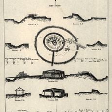
Fort Reno Park, Urban park in Tenleytown, United States.

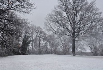
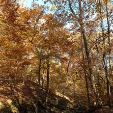
Fort Reno Park spreads across gentle hills in the northwest part of the city and reaches the highest natural elevation in the capital at 125 meters (409 feet) above sea level. Large grassy areas take up most of the space, surrounded by rows of trees and crossed by gravel paths.

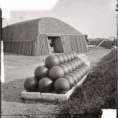
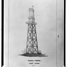
A defense post was built here in 1861 to protect the capital during the Civil War and carried another name before being dedicated to the fallen officer. Later the military structures disappeared and the grounds became open to the public in the early 20th century.

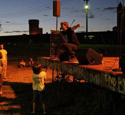
The name honors a Civil War general, while the open lawns today serve neighbors for picnics and walks with their dogs. Summer concerts are also held here on a simple stage that draws young people from around the area.

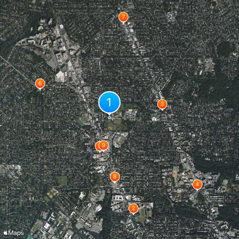
The easiest way to arrive is on foot or by metro to the nearest stop, then walk a bit uphill through residential streets. The playgrounds and sports fields are in the lower section and work well for families with children.

Beneath the grass lie concrete bunkers and cylindrical structures from Cold War days that were meant to serve as an emergency communication center. Some entrances are overgrown, while others stand clearly visible among the trees.

The community of curious travelers

AroundUs brings together thousands of curated places, local tips, and hidden gems, enriched daily by 60,000 contributors worldwide.

Start exploring
Location
Inception
1901
Operator
National Park Service
Part of
Rock Creek Park (U.S. agency)
Address
4000 Chesapeake St NW, Washington, DC 20016
GPS coordinates
38.95250,-77.07889
Latest update
December 20, 2025 15:14
Around this place
Sidwell Friends School
United States of America

Sidwell Friends School

1.5 km
Peter Muhlenberg Memorial
United States of America

Peter Muhlenberg Memorial

822 m
Intelsat headquarters
United States of America

Intelsat headquarters

1.7 km
Janney Elementary School
United States of America

Janney Elementary School

545 m
Fort Bayard
United States of America

Fort Bayard

1.1 km
Avalon Theatre
United States of America

Avalon Theatre

1.5 km
Harold and Sylvia Greenberg Theatre
United States of America

Harold and Sylvia Greenberg Theatre

998 m
Sears, Roebuck and Company Department Store
United States of America

Sears, Roebuck and Company Department Store

520 m
Fort Kearny
United States of America

Fort Kearny

1.1 km
Willoughby Condominium
United States of America

Willoughby Condominium

1.5 km
Jesse Reno School
United States of America

Jesse Reno School

144 m
Grant Road Historic District
United States of America

Grant Road Historic District

286 m
Dumblane
United States of America

Dumblane

759 m
Chevy Chase Arcade
United States of America

Chevy Chase Arcade

1.2 km
Tenley-Friendship Neighborhood Library
United States of America

Tenley-Friendship Neighborhood Library

543 m
Convent de Bon Secours
United States of America

Convent de Bon Secours

486 m
Eldbrooke United Methodist Church
United States of America

Eldbrooke United Methodist Church

444 m
Ponce de Leon Apartment Building
United States of America

Ponce de Leon Apartment Building

1.2 km
Willoughby Park
United States of America

Willoughby Park

1.4 km
Chevy Chase Neighborhood Library
United States of America

Chevy Chase Neighborhood Library

1.5 km
Springland
United States of America

Springland

1.5 km
N. Webster Chappell House
United States of America

N. Webster Chappell House

677 m
Robert and Lillie May Stone House
United States of America

Robert and Lillie May Stone House

1.2 km
Walde-Carter House
United States of America

Walde-Carter House

1.4 km
Dopamine Land D.C.: A Multisensory Experience
United States of America

Dopamine Land D.C.: A Multisensory Experience

948 m
Fort Reno
United States of America

Fort Reno

260 m
Hilleary T. Burrows House
United States of America

Hilleary T. Burrows House

1 km
Soapstone Valley Park
United States of America

Soapstone Valley Park

1.8 km
Show the full map
« Fort Reno Park - Urban park in Tenleytown, United States » is provided by Around Us (aroundus.com). Images and texts are derived from Wikimedia project under a Creative Commons license. You are allowed to copy, distribute, and modify copies of this page, under the conditions set by the license, as long as this note is clearly visible.

Discover hidden gems everywhere you go!

From secret cafés to breathtaking viewpoints, skip the crowded tourist spots and find places that match your style. Our app makes it easy with voice search, smart filtering, route optimization, and insider tips from travelers worldwide. Download now for the complete mobile experience.

Around Us App Screenshot

A unique approach to discovering new places

Le Figaro

All the places worth exploring

France Info

A tailor-made excursion in just a few clicks

20 Minutes

Around Us
Travel Guide & Maps
Download

Send to your phone

QR Code
1

Open the camera app on your mobile.

2

Point at the QR code with your camera. A notification will appear.

3

Tap the notification to open the link.