Enable Location

We need your location to show you interesting places around you

Discover nearby places

Find interesting locations and hidden gems around you

Precise directions

Get accurate directions and distances to places

Your location is never shared with other users. It's only used when you tap the location button.

Grant Road Historic District

Log in to your account

Start exploring — it's free

Trusted by 62,373 travelers worldwide

Continue with Google
Continue with Apple
or

We will send you a code to connect

By continuing, you accept our Terms and Conditions and our Privacy Policy

Check your inbox

We've sent a pincode in your inbox. Please enter the code below.

Grant Road Historic District, historic district in Washington, D.C., United States

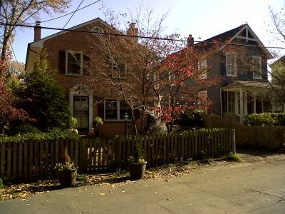
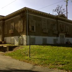
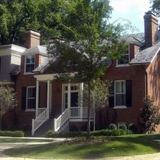
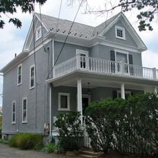
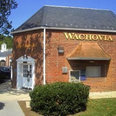
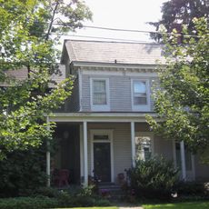
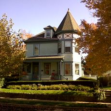
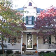
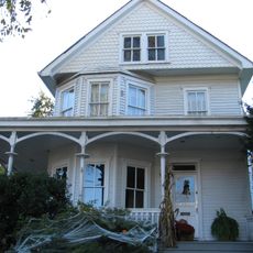
The Grant Road Historic District is a neighborhood in Washington, D.C., featuring a narrow, winding street section that has remained largely unchanged for over a century. The area includes about 13 historic buildings dating from 1860 to 1931, including small two-story homes in I-House style, Italianate boxes, and folk houses with gabled roofs, plus a notable 1887 commercial structure on Wisconsin Avenue that once housed a general store and post office.

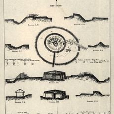
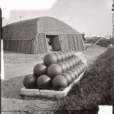
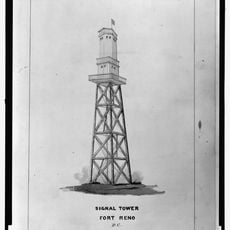
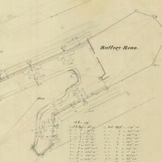
The district emerged in the 1860s after Fort Reno was built nearby during the Civil War, bringing military activity to the area. After the war, Grant Road developed into a residential street, with increased house building in the late 1800s, especially after a streetcar line opened along Wisconsin Avenue in 1890, connecting the area to downtown.

Grant Road takes its name from General and later President Ulysses S. Grant, a key leader during the Civil War. The street evolved after the war into a residential area for working-class families, reflecting how this rural settlement gradually transformed into a neighborhood.

The district is located in the Tenleytown neighborhood and can be explored on foot by walking along Grant Road between Wisconsin Avenue and Brandywine Street. This short, quiet walk best reveals the original street and old houses, with flat terrain that remains easy to navigate.

A notable aspect of the district is that President Theodore Roosevelt was known to ride horseback through the neighborhood, visiting friends or going to nearby hunting lodges. This personal connection to an American president highlights the area's role as a quiet rural refuge near the city.

The community of curious travelers

AroundUs brings together thousands of curated places, local tips, and hidden gems, enriched daily by 60,000 contributors worldwide.

Start exploring
Location
GPS coordinates
38.95028,-77.07722
Latest update
February 9, 2026 07:44
Around this place
Fort Reno Park
United States of America

Fort Reno Park

286 m
Peter Muhlenberg Memorial
United States of America

Peter Muhlenberg Memorial

763 m
Intelsat headquarters
United States of America

Intelsat headquarters

1.5 km
Katzen Arts Center
United States of America

Katzen Arts Center

1.5 km
American University Museum
United States of America

American University Museum

1.5 km
General Artemas Ward
United States of America

General Artemas Ward

1.6 km
Fort Bayard
United States of America

Fort Bayard

1.4 km
Harold and Sylvia Greenberg Theatre
United States of America

Harold and Sylvia Greenberg Theatre

750 m
Fort Kearny
United States of America

Fort Kearny

1.1 km
Jesse Reno School
United States of America

Jesse Reno School

247 m
Dumblane
United States of America

Dumblane

618 m
Chevy Chase Arcade
United States of America

Chevy Chase Arcade

1.4 km
Tenley-Friendship Neighborhood Library
United States of America

Tenley-Friendship Neighborhood Library

367 m
Convent de Bon Secours
United States of America

Convent de Bon Secours

361 m
Eldbrooke United Methodist Church
United States of America

Eldbrooke United Methodist Church

376 m
Ponce de Leon Apartment Building
United States of America

Ponce de Leon Apartment Building

998 m
Willoughby Park
United States of America

Willoughby Park

1.7 km
Springland
United States of America

Springland

1.2 km
N. Webster Chappell House
United States of America

N. Webster Chappell House

524 m
Massachusetts Avenue Parking Shops
United States of America

Massachusetts Avenue Parking Shops

1.7 km
Samuel and Harriet Burrows House
United States of America

Samuel and Harriet Burrows House

1.5 km
Robert and Lillie May Stone House
United States of America

Robert and Lillie May Stone House

1.4 km
Walde-Carter House
United States of America

Walde-Carter House

1.5 km
Dopamine Land D.C.: A Multisensory Experience
United States of America

Dopamine Land D.C.: A Multisensory Experience

1.2 km
Fort Reno
United States of America

Fort Reno

290 m
Hilleary T. Burrows House
United States of America

Hilleary T. Burrows House

1.3 km
Soapstone Valley Park
United States of America

Soapstone Valley Park

1.6 km
Battery Reno
United States of America

Battery Reno

619 m
Show the full map
« Grant Road Historic District - historic district in Washington, D.C., United States » is provided by Around Us (aroundus.com). Images and texts are derived from Wikimedia project under a Creative Commons license. You are allowed to copy, distribute, and modify copies of this page, under the conditions set by the license, as long as this note is clearly visible.

Discover hidden gems everywhere you go!

From secret cafés to breathtaking viewpoints, skip the crowded tourist spots and find places that match your style. Our app makes it easy with voice search, smart filtering, route optimization, and insider tips from travelers worldwide. Download now for the complete mobile experience.

Around Us App Screenshot

A unique approach to discovering new places

Le Figaro

All the places worth exploring

France Info

A tailor-made excursion in just a few clicks

20 Minutes

Around Us
Travel Guide & Maps
Download

Send to your phone

QR Code
1

Open the camera app on your mobile.

2

Point at the QR code with your camera. A notification will appear.

3

Tap the notification to open the link.