Enable Location

We need your location to show you interesting places around you

Discover nearby places

Find interesting locations and hidden gems around you

Precise directions

Get accurate directions and distances to places

Your location is never shared with other users. It's only used when you tap the location button.

Log in to your account

Start exploring — it's free

Trusted by 61,830 travelers worldwide

Continue with Google
Continue with Apple
or

We will send you a code to connect

By continuing, you accept our Terms and Conditions and our Privacy Policy

Check your inbox

We've sent a pincode in your inbox. Please enter the code below.

Fort Halifax

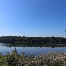
Fort Halifax, Protected area in Halifax, Pennsylvania, United States.

Description

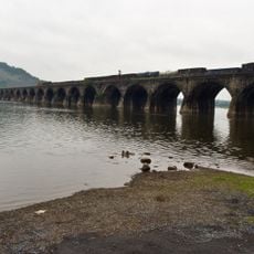
Fort Halifax is a historic fortification along the Susquehanna River featuring four bastions and earthen works that measure approximately 160 feet square and stand about 10 feet high. The site displays the geometric layout of this colonial defensive structure with its distinctive corner reinforcements still visible.

History

Colonel William Clapham founded the fort in 1756 during the French and Indian War as a defensive post to protect the region. Local pine timber was used in its construction to secure this strategic river crossing area against French attacks.

Culture

The site served as a meeting ground where British colonial officials and Iroquois leaders gathered to discuss military and territorial matters. These encounters shaped the relationship between European settlers and Native peoples in the region.

Practical

The site is now maintained by Halifax Township Park and Conservation Area with interpretive signage throughout the grounds. Visitors should wear sturdy footwear as the earthen works can be slippery, especially after rain or during wet seasons.

Did you know?

Archaeological digs in 2023 uncovered everyday objects that tell stories of those who lived here, including clay pipes, brass buttons, and musket balls. These discoveries offer glimpses into the daily lives of soldiers and inhabitants who occupied the fort.

Location
GPS coordinates
40.47790,-76.93340
Latest update
December 14, 2025 11:00

AroundUs brings together thousands of curated places, local tips, and hidden gems, enriched daily by 60,000 contributors worldwide. Discover all places nearby (Pennsylvania).

Around this place
Rockville Bridge
United States of America

Rockville Bridge

16.2 km
Little Buffalo State Park
United States of America

Little Buffalo State Park

20.5 km
Boyd Big Tree Preserve Conservation Area
United States of America

Boyd Big Tree Preserve Conservation Area

15.1 km
Zembo Shrine Building
United States of America

Zembo Shrine Building

21 km
Joseph E. Ibberson Conservation Area
United States of America

Joseph E. Ibberson Conservation Area

8.4 km
Wildwood Park
United States of America

Wildwood Park

18.6 km
Kesher Israel Congregation
United States of America

Kesher Israel Congregation

21.6 km
Harvest
United States of America

Harvest

20.9 km
Archibald McAllister House
United States of America

Archibald McAllister House

15.2 km
Dauphin County Veteran's Memorial Obelisk
United States of America

Dauphin County Veteran's Memorial Obelisk

20.9 km
Clemson Island Prehistoric District
United States of America

Clemson Island Prehistoric District

1.8 km
Dellville Covered Bridge
United States of America

Dellville Covered Bridge

20.1 km
State Game Lands Number 256
United States of America

State Game Lands Number 256

19 km
Newport Historic District
United States of America

Newport Historic District

16.9 km
North Oriental Covered Bridge
United States of America

North Oriental Covered Bridge

21.5 km
East Oriental Covered Bridge
United States of America

East Oriental Covered Bridge

18.8 km
Red Covered Bridge
United States of America

Red Covered Bridge

12.2 km
Fort Hunter Historic District
United States of America

Fort Hunter Historic District

15.3 km
Bridge in Newport Borough
United States of America

Bridge in Newport Borough

16.7 km
Dauphin County Bridge No. 27
United States of America

Dauphin County Bridge No. 27

18.6 km
John Ayres House
United States of America

John Ayres House

8.9 km
Fleisher Covered Bridge
United States of America

Fleisher Covered Bridge

19.1 km
Henniger Farm Covered Bridge
United States of America

Henniger Farm Covered Bridge

16.8 km
Romberger-Stover House
United States of America

Romberger-Stover House

17.3 km
Bridge in Reed Township
United States of America

Bridge in Reed Township

8.7 km
Little Buffalo Historic District
United States of America

Little Buffalo Historic District

20.2 km
Marysville Bridge
United States of America

Marysville Bridge

13.1 km
Halifax, Pennsylvania
United States of America

Halifax, Pennsylvania

1 km
Show the full map
« Fort Halifax - Protected area in Halifax, Pennsylvania, United States » is provided by Around Us (aroundus.com). Images and texts are derived from Wikimedia project under a Creative Commons license. You are allowed to copy, distribute, and modify copies of this page, under the conditions set by the license, as long as this note is clearly visible.

Discover hidden gems everywhere you go!

From secret cafés to breathtaking viewpoints, skip the crowded tourist spots and find places that match your style. Our app makes it easy with voice search, smart filtering, route optimization, and insider tips from travelers worldwide. Download now for the complete mobile experience.

Around Us App Screenshot

A unique approach to discovering new places

Le Figaro

All the places worth exploring

France Info

A tailor-made excursion in just a few clicks

20 Minutes

Around Us
Travel Guide & Maps
Download

Send to your phone

QR Code
1

Open the camera app on your mobile.

2

Point at the QR code with your camera. A notification will appear.

3

Tap the notification to open the link.