Chest opened
+${chestReward.xp} XP
Explorer
NOUVEAU ×${chestReward.collectible.quantity}
tapez pour fermer

See the monuments around you in AR Open chests in the app

Around Us is built for your phone — point your camera at the streets and discover the monuments and places around you in augmented reality. Around Us is built for your phone — chests unlock when you walk, explore and capture nearby places.

Enable Location

We need your location to show you interesting places around you

Discover nearby places

Find interesting locations and hidden gems around you

Precise directions

Get accurate directions and distances to places

Your location is never shared with other users. It's only used when you tap the location button.

Log in to your account

Start exploring — it's free

Trusted by 86,132 travelers worldwide

Continue with Google
Continue with Apple
or

We will send you a code to connect

By continuing, you accept our Terms and Conditions and our Privacy Policy

Check your inbox

We've sent a pincode in your inbox. Please enter the code below.

Fort Hoop
Discussion Reviews Photo
3.3k Popularity

Fort Hoop, Dutch trading post in Hartford, Connecticut, United States

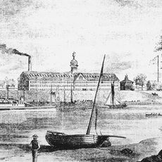
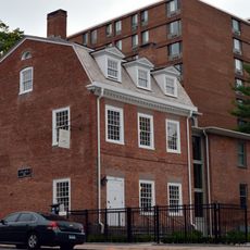
Fort Hoop was a Dutch settlement at the junction where the Park River met the Connecticut River in Hartford. The site contained a block house, palisade walls, and cannons positioned to protect the trading operation.

Jacob van Curler established the fort in 1633 for the Dutch West India Company after buying land from the Sequins, a local Native people. The settlement aimed to secure Dutch trading interests in New England.

The settlement served as a Dutch commercial hub where trade with local peoples formed the center of daily activity. This location shaped early European contact in the region and demonstrated how the Dutch sought economic influence through commerce.

The historical site is located in Hartford's Dutch Point neighborhood, with Huyshope Avenue marking where the original structures stood. The area is accessible to visitors interested in exploring colonial history and following the riverside path.

The garrison numbered only around fourteen soldiers in 1639, revealing vulnerability to English settlers who began establishing nearby communities. This small force proved unable to resist the growing English presence in the region.

The community of curious travelers

AroundUs brings together thousands of curated places, local tips, and hidden gems, enriched daily by 60,000 contributors worldwide.
Start exploring
Location
GPS coordinates
41.76000,-72.67000
Latest update
September 12, 2026 07:30
Around this place
Charter Oak
United States of America

Charter Oak

0.2 mi
Wadsworth Atheneum Museum of Art
United States of America

Wadsworth Atheneum Museum of Art

0.3 mi
Colt Armory
United States of America

Colt Armory

0.4 mi
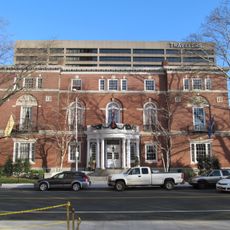
Travelers Tower
United States of America

Travelers Tower

0.3 mi
Armsmear
United States of America

Armsmear

0.5 mi
Old State House
United States of America

Old State House

0.4 mi
Connecticut Science Center
United States of America

Connecticut Science Center

0.3 mi
Founders Bridge
United States of America

Founders Bridge

0.5 mi
Hartford Public Library
United States of America

Hartford Public Library

0.3 mi
Hartford Club
United States of America

Hartford Club

0.4 mi
777 Main Street
United States of America

777 Main Street

0.5 mi
Municipal Building
United States of America

Municipal Building

0.3 mi
Goodwin Square
United States of America

Goodwin Square

0.4 mi
Butler-McCook Homestead
United States of America

Butler-McCook Homestead

0.3 mi
Hartford Times Building
United States of America

Hartford Times Building

0.2 mi
Capewell Horse Nail Company
United States of America

Capewell Horse Nail Company

0.2 mi
Hartford Holy Trinity Roman Catholic Lithuanian Church
United States of America

Hartford Holy Trinity Roman Catholic Lithuanian Church

0.4 mi
Sts. Cyril and Methodius Church
United States of America

Sts. Cyril and Methodius Church

0.2 mi
Hartford Botanical Garden
United States of America

Hartford Botanical Garden

0.4 mi
Henry Barnard House
United States of America

Henry Barnard House

0.4 mi
Charter Oak Place
United States of America

Charter Oak Place

0.2 mi
St. John's Episcopal Church
United States of America

St. John's Episcopal Church

0.3 mi
Main Street Historic District No. 2
United States of America

Main Street Historic District No. 2

0.3 mi
Amos Bull House
United States of America

Amos Bull House

0.2 mi
First National Bank Building
United States of America

First National Bank Building

0.5 mi
Stone Bridge
United States of America

Stone Bridge

0.3 mi
Buckingham Square District
United States of America

Buckingham Square District

0.3 mi
Hyde-St. John House
United States of America

Hyde-St. John House

0.2 mi
Show the full map
Reviews
Share your experience

No review yet

Discussions
Start a discussion...

No discussion yet

« Fort Hoop - Dutch trading post in Hartford, Connecticut, United States » is provided by Around Us (aroundus.com). Images and texts are derived from Wikimedia project under a Creative Commons license. You are allowed to copy, distribute, and modify copies of this page, under the conditions set by the license, as long as this note is clearly visible.

Discover hidden gems everywhere you go!

From secret cafés to breathtaking viewpoints, skip the crowded tourist spots and find places that match your style. Our app makes it easy with voice search, smart filtering, route optimization, and insider tips from travelers worldwide. Download now for the complete mobile experience.

Around Us App Screenshot

A unique approach to discovering new places

Le Figaro

All the places worth exploring

France Info

A tailor-made excursion in just a few clicks

20 Minutes

Around Us
Travel Guide & Maps
Download

Send to your phone

QR Code
1

Open the camera app on your mobile.

2

Point at the QR code with your camera. A notification will appear.

3

Tap the notification to open the link.