Chest opened
+${chestReward.xp} XP
Explorer
NOUVEAU ×${chestReward.collectible.quantity}
tapez pour fermer
Chest locked

Open chests in the app

Around Us is built for your phone — chests unlock when you walk, explore and capture nearby places.

Enable Location

We need your location to show you interesting places around you

Discover nearby places

Find interesting locations and hidden gems around you

Precise directions

Get accurate directions and distances to places

Your location is never shared with other users. It's only used when you tap the location button.

Log in to your account

Start exploring — it's free

Trusted by 72,878 travelers worldwide

Continue with Google
Continue with Apple
or

We will send you a code to connect

By continuing, you accept our Terms and Conditions and our Privacy Policy

Check your inbox

We've sent a pincode in your inbox. Please enter the code below.

Discussion Reviews Photo
1.2k Popularity

Glen Rock Historic District, Historic district in Glen Rock, Pennsylvania.

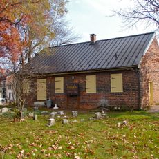
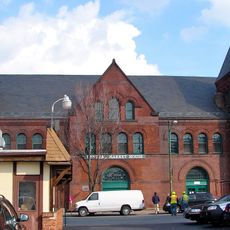
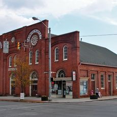
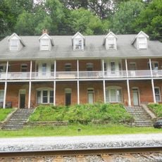
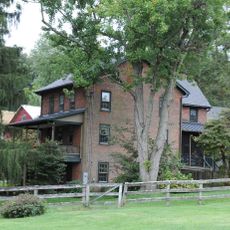
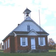
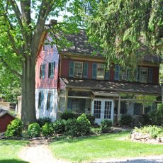
Glen Rock Historic District is a residential area in Pennsylvania with wood-frame buildings constructed between 1838 and 1945. The area stretches across several blocks and contains houses, an old theater, and two churches that remain visible today.

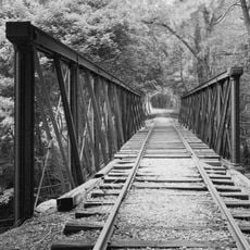
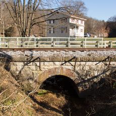
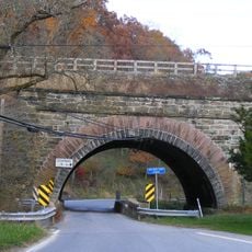
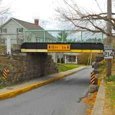
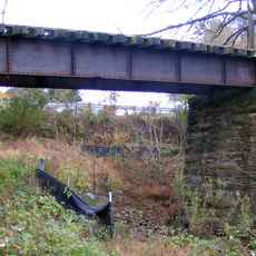
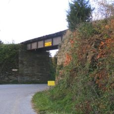
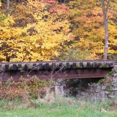
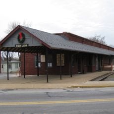
The area grew around a railroad line in the 1800s that brought industry and commerce to the region. The arrival of the railway bridge in 1871 accelerated settlement and building construction.

The district contains buildings from different periods that show how residents lived and conducted their daily routines. Churches and the old theater served as gathering places where the community came together.

The district is located near Glenvue Road, Hanover Street, Manchester Street, and Center Street and can be explored on foot. Walking slowly through the different blocks allows you to see the various buildings and street layouts.

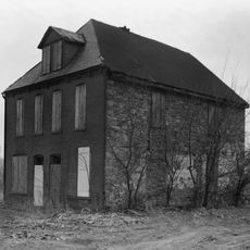
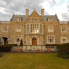
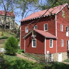
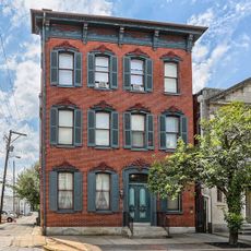
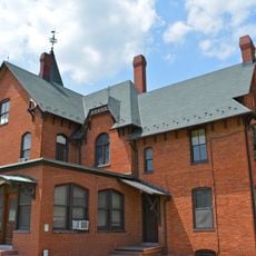
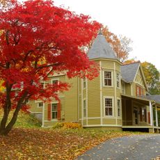
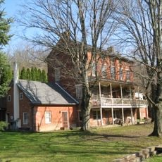
The Philip Shaffer House from 1840 displays the early building style of this area. In contrast, 'The Castle' from 1889 is a more elaborate structure that shows how the prosperity of residents grew over the decades.

The community of curious travelers

AroundUs brings together thousands of curated places, local tips, and hidden gems, enriched daily by 60,000 contributors worldwide.

Start exploring
Location
GPS coordinates
39.79280,-76.73280
Latest update
December 14, 2025 18:02
Around this place
Codorus State Park
United States of America

Codorus State Park

17.6 km
Prettyboy Reservoir
United States of America

Prettyboy Reservoir

16.7 km
Cookes House
United States of America

Cookes House

18.1 km
York Meetinghouse
United States of America

York Meetinghouse

18.8 km
York Historic District
United States of America

York Historic District

17.5 km
Farmers Market
United States of America

Farmers Market

18.5 km
Valley Road Bridge, Stewartstown Railroad
United States of America

Valley Road Bridge, Stewartstown Railroad

11.4 km
Springdale Historic District
United States of America

Springdale Historic District

17.5 km
Wallace-Cross Mill
United States of America

Wallace-Cross Mill

16.4 km
South Road Bridge, Northern Central Railway
United States of America

South Road Bridge, Northern Central Railway

3.9 km
Bridge 634, Northern Central Railway
United States of America

Bridge 634, Northern Central Railway

2.4 km
Bridge 5+92, Northern Central Railway
United States of America

Bridge 5+92, Northern Central Railway

7.6 km
Stone Arch Road Bridge, Stewartstown Railroad
United States of America

Stone Arch Road Bridge, Stewartstown Railroad

6.1 km
Smyser-Bair House
United States of America

Smyser-Bair House

18.7 km
Ridge Road Bridge, Stewartstown Railroad
United States of America

Ridge Road Bridge, Stewartstown Railroad

9.9 km
Deer Creek Bridge, Stewartstown Railroad
United States of America

Deer Creek Bridge, Stewartstown Railroad

8.2 km
Red Lion Borough Historic District
United States of America

Red Lion Borough Historic District

15.8 km
Spring Grove Borough Historic District
United States of America

Spring Grove Borough Historic District

14.5 km
S. B. Brodbeck Housing
United States of America

S. B. Brodbeck Housing

8.5 km
Jacob F. Shaffer Farm
United States of America

Jacob F. Shaffer Farm

13.3 km
Fissel's School
United States of America

Fissel's School

2.8 km
The Nook
United States of America

The Nook

17 km
Samuel Stoner Homestead
United States of America

Samuel Stoner Homestead

14.8 km
Railroad Borough Historic District
United States of America

Railroad Borough Historic District

4.7 km
Heritage Hills Golf Course
United States of America

Heritage Hills Golf Course

18.5 km
Bridgewater
United States of America

Bridgewater

16.7 km
Agricultural & Industrial Museum
United States of America

Agricultural & Industrial Museum

18.5 km
Nixon County Park
United States of America

Nixon County Park

10.1 km
Show the full map
Reviews
Share your experience

No review yet

Discussions
Start a discussion...

No discussion yet

« Glen Rock Historic District - Historic district in Glen Rock, Pennsylvania » is provided by Around Us (aroundus.com). Images and texts are derived from Wikimedia project under a Creative Commons license. You are allowed to copy, distribute, and modify copies of this page, under the conditions set by the license, as long as this note is clearly visible.

Discover hidden gems everywhere you go!

From secret cafés to breathtaking viewpoints, skip the crowded tourist spots and find places that match your style. Our app makes it easy with voice search, smart filtering, route optimization, and insider tips from travelers worldwide. Download now for the complete mobile experience.

Around Us App Screenshot

A unique approach to discovering new places

Le Figaro

All the places worth exploring

France Info

A tailor-made excursion in just a few clicks

20 Minutes

Around Us
Travel Guide & Maps
Download

Send to your phone

QR Code
1

Open the camera app on your mobile.

2

Point at the QR code with your camera. A notification will appear.

3

Tap the notification to open the link.