Chest opened
+${chestReward.xp} XP
Explorer
NOUVEAU ×${chestReward.collectible.quantity}
tapez pour fermer
Chest locked

Open chests in the app

Around Us is built for your phone — chests unlock when you walk, explore and capture nearby places.

Enable Location

We need your location to show you interesting places around you

Discover nearby places

Find interesting locations and hidden gems around you

Precise directions

Get accurate directions and distances to places

Your location is never shared with other users. It's only used when you tap the location button.

Hazelwood

Log in to your account

Start exploring — it's free

Trusted by 72,886 travelers worldwide

Continue with Google
Continue with Apple
or

We will send you a code to connect

By continuing, you accept our Terms and Conditions and our Privacy Policy

Check your inbox

We've sent a pincode in your inbox. Please enter the code below.

Discussion Reviews 1 Photos
11.9k Popularity

Hazelwood, Residential neighborhood in Pittsburgh, United States

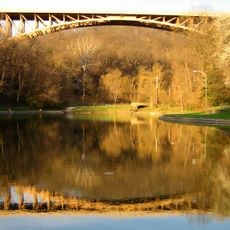
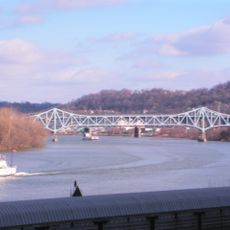
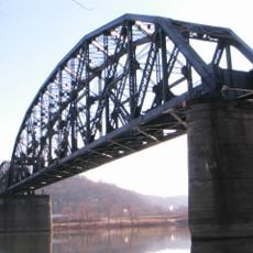
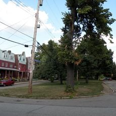
Hazelwood is a residential neighborhood in Pittsburgh that runs along the Monongahela River and borders Greenfield, Oakland, Squirrel Hill, and Glen Hazel. The area contains a mix of residential streets and green spaces throughout its hilly terrain.

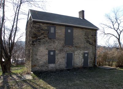
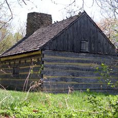
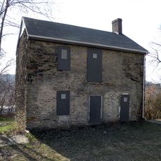
Scottish settlers established the area as Scotch Bottom, and John Woods built his estate 'Hazel Hill' in 1784, one of Pittsburgh's oldest stone buildings. The neighborhood later became a major center for steel and coke production.

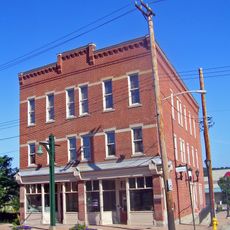
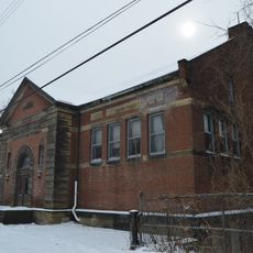
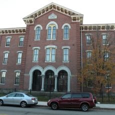
The neighborhood became home to Hungarian, Italian, Slovak, Carpatho-Rusin, Polish, and Irish communities starting in the late 1800s. You can still see traces of this diversity reflected in the local streets and buildings today.

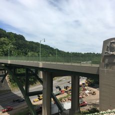
The neighborhood connects to public transportation through 18 flights of city steps that help navigate the steep hills. These stairs serve as important landmarks and routes for visitors exploring the hilly terrain.

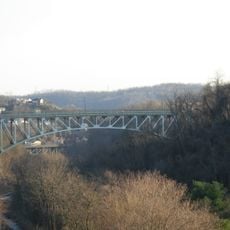
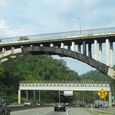
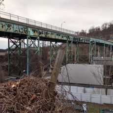
The former Hazelwood Coke Works, Pittsburgh's last operating steel mill until 1998, occupied 178 acres along the river. Today this site is being transformed into Hazelwood Green, a major development project reshaping the area's industrial past.

The community of curious travelers

AroundUs brings together thousands of curated places, local tips, and hidden gems, enriched daily by 60,000 contributors worldwide.

Start exploring
Location
GPS coordinates
40.40900,-79.94100
Latest update
December 7, 2025 20:48
Around this place
Taylor Allderdice High School
United States of America

Taylor Allderdice High School

2.9 km
Schenley Park
United States of America

Schenley Park

2.8 km
Hot Metal Bridge
United States of America

Hot Metal Bridge

2.7 km
Carnegie Library of Homestead
United States of America

Carnegie Library of Homestead

3.2 km
Sandcastle Waterpark
United States of America

Sandcastle Waterpark

1.6 km
Homestead Grays Bridge
United States of America

Homestead Grays Bridge

1.9 km
Panther Hollow Bridge
United States of America

Panther Hollow Bridge

3.1 km
Glenwood Bridge
United States of America

Glenwood Bridge

1.4 km
Neill Log House
United States of America

Neill Log House

3.1 km
Greenfield Bridge
United States of America

Greenfield Bridge

2.1 km
Glenwood B&O Railroad Bridge
United States of America

Glenwood B&O Railroad Bridge

1.4 km
Panther Hollow Lake
United States of America

Panther Hollow Lake

3.2 km
Bost Building
United States of America

Bost Building

3.1 km
St. Philomena's Church
United States of America

St. Philomena's Church

2.8 km
John Woods House
United States of America

John Woods House

704 m
Oakland Square Historic District
United States of America

Oakland Square Historic District

3.3 km
Pittsburgh Mercantile Company Building
United States of America

Pittsburgh Mercantile Company Building

3.1 km
Charles Anderson Memorial Bridge
United States of America

Charles Anderson Memorial Bridge

2.9 km
Hazelwood Branch of the Carnegie Library of Pittsburgh
United States of America

Hazelwood Branch of the Carnegie Library of Pittsburgh

392 m
Homestead Historic District
United States of America

Homestead Historic District

2.9 km
Catahecassa (Snyder) Spring
United States of America

Catahecassa (Snyder) Spring

3 km
Samuel F.B. Morse School
United States of America

Samuel F.B. Morse School

3.2 km
Greenfield Bridge
United States of America

Greenfield Bridge

2.2 km
Swinburne Bridge
United States of America

Swinburne Bridge

2.1 km
Frazier Street Bridge
United States of America

Frazier Street Bridge

2.2 km
Magee Playground
United States of America

Magee Playground

1.8 km
Hot Metal Bridge
United States of America

Hot Metal Bridge

2.7 km
Wilmot Street Bridge
United States of America

Wilmot Street Bridge

2.9 km
Show the full map
Reviews
Share your experience

No review yet

Discussions
Start a discussion...

No discussion yet

« Hazelwood - Residential neighborhood in Pittsburgh, United States » is provided by Around Us (aroundus.com). Images and texts are derived from Wikimedia project under a Creative Commons license. You are allowed to copy, distribute, and modify copies of this page, under the conditions set by the license, as long as this note is clearly visible.

Discover hidden gems everywhere you go!

From secret cafés to breathtaking viewpoints, skip the crowded tourist spots and find places that match your style. Our app makes it easy with voice search, smart filtering, route optimization, and insider tips from travelers worldwide. Download now for the complete mobile experience.

Around Us App Screenshot

A unique approach to discovering new places

Le Figaro

All the places worth exploring

France Info

A tailor-made excursion in just a few clicks

20 Minutes

Around Us
Travel Guide & Maps
Download

Send to your phone

QR Code
1

Open the camera app on your mobile.

2

Point at the QR code with your camera. A notification will appear.

3

Tap the notification to open the link.