Enable Location

We need your location to show you interesting places around you

Discover nearby places

Find interesting locations and hidden gems around you

Precise directions

Get accurate directions and distances to places

Your location is never shared with other users. It's only used when you tap the location button.

Harvey's Lake

Log in to your account

Start exploring — it's free

Trusted by 62,302 travelers worldwide

Continue with Google
Continue with Apple
or

We will send you a code to connect

By continuing, you accept our Terms and Conditions and our Privacy Policy

Check your inbox

We've sent a pincode in your inbox. Please enter the code below.

Harvey's Lake

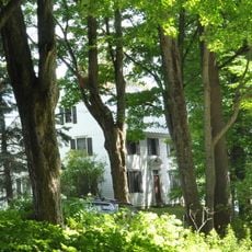
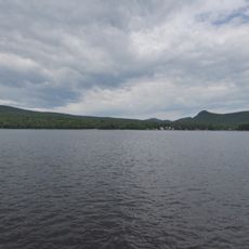
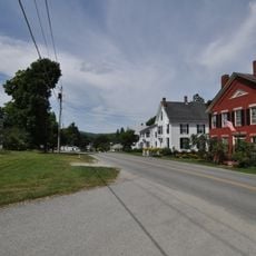
Harvey's Lake, lake in Barnet, Vermont

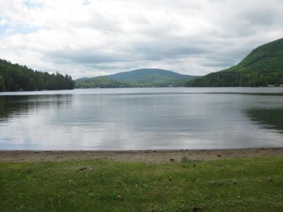
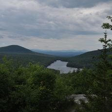
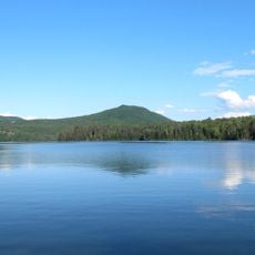
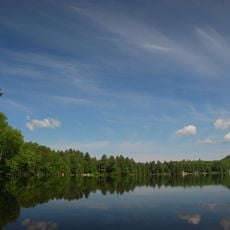
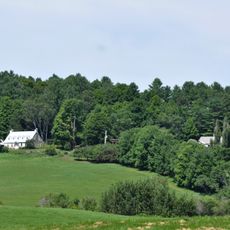
Harvey's Lake is a reservoir near the town of Barnet in northeastern Vermont, covering just over half a square mile with depths reaching over 140 feet. A small dam at the northern end is operated by the town of Barnet to hold back the water.

The lake was shaped by the region's early settlers hundreds of years ago and has served as a recreation spot ever since. A notable moment occurred in the early 1920s when young Jacques Cousteau attended summer camp nearby and experimented with breathing underwater using hollow reeds from the shallows.

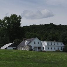
The lake's name comes from the area's early settler history, though official maps write it without an apostrophe. Locals value the place as a gathering spot where families and friends come together to enjoy simple pleasures by the water.

The lake sits at about 900 feet above sea level and is accessible for swimming, canoeing, and fishing during the summer months. Harvey's Lake Park on the northern shore offers beaches and picnic areas, and a private campground is located nearby for visitors.

The lake was where Cousteau experimented as a boy in the 1920s with hollow reeds from the shallows before he later invented diving equipment. These early attempts in shallow water helped him understand how to stay underwater longer.

The community of curious travelers

AroundUs brings together thousands of curated places, local tips, and hidden gems, enriched daily by 60,000 contributors worldwide.

Start exploring
Location
Elevation above the sea
272 m
GPS coordinates
44.29396,-72.13824
Latest update
February 9, 2026 08:23
Around this place
St. Johnsbury Athenaeum
United States of America

St. Johnsbury Athenaeum

16.7 km
Fairbanks Museum and Planetarium
United States of America

Fairbanks Museum and Planetarium

16.9 km
Comerford Reservoir
United States of America

Comerford Reservoir

11.5 km
Groton State Forest
United States of America

Groton State Forest

12.4 km
Kettle Pond State Park
United States of America

Kettle Pond State Park

13.5 km
Greenbanks Hollow Covered Bridge
United States of America

Greenbanks Hollow Covered Bridge

9.4 km
Molly's Falls Pond State Park
United States of America

Molly's Falls Pond State Park

15.3 km
Ricker Pond State Park
United States of America

Ricker Pond State Park

10.7 km
New Discovery State Park
United States of America

New Discovery State Park

12.5 km
Elkins Tavern
United States of America

Elkins Tavern

3.9 km
Stillwater State Park
United States of America

Stillwater State Park

10.8 km
Whitehill House
United States of America

Whitehill House

4.3 km
Caleb H. Marshall House
United States of America

Caleb H. Marshall House

17 km
William and Agnes Gilkerson Farm
United States of America

William and Agnes Gilkerson Farm

16.3 km
Railroad Street Historic District
United States of America

Railroad Street Historic District

16.8 km
McIndoes Academy
United States of America

McIndoes Academy

6.7 km
Alice Lord Goodine House
United States of America

Alice Lord Goodine House

10.3 km
Whittier House
United States of America

Whittier House

9.5 km
Lind Houses
United States of America

Lind Houses

12.1 km
St. Johnsbury Main Street Historic District
United States of America

St. Johnsbury Main Street Historic District

16.7 km
J. R. Darling Store
United States of America

J. R. Darling Store

10.2 km
Barnet Center Historic District
United States of America

Barnet Center Historic District

4.6 km
Franklin Fairbanks House
United States of America

Franklin Fairbanks House

16.3 km
St. Johnsbury Historic District
United States of America

St. Johnsbury Historic District

16.9 km
Peacham Corner Historic District
United States of America

Peacham Corner Historic District

4.6 km
Phineas Thurston House
United States of America

Phineas Thurston House

12.1 km
Maple Street-Clarks Avenue Historic District
United States of America

Maple Street-Clarks Avenue Historic District

17.1 km
Peacham
United States of America

Peacham

4.7 km
Show the full map
« Harvey's Lake - lake in Barnet, Vermont » is provided by Around Us (aroundus.com). Images and texts are derived from Wikimedia project under a Creative Commons license. You are allowed to copy, distribute, and modify copies of this page, under the conditions set by the license, as long as this note is clearly visible.

Discover hidden gems everywhere you go!

From secret cafés to breathtaking viewpoints, skip the crowded tourist spots and find places that match your style. Our app makes it easy with voice search, smart filtering, route optimization, and insider tips from travelers worldwide. Download now for the complete mobile experience.

Around Us App Screenshot

A unique approach to discovering new places

Le Figaro

All the places worth exploring

France Info

A tailor-made excursion in just a few clicks

20 Minutes

Around Us
Travel Guide & Maps
Download

Send to your phone

QR Code
1

Open the camera app on your mobile.

2

Point at the QR code with your camera. A notification will appear.

3

Tap the notification to open the link.