Groton State Forest

Log in to your account

AroundUs is a community-driven map of interesting places, built by curious explorers like you. It grows with every review, story, and photo you share.
Connect to save your favorite spots, contribute locations, and create personalized routes.
Continue with Google
Continue with Apple
Continue with X
Continue with Facebook
Continue with email
By continuing, you accept our Terms and Conditions and our Privacy Policy
Create an account
Add to collection
Map
Suggest a change
Share

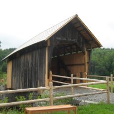
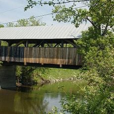
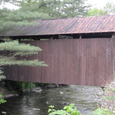
Groton State Forest, State forest in Caledonia, Orange, and Washington Counties, Vermont.

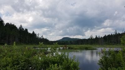
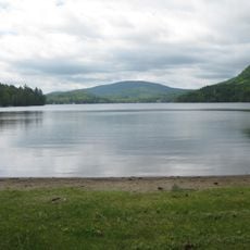
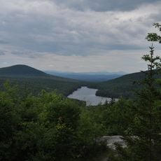
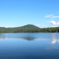
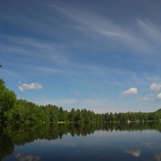
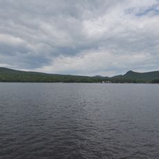
Groton State Forest is a large protected forest in three counties in Vermont that includes seven state parks, eight lakes and ponds, and natural areas with mountains, wetlands, and various forest types. The land features diverse terrain where you can find open water, swampy areas, and tree-covered slopes all within the same region.

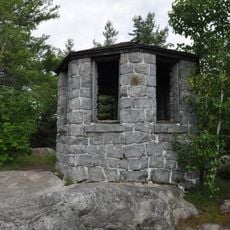
The forest was established in 1919 and later developed by the Civilian Conservation Corps, which built trails, facilities, and recreational areas that remain in use today. These early improvements shaped how the forest functions as a public space.

The forest serves as a hub for outdoor recreation where locals and visitors follow marked trails for hiking and skiing throughout the year. These pathways connect different parts of the landscape and shape how people move through and experience the forest.

The forest offers year-round activities including hiking, camping, swimming, and fishing on marked trails throughout the property. In winter, these same paths become routes for cross-country skiing and snowmobile riding.

Within the forest lies Peacham Bog Natural Area, where rare plants grow and a distinctive rounded dome shape was created by glacial processes thousands of years ago. Walking through this boggy section shows you geological features that differ from the rest of the forest.

Location: Caledonia County

Location: Orange County

Location: Washington County

Inception: 1919

Website: https://fpr.vermont.gov/groton-state-forest

GPS coordinates: 44.27600,-72.29140

Latest update: December 14, 2025 12:22

Photos
Around this place
Harvey's Lake
United States of America

Harvey's Lake

12.4 km
Kettle Pond State Park
United States of America

Kettle Pond State Park

2.4 km
Greenbanks Hollow Covered Bridge
United States of America

Greenbanks Hollow Covered Bridge

17.6 km
Molly's Falls Pond State Park
United States of America

Molly's Falls Pond State Park

9.8 km
Ricker Pond State Park
United States of America

Ricker Pond State Park

4.5 km
New Discovery State Park
United States of America

New Discovery State Park

5 km
Elkins Tavern
United States of America

Elkins Tavern

11.3 km
Stillwater State Park
United States of America

Stillwater State Park

1.5 km
Martin Covered Bridge
United States of America

Martin Covered Bridge

9.4 km
Coburn Covered Bridge
United States of America

Coburn Covered Bridge

13.1 km
Whitehill House
United States of America

Whitehill House

9.4 km
Robbins Nest Covered Bridge
United States of America

Robbins Nest Covered Bridge

17.9 km
Allenwood Farm
United States of America

Allenwood Farm

11.4 km
McIndoes Academy
United States of America

McIndoes Academy

18.1 km
Alice Lord Goodine House
United States of America

Alice Lord Goodine House

10.6 km
Whittier House
United States of America

Whittier House

17.6 km
East Village Meetinghouse
United States of America

East Village Meetinghouse

15.7 km
Lind Houses
United States of America

Lind Houses

15.8 km
J. R. Darling Store
United States of America

J. R. Darling Store

10.5 km
Barnet Center Historic District
United States of America

Barnet Center Historic District

16.9 km
North Calais Village Historic District
United States of America

North Calais Village Historic District

17.6 km
Peacham Corner Historic District
United States of America

Peacham Corner Historic District

11.1 km
Elwin Chase House
United States of America

Elwin Chase House

17.9 km
Theodore Wood House
United States of America

Theodore Wood House

10.2 km
Gale-Bancroft House
United States of America

Gale-Bancroft House

10.5 km
Plainfield Village Historic District
United States of America

Plainfield Village Historic District

10.7 km
Peacham
United States of America

Peacham

11.3 km
Cutler Memorial
United States of America

Cutler Memorial

10.9 km
Show the full map
Reviews

Visited this place? Tap the stars to rate it and share your experience / photos with the community! Try now! You can cancel it anytime.

« Groton State Forest - State forest in Caledonia, Orange, and Washington Counties, Vermont » is provided by Around Us (aroundus.com). Images and texts are derived from Wikimedia project under a Creative Commons license. You are allowed to copy, distribute, and modify copies of this page, under the conditions set by the license, as long as this note is clearly visible.

Discover hidden gems everywhere you go!

From secret cafés to breathtaking viewpoints, skip the crowded tourist spots and find places that match your style. Our app makes it easy with voice search, smart filtering, route optimization, and insider tips from travelers worldwide. Download now for the complete mobile experience.

Around Us App Screenshot

A unique approach to discovering new places

Le Figaro

All the places worth exploring

France Info

A tailor-made excursion in just a few clicks

20 Minutes