Enable Location

We need your location to show you interesting places around you

Discover nearby places

Find interesting locations and hidden gems around you

Precise directions

Get accurate directions and distances to places

Your location is never shared with other users. It's only used when you tap the location button.

Kensington Historic District

Log in to your account

Start exploring — it's free

Trusted by 61,858 travelers worldwide

Continue with Google
Continue with Apple
or

We will send you a code to connect

By continuing, you accept our Terms and Conditions and our Privacy Policy

Check your inbox

We've sent a pincode in your inbox. Please enter the code below.

Kensington Historic District, Historic district in Montgomery County, Maryland.

Description

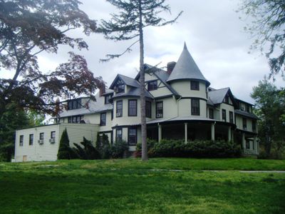
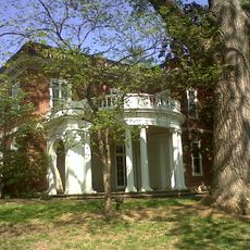
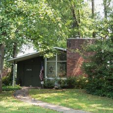
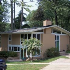
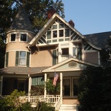
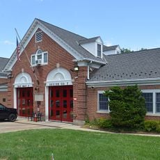
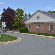
Kensington Historic District is a residential area in Montgomery County featuring tree-lined streets, curved brick sidewalks, and spacious residential properties. Most buildings date from the late 1800s and early 1900s and display Victorian and Colonial Revival architectural styles.

History

The district was officially incorporated as a town in 1894 and developed from agricultural land into an affluent residential community near Washington, D.C. This transformation reflects the suburban expansion that was reshaping the region during that period.

Culture

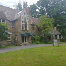
The neighborhood displays numerous houses from the late 1800s and early 1900s with wraparound porches, stained glass windows, and detailed architectural flourishes. These features shape how the streets feel today and reflect the tastes of families who built their homes here over a century ago.

Practical

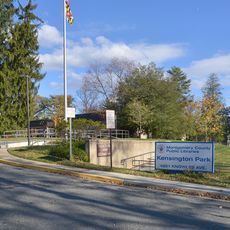
The district is best explored on foot, taking time for slow walks through its winding streets to appreciate the surroundings. Daytime visits work well for seeing the architectural details and garden landscaping that define each property.

Did you know?

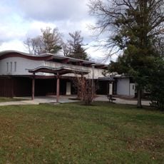
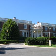
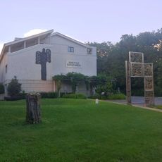
At the heart of the area stands the Kensington House for the Blind, a specialized building that reveals a less obvious social purpose of the neighborhood. This structure shows that the district served purposes beyond typical residential living.

Location
GPS coordinates
39.02470,-77.07580
Latest update
December 14, 2025 17:02

AroundUs brings together thousands of curated places, local tips, and hidden gems, enriched daily by 60,000 contributors worldwide. Discover all places nearby (Maryland).

Around this place
Washington D.C. Temple
United States of America

Washington D.C. Temple

1.5 km
United States National Library of Medicine
United States of America

United States National Library of Medicine

3.9 km
Uniformed Services University of the Health Sciences
United States of America

Uniformed Services University of the Health Sciences

2.8 km
National Museum of Health and Medicine
United States of America

National Museum of Health and Medicine

2.6 km
National Park Seminary
United States of America

National Park Seminary

2.3 km
Columbia Country Club
United States of America

Columbia Country Club

3.4 km
Bethesda Meeting House
United States of America

Bethesda Meeting House

2.5 km
Talbot Avenue bridge
United States of America

Talbot Avenue bridge

3.7 km
Wheaton Youth Center
United States of America

Wheaton Youth Center

3.4 km
Woodend
United States of America

Woodend

2.6 km
Hammond Wood Historic District
United States of America

Hammond Wood Historic District

2.6 km
North Bethesda Market
United States of America

North Bethesda Market

3.8 km
Rock Creek Woods Historic District
United States of America

Rock Creek Woods Historic District

2.4 km
Cedar Lane Unitarian Universalist Church
United States of America

Cedar Lane Unitarian Universalist Church

1.8 km
Garrett Park Historic District
United States of America

Garrett Park Historic District

2 km
Music Center at Strathmore
United States of America

Music Center at Strathmore

2.5 km
Mansion at Strathmore
United States of America

Mansion at Strathmore

2.6 km
Rock Creek Stream Valley Park
United States of America

Rock Creek Stream Valley Park

3 km
Sligo Creek Park
United States of America

Sligo Creek Park

4.3 km
Bethesda Trolley Trail
United States of America

Bethesda Trolley Trail

3.3 km
Noyes Library For Young Children
United States of America

Noyes Library For Young Children

246 m
St. Jane Frances de Chantal, Bethesda
United States of America

St. Jane Frances de Chantal, Bethesda

3.8 km
Montgomery County Fire and Rescue Station 7
United States of America

Montgomery County Fire and Rescue Station 7

3.8 km
Chevy Chase Library
United States of America

Chevy Chase Library

3.7 km
The Ratner Museum
United States of America

The Ratner Museum

4 km
Gifford Pinchot Forest Building
United States of America

Gifford Pinchot Forest Building

2.9 km
Kensington Park Library
United States of America

Kensington Park Library

686 m
Bethesda Naval Hospital Tower
United States of America

Bethesda Naval Hospital Tower

3 km
Show the full map
« Kensington Historic District - Historic district in Montgomery County, Maryland » is provided by Around Us (aroundus.com). Images and texts are derived from Wikimedia project under a Creative Commons license. You are allowed to copy, distribute, and modify copies of this page, under the conditions set by the license, as long as this note is clearly visible.

Discover hidden gems everywhere you go!

From secret cafés to breathtaking viewpoints, skip the crowded tourist spots and find places that match your style. Our app makes it easy with voice search, smart filtering, route optimization, and insider tips from travelers worldwide. Download now for the complete mobile experience.

Around Us App Screenshot

A unique approach to discovering new places

Le Figaro

All the places worth exploring

France Info

A tailor-made excursion in just a few clicks

20 Minutes

Around Us
Travel Guide & Maps
Download

Send to your phone

QR Code
1

Open the camera app on your mobile.

2

Point at the QR code with your camera. A notification will appear.

3

Tap the notification to open the link.