Enable Location

We need your location to show you interesting places around you

Discover nearby places

Find interesting locations and hidden gems around you

Precise directions

Get accurate directions and distances to places

Your location is never shared with other users. It's only used when you tap the location button.

Kinkaid Lake

Log in to your account

Start exploring — it's free

Trusted by 62,173 travelers worldwide

Continue with Google
Continue with Apple
or

We will send you a code to connect

By continuing, you accept our Terms and Conditions and our Privacy Policy

Check your inbox

We've sent a pincode in your inbox. Please enter the code below.

Kinkaid Lake

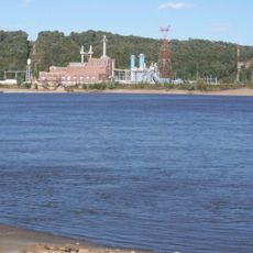
Kinkaid Lake, body of water

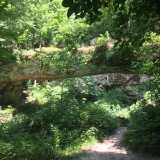
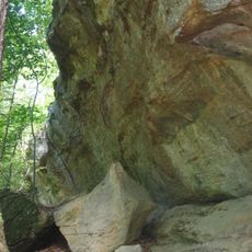
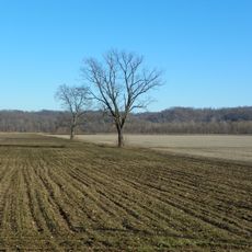
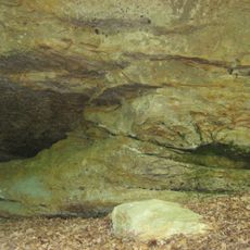
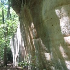
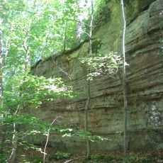
Kinkaid Lake is a large reservoir in southern Illinois with an expansive water surface stretching through rolling terrain. The shoreline is lined with oak and hickory trees, while gentle hills and rocky outcrops shape the landscape, with average depths around 39 feet (12 meters) and depths near the dam reaching about 80 feet (24 meters).

The reservoir was created in 1968 to serve as a water source for the area. A fish barrier was added in 1998 to help maintain the fish population and protect the lake ecosystem.

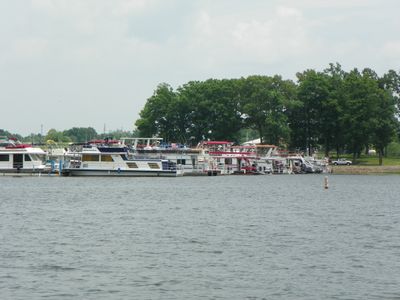
The lake serves as a gathering place for the local community, where people fish, boat, and picnic together. These activities shape how the water is used throughout the year, especially in warmer months when families and groups regularly visit.

The site has multiple boat launches and docks, with daytime speed limited to 50 miles per hour (80 kilometers per hour). Visitors find camping areas with picnic tables, shelters, grills, and restrooms, plus a nearby marina offering boat rentals and shower facilities.

The lake is home to fish bred for size, including rare muskies that anglers specifically pursue. These stocks are maintained through specialized management, making it a destination for serious fishing enthusiasts.

The community of curious travelers

AroundUs brings together thousands of curated places, local tips, and hidden gems, enriched daily by 60,000 contributors worldwide.

Start exploring
Location
GPS coordinates
37.79760,-89.43150
Latest update
February 7, 2026 11:01
Around this place
R. Buckminster Fuller and Anne Hewlett Dome Home
United States of America

R. Buckminster Fuller and Anne Hewlett Dome Home

20 km
Little Grand Canyon
United States of America

Little Grand Canyon

12.7 km
Tower Rock
United States of America

Tower Rock

19.9 km
Shryock Auditorium
United States of America

Shryock Auditorium

20.9 km
Grand Tower Pipeline Bridge
United States of America

Grand Tower Pipeline Bridge

18.9 km
Faner Hall
United States of America

Faner Hall

20.8 km
Cleiman Mound and Village Site
United States of America

Cleiman Mound and Village Site

9.2 km
Pomona Natural Bridge
United States of America

Pomona Natural Bridge

18.3 km
Fountain Bluff
United States of America

Fountain Bluff

14.6 km
Altgeld Hall
United States of America

Altgeld Hall

20.9 km
Jackson County Courthouse
United States of America

Jackson County Courthouse

9.3 km
Tegtmeyer Site
United States of America

Tegtmeyer Site

21.3 km
William H. Hull House
United States of America

William H. Hull House

8.8 km
Somerset Grange Hall
United States of America

Somerset Grange Hall

9.9 km
Seventy-Six Conservation Area, Perry County, Missouri
United States of America

Seventy-Six Conservation Area, Perry County, Missouri

18.1 km
Riverside Park Bandshell
United States of America

Riverside Park Bandshell

8 km
Brazeau Bottom
United States of America

Brazeau Bottom

16.9 km
Piney Creek West Site
United States of America

Piney Creek West Site

21.2 km
Piney Creek Site
United States of America

Piney Creek Site

21.1 km
Reef House
United States of America

Reef House

20.3 km
Liberty Theater
United States of America

Liberty Theater

9 km
Murphysboro Elks Lodge
United States of America

Murphysboro Elks Lodge

9 km
West Walnut Street Historic District
United States of America

West Walnut Street Historic District

19.9 km
Robert W. Hamilton House
United States of America

Robert W. Hamilton House

9.2 km
Piney Creek South Site
United States of America

Piney Creek South Site

21.1 km
Pomona Natural Bridge
United States of America

Pomona Natural Bridge

18.3 km
Carbondale Public Library
United States of America

Carbondale Public Library

20.2 km
Varsity Center for the Arts
United States of America

Varsity Center for the Arts

20.6 km
Show the full map
« Kinkaid Lake - body of water » is provided by Around Us (aroundus.com). Images and texts are derived from Wikimedia project under a Creative Commons license. You are allowed to copy, distribute, and modify copies of this page, under the conditions set by the license, as long as this note is clearly visible.

Discover hidden gems everywhere you go!

From secret cafés to breathtaking viewpoints, skip the crowded tourist spots and find places that match your style. Our app makes it easy with voice search, smart filtering, route optimization, and insider tips from travelers worldwide. Download now for the complete mobile experience.

Around Us App Screenshot

A unique approach to discovering new places

Le Figaro

All the places worth exploring

France Info

A tailor-made excursion in just a few clicks

20 Minutes

Around Us
Travel Guide & Maps
Download

Send to your phone

QR Code
1

Open the camera app on your mobile.

2

Point at the QR code with your camera. A notification will appear.

3

Tap the notification to open the link.