Kitch-iti-kipi

Log in to your account

AroundUs is a community-driven map of interesting places, built by curious explorers like you. It grows with every review, story, and photo you share.
Connect to save your favorite spots, contribute locations, and create personalized routes.
Continue with Google
Continue with Apple
Continue with X
Continue with Facebook
Continue with email
By continuing, you accept our Terms and Conditions and our Privacy Policy
Create an account
Add to collection
Map
Suggest a change
Share

Kitch-iti-kipi, Natural spring in Schoolcraft County, US

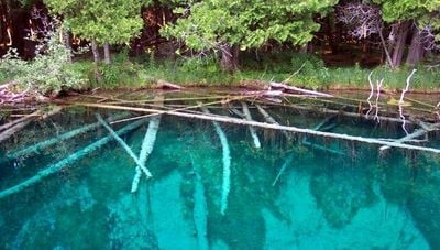
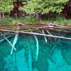
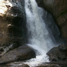
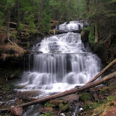
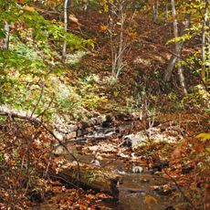
Kitch-iti-kipi is a natural spring located within Palms Book State Park, featuring water so clear that the sandy bottom is easily visible from above. The spring emerges from limestone and maintains a cold temperature year-round, creating an otherworldly blue-green color.

The spring held significance for indigenous peoples of the Upper Peninsula who relied on it across generations. European settlement in the region during the 1800s gradually changed how the area was used and perceived.

The name originates from Native American languages of the Upper Peninsula Michigan tribes, reflecting their connection to this water source across generations.

Visitors can reach the spring using a self-operated raft that glides across the water via a cable system, allowing close observation of the underwater world. This manual method provides a peaceful way to explore the spring without disturbing the environment.

The limestone bottom continuously releases water at a tremendous rate, creating shifting sand patterns that are visible from above. This constant movement beneath the surface creates an ever-changing underwater display that visitors rarely forget.

Location: Schoolcraft County

Elevation above the sea: 190 m

GPS coordinates: 46.00416,-86.38194

Latest update: December 6, 2025 19:04

Photos
Michigan natural and historic sites

Michigan holds a wide array of natural and historical sites across its two peninsulas. The shoreline runs for hundreds of miles along the Great Lakes, showing sand beaches, rocky cliffs, and dune formations. In the north, dense forests, waterfalls, and rock formations shaped by erosion dominate the...

Around this place
Fayette Historic State Park
United States of America

Fayette Historic State Park

38.6 km
Seney National Wildlife Refuge
United States of America

Seney National Wildlife Refuge

35 km
Palms Book State Park
United States of America

Palms Book State Park

484 m
Grand Island East Channel Light
United States of America

Grand Island East Channel Light

53.7 km
Munising Falls
United States of America

Munising Falls

50.1 km
Seul Choix Light
United States of America

Seul Choix Light

37.5 km
Miners Falls
United States of America

Miners Falls

53.6 km
Indian Lake State Park
United States of America

Indian Lake State Park

7.8 km
Spider Cave
United States of America

Spider Cave

43.4 km
Wagner Falls Scenic Site
United States of America

Wagner Falls Scenic Site

47.3 km
Wagner Falls
United States of America

Wagner Falls

47.3 km
Manistique East Breakwater Light
United States of America

Manistique East Breakwater Light

12.3 km
Tannery Falls
United States of America

Tannery Falls

49.5 km
Onota, Au Train Township, Michigan
United States of America

Onota, Au Train Township, Michigan

54.6 km
Munising Front Range Light
United States of America

Munising Front Range Light

50.5 km
Grand Island Harbor Rear Range Light
United States of America

Grand Island Harbor Rear Range Light

53.7 km
Munising Rear Range Light
United States of America

Munising Rear Range Light

50.4 km
Alger Falls
United States of America

Alger Falls

47.9 km
Manistique Pumping Station
United States of America

Manistique Pumping Station

11.1 km
Memorial Falls
United States of America

Memorial Falls

49.8 km
County Road I-39–Rapid River Bridge
United States of America

County Road I-39–Rapid River Bridge

46.2 km
Schoolcraft Furnace Site
United States of America

Schoolcraft Furnace Site

50.3 km
Lobb House
United States of America

Lobb House

50 km
Ekdahl–Goudreau Site
United States of America

Ekdahl–Goudreau Site

37.3 km
Grand Island Harbor Front Range Light
United States of America

Grand Island Harbor Front Range Light

54 km
Nahma and Northern Railway no. 5
United States of America

Nahma and Northern Railway no. 5

28.4 km
Munising School Public Library
United States of America

Munising School Public Library

50.8 km
J Pool
United States of America

J Pool

45.1 km
Show the full map
Reviews

Visited this place? Tap the stars to rate it and share your experience / photos with the community! Try now! You can cancel it anytime.

« Kitch-iti-kipi - Natural spring in Schoolcraft County, US » is provided by Around Us (aroundus.com). Images and texts are derived from Wikimedia project under a Creative Commons license. You are allowed to copy, distribute, and modify copies of this page, under the conditions set by the license, as long as this note is clearly visible.

Discover hidden gems everywhere you go!

From secret cafés to breathtaking viewpoints, skip the crowded tourist spots and find places that match your style. Our app makes it easy with voice search, smart filtering, route optimization, and insider tips from travelers worldwide. Download now for the complete mobile experience.

Around Us App Screenshot

A unique approach to discovering new places

Le Figaro

All the places worth exploring

France Info

A tailor-made excursion in just a few clicks

20 Minutes