Chest opened
+${chestReward.xp} XP
Explorer
NOUVEAU ×${chestReward.collectible.quantity}
tapez pour fermer
Chest locked

Open chests in the app

Around Us is built for your phone — chests unlock when you walk, explore and capture nearby places.

Enable Location

We need your location to show you interesting places around you

Discover nearby places

Find interesting locations and hidden gems around you

Precise directions

Get accurate directions and distances to places

Your location is never shared with other users. It's only used when you tap the location button.

Log in to your account

Start exploring — it's free

Trusted by 72,888 travelers worldwide

Continue with Google
Continue with Apple
or

We will send you a code to connect

By continuing, you accept our Terms and Conditions and our Privacy Policy

Check your inbox

We've sent a pincode in your inbox. Please enter the code below.

Discussion Reviews Photo
18.4k Popularity

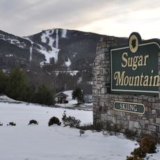
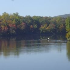
Linville, unincorporated community in Avery County, North Carolina

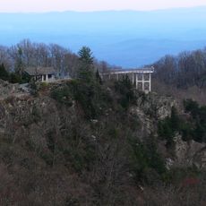
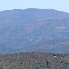
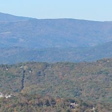
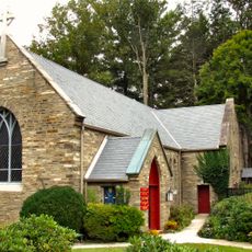
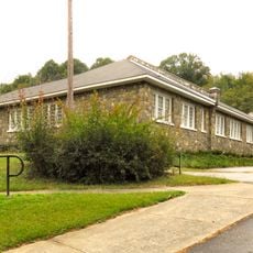
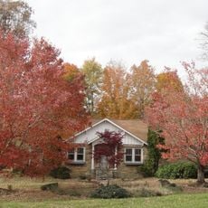
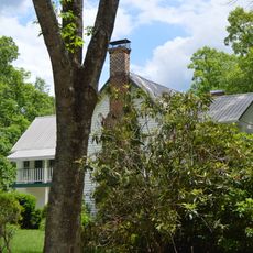
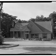
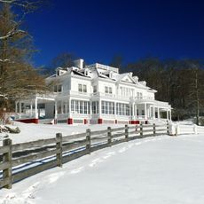
Linville is a small unincorporated community in Avery County, North Carolina, situated in the Appalachian Mountains near the Blue Ridge Parkway. The streets follow a simple, organized layout with buildings constructed from local stone and wood, reflecting the thoughtful planning that shaped this place decades ago.

The community was designed in 1883 following a deliberate plan that included simple streets and open spaces still visible today. It took its name from brothers William and John Linville, whose death in 1766 at the hands of the Cherokee nation became an event rooted in local history.

The name Linville honors brothers William and John Linville, whose story remains part of local memory. Visitors experience this connection by walking the town's carefully designed streets and gathering spaces that shape how people use the community today.

Walking around is straightforward thanks to the square street layout that makes navigation easy and keeps distances short between points of interest. Bring comfortable shoes and water, especially if hiking nearby areas, and check weather conditions before heading out, particularly after heavy rain.

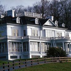
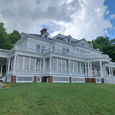
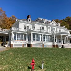
Strathsheil Cottage was designed by architect Henry Bacon, who also created the Lincoln Memorial, and he built homes here using chestnut-bark shingles and log lattice work on porches. The golf course was designed by Donald Ross, one of the most influential golf course designers of his era.

The community of curious travelers

AroundUs brings together thousands of curated places, local tips, and hidden gems, enriched daily by 60,000 contributors worldwide.

Start exploring
Location
Elevation above the sea
1,117 m
GPS coordinates
36.06639,-81.87028
Latest update
February 16, 2026 23:40
Around this place
Grandfather Mountain
United States of America

Grandfather Mountain

7.3 km
Linville Falls
United States of America

Linville Falls

14 km
Linville Gorge Wilderness
United States of America

Linville Gorge Wilderness

18.3 km
Linn Cove Viaduct
United States of America

Linn Cove Viaduct

5.9 km
Table Rock
United States of America

Table Rock

19.6 km
Sugar Mountain
United States of America

Sugar Mountain

6.5 km
Moses H. Cone Memorial Park
United States of America

Moses H. Cone Memorial Park

18.5 km
Julian Price Memorial Park
United States of America

Julian Price Memorial Park

14.8 km
Beech Mountain
United States of America

Beech Mountain

13.2 km
Blowing Rock
United States of America

Blowing Rock

19.5 km
Grassy Ridge Bald
United States of America

Grassy Ridge Bald

19.3 km
Big Yellow Mountain
United States of America

Big Yellow Mountain

14.9 km
Valle Crucis Episcopal Mission
United States of America

Valle Crucis Episcopal Mission

15.9 km
Bee Mountain
United States of America

Bee Mountain

5.8 km
Chestnut Mountain
United States of America

Chestnut Mountain

13 km
The Cone Manor
United States of America

The Cone Manor

18.4 km
Little Chestnut Mountain
United States of America

Little Chestnut Mountain

16.3 km
Elk Park School
United States of America

Elk Park School

14.5 km
Westglow
United States of America

Westglow

16.2 km
Ray Wiseman House
United States of America

Ray Wiseman House

10.5 km
Milligan Shuford Wise and Theron Colbert Dellinger Houses
United States of America

Milligan Shuford Wise and Theron Colbert Dellinger Houses

7.5 km
Franklin-Penland House
United States of America

Franklin-Penland House

14 km
Price Lake
United States of America

Price Lake

14.5 km
Flat Top Manor
United States of America

Flat Top Manor

18.4 km
Linville Falls Visitor Center
United States of America

Linville Falls Visitor Center

13.5 km
Linn Cove Visitor Center
United States of America

Linn Cove Visitor Center

5.7 km
Parkway Craft Center
United States of America

Parkway Craft Center

18.5 km
Blue Ridge Parkway North Carolina 181 Bridge
United States of America

Blue Ridge Parkway North Carolina 181 Bridge

7.1 km
Show the full map
Reviews
Share your experience

No review yet

Discussions
Start a discussion...

No discussion yet

« Linville - unincorporated community in Avery County, North Carolina » is provided by Around Us (aroundus.com). Images and texts are derived from Wikimedia project under a Creative Commons license. You are allowed to copy, distribute, and modify copies of this page, under the conditions set by the license, as long as this note is clearly visible.

Discover hidden gems everywhere you go!

From secret cafés to breathtaking viewpoints, skip the crowded tourist spots and find places that match your style. Our app makes it easy with voice search, smart filtering, route optimization, and insider tips from travelers worldwide. Download now for the complete mobile experience.

Around Us App Screenshot

A unique approach to discovering new places

Le Figaro

All the places worth exploring

France Info

A tailor-made excursion in just a few clicks

20 Minutes

Around Us
Travel Guide & Maps
Download

Send to your phone

QR Code
1

Open the camera app on your mobile.

2

Point at the QR code with your camera. A notification will appear.

3

Tap the notification to open the link.