Enable Location

We need your location to show you interesting places around you

Discover nearby places

Find interesting locations and hidden gems around you

Precise directions

Get accurate directions and distances to places

Your location is never shared with other users. It's only used when you tap the location button.

Liggett and Myers Tobacco Company

Log in to your account

Start exploring — it's free

Trusted by 62,534 travelers worldwide

Continue with Google
Continue with Apple
or

We will send you a code to connect

By continuing, you accept our Terms and Conditions and our Privacy Policy

Check your inbox

We've sent a pincode in your inbox. Please enter the code below.

Liggett and Myers Tobacco Company

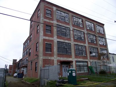
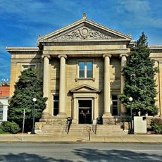
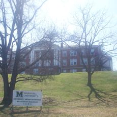
Liggett and Myers Tobacco Company, building

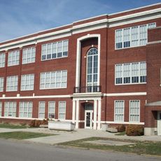
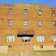
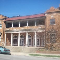
Liggett and Myers Tobacco Company is a historic factory in Huntington, West Virginia, that manufactured and stored tobacco products. The main building from 1917 is four stories tall with large windows and red brick construction, alongside a narrower two-story addition from 1920 and an older single-story redrying plant from 1910 at the back of the property.

The company began in the early 1800s as a snuff mill in New Jersey and later expanded westward. In Huntington, Liggett & Myers built their factory in 1917 to manufacture cigarettes and cigars and to process and store tobacco leaves purchased from farmers.

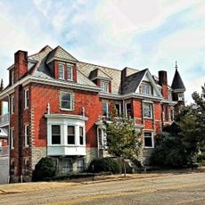
The name reflects the founders and their long history in tobacco manufacturing. The red brick buildings show the practical industrial style of structures built to last and serve their purpose well.

The building sits on 27th Street in Huntington and is easy to locate, surrounded by other old industrial sites. The location is no longer in production, but the brick structure remains visible and preservation efforts focus on keeping the original construction intact for future visitors.

The company regained independence in 1911 after a court ruling, having briefly been part of the American Tobacco Company. This decision allowed the firm to continue making its own products like 'Old White' cigarettes and helped shape Huntington's tobacco industry in the first half of the 20th century.

The community of curious travelers

AroundUs brings together thousands of curated places, local tips, and hidden gems, enriched daily by 60,000 contributors worldwide.

Start exploring
Location
Official opening
1910
GPS coordinates
38.43389,-82.40917
Latest update
February 9, 2026 08:21
Around this place
Camden Park
United States of America

Camden Park

3.2 km
Joan C. Edwards Stadium
United States of America

Joan C. Edwards Stadium

1.4 km
Fairfield Stadium
United States of America

Fairfield Stadium

3.3 km
Cam Henderson Center
United States of America

Cam Henderson Center

1.8 km
Keith-Albee Theatre
United States of America

Keith-Albee Theatre

3.3 km
East Huntington Bridge
United States of America

East Huntington Bridge

1.7 km
Robert C. Byrd Bridge
United States of America

Robert C. Byrd Bridge

3.8 km
Old Main
United States of America

Old Main

2.2 km
Old Huntington High School
United States of America

Old Huntington High School

3.7 km
Douglass Junior and Senior High School
United States of America

Douglass Junior and Senior High School

2.9 km
Ritter Park Historic District
United States of America

Ritter Park Historic District

4.1 km
Cabell County Courthouse
United States of America

Cabell County Courthouse

3.6 km
Downtown Huntington Historic District
United States of America

Downtown Huntington Historic District

3 m
Thomas Carroll House
United States of America

Thomas Carroll House

1.8 km
Pink Bridge
United States of America

Pink Bridge

4.1 km
Ohev Sholom Temple
United States of America

Ohev Sholom Temple

3.6 km
Rotary Park Bridge
United States of America

Rotary Park Bridge

2.1 km
Carnegie Public Library
United States of America

Carnegie Public Library

3.4 km
Elk River Coal and Lumber Company No. 10
United States of America

Elk River Coal and Lumber Company No. 10

3 km
United States Post Office and Court House
United States of America

United States Post Office and Court House

3.5 km
Barnett Hospital and Nursing School
United States of America

Barnett Hospital and Nursing School

3.1 km
West Virginia Colored Children's Home
United States of America

West Virginia Colored Children's Home

4.1 km
Campbell-Hicks House
United States of America

Campbell-Hicks House

3 km
Zachary Taylor Wellington House
United States of America

Zachary Taylor Wellington House

1.9 km
Simms School Building
United States of America

Simms School Building

2.7 km
Mortimer Place Historic District
United States of America

Mortimer Place Historic District

3.7 km
Ricketts House
United States of America

Ricketts House

3.1 km
Prichard House
United States of America

Prichard House

4.4 km
Show the full map
« Liggett and Myers Tobacco Company - building » is provided by Around Us (aroundus.com). Images and texts are derived from Wikimedia project under a Creative Commons license. You are allowed to copy, distribute, and modify copies of this page, under the conditions set by the license, as long as this note is clearly visible.

Discover hidden gems everywhere you go!

From secret cafés to breathtaking viewpoints, skip the crowded tourist spots and find places that match your style. Our app makes it easy with voice search, smart filtering, route optimization, and insider tips from travelers worldwide. Download now for the complete mobile experience.

Around Us App Screenshot

A unique approach to discovering new places

Le Figaro

All the places worth exploring

France Info

A tailor-made excursion in just a few clicks

20 Minutes

Around Us
Travel Guide & Maps
Download

Send to your phone

QR Code
1

Open the camera app on your mobile.

2

Point at the QR code with your camera. A notification will appear.

3

Tap the notification to open the link.