Chest opened
+${chestReward.xp} XP
Explorer
NOUVEAU ×${chestReward.collectible.quantity}
tapez pour fermer
Chest locked

Open chests in the app

Around Us is built for your phone — chests unlock when you walk, explore and capture nearby places.

Enable Location

We need your location to show you interesting places around you

Discover nearby places

Find interesting locations and hidden gems around you

Precise directions

Get accurate directions and distances to places

Your location is never shared with other users. It's only used when you tap the location button.

Log in to your account

Start exploring — it's free

Trusted by 72,881 travelers worldwide

Continue with Google
Continue with Apple
or

We will send you a code to connect

By continuing, you accept our Terms and Conditions and our Privacy Policy

Check your inbox

We've sent a pincode in your inbox. Please enter the code below.

Memorial Bridge
Discussion Reviews Photo
1.1k Popularity

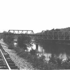
Memorial Bridge, bridge in United States of America

Memorial Bridge is a road bridge in Philadelphia, Pennsylvania, built in 1951 from concrete and steel. It features a simple, functional design typical of mid-20th century construction and connects different neighborhoods while spanning roadways below.

Built in 1951, the bridge was created to help people move quickly across the area without traveling through congested city streets. It has maintained its original form and purpose over the decades, remaining a quiet record of 1950s urban planning.

The name 'Memorial' refers to a tribute to people who served in the military, though the bridge itself does not display obvious monuments. It is part of the daily routine for many residents who cross it regularly while moving through the city.

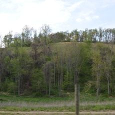
The wide roadway and simple railings accommodate both vehicles and pedestrians comfortably. The quiet surroundings with trees and green spaces nearby offer a brief respite from busier urban traffic.

While many older bridges in the city were discussed for replacement or updating, Memorial Bridge retained its original form entirely. This makes it an unexpected example of how 1950s infrastructure has endured relatively unchanged through the decades.

The community of curious travelers

AroundUs brings together thousands of curated places, local tips, and hidden gems, enriched daily by 60,000 contributors worldwide.

Start exploring
Location
Official opening
1952
GPS coordinates
40.02150,-79.59690
Latest update
February 9, 2026 07:43
Around this place
West Overton
United States of America

West Overton

10.9 km
United States of America

Jacob's Creek Bridge

10.8 km
Isaac Meason House
United States of America

Isaac Meason House

9.9 km
Linden Hall at Saint James Park
United States of America

Linden Hall at Saint James Park

9.8 km
Providence Quaker Cemetery and Chapel
United States of America

Providence Quaker Cemetery and Chapel

16.8 km
Layton Bridge
United States of America

Layton Bridge

13.6 km
Francis Farm Petroglyphs
United States of America

Francis Farm Petroglyphs

16.9 km
John S. Douglas House
United States of America

John S. Douglas House

16.9 km
St. Nicholas Byzantine Catholic Church
United States of America

St. Nicholas Byzantine Catholic Church

14.8 km
Cochran Memorial United Methodist Church
United States of America

Cochran Memorial United Methodist Church

5.7 km
Alliance Furnace
United States of America

Alliance Furnace

14.4 km
Star Junction Historic District
United States of America

Star Junction Historic District

14.8 km
Mount Vernon Furnace
United States of America

Mount Vernon Furnace

11.1 km
Mount Pleasant Historic District
United States of America

Mount Pleasant Historic District

14.8 km
Dawson Historic District
United States of America

Dawson Historic District

6 km
Carnegie Free Library
United States of America

Carnegie Free Library

965 m
Laurel Hill Presbyterian Church
United States of America

Laurel Hill Presbyterian Church

10.1 km
Searight's Fulling Mill
United States of America

Searight's Fulling Mill

14.4 km
Scottdale Historic District
United States of America

Scottdale Historic District

8.9 km
Peter and Jonathan Newmyer Farm
United States of America

Peter and Jonathan Newmyer Farm

6.9 km
Colonial National Bank Building
United States of America

Colonial National Bank Building

793 m
Youghiogheny Bank of Pennsylvania
United States of America

Youghiogheny Bank of Pennsylvania

15 km
Samuel Warden House
United States of America

Samuel Warden House

14.7 km
Dr. J.C. McClenathan House and Office
United States of America

Dr. J.C. McClenathan House and Office

799 m
Karolcik Building
United States of America

Karolcik Building

15 km
West Overton Village
United States of America

West Overton Village

10.8 km
Connellsville Canteen
United States of America

Connellsville Canteen

713 m

Show the full map
Reviews
Share your experience

No review yet

Discussions
Start a discussion...

No discussion yet

« Memorial Bridge - bridge in United States of America » is provided by Around Us (aroundus.com). Images and texts are derived from Wikimedia project under a Creative Commons license. You are allowed to copy, distribute, and modify copies of this page, under the conditions set by the license, as long as this note is clearly visible.

Discover hidden gems everywhere you go!

From secret cafés to breathtaking viewpoints, skip the crowded tourist spots and find places that match your style. Our app makes it easy with voice search, smart filtering, route optimization, and insider tips from travelers worldwide. Download now for the complete mobile experience.

Around Us App Screenshot

A unique approach to discovering new places

Le Figaro

All the places worth exploring

France Info

A tailor-made excursion in just a few clicks

20 Minutes

Around Us
Travel Guide & Maps
Download

Send to your phone

QR Code
1

Open the camera app on your mobile.

2

Point at the QR code with your camera. A notification will appear.

3

Tap the notification to open the link.