Enable Location

We need your location to show you interesting places around you

Discover nearby places

Find interesting locations and hidden gems around you

Precise directions

Get accurate directions and distances to places

Your location is never shared with other users. It's only used when you tap the location button.

Log in to your account

Start exploring — it's free

Trusted by 61,319 travelers worldwide

Continue with Google
Continue with Apple
or

We will send you a code to connect

By continuing, you accept our Terms and Conditions and our Privacy Policy

Check your inbox

We've sent a pincode in your inbox. Please enter the code below.

Mount Oread Civil War posts

Mount Oread Civil War posts, Civil War military posts on Mount Oread in Lawrence, United States.

Description

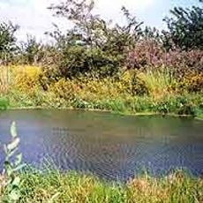
Mount Oread Civil War posts were military fortifications built on a hill rising about 1,037 feet above sea level in Lawrence. The installations included defensive structures positioned to command views across the surrounding valleys and monitor approaches to the town.

History

Union soldiers established fortifications on Mount Oread in response to Confederate threats to Lawrence. The installations were built and expanded during the final years of the Civil War to secure the town.

Culture

Local citizens actively participated in constructing Fort Ulysses during 1864, demonstrating the community's commitment to defending their town.

Practical

The elevated location offers wide sight lines in all directions, making it easy to understand the military strategy of that era. The site is accessible on foot and allows visitors to explore the terrain and appreciate its tactical importance firsthand.

Did you know?

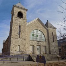
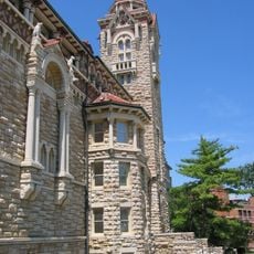
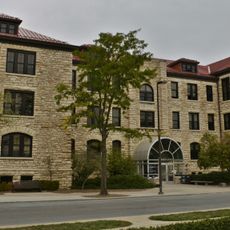
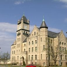
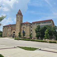
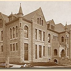
Limestone quarried from the hill during fortification was later used as building material for the first University of Kansas structures. This connection shows how the wartime installation shaped the campus development.

Location
GPS coordinates
38.96310,-95.25720
Latest update
December 14, 2025 18:03

AroundUs brings together thousands of curated places, local tips, and hidden gems, enriched daily by 60,000 contributors worldwide. Discover all places nearby (Kansas).

Around this place
Haskell Indian Nations University
United States of America

Haskell Indian Nations University

3.4 km
David Booth Kansas Memorial Stadium
United States of America

David Booth Kansas Memorial Stadium

936 m
The Eldridge Hotel
United States of America

The Eldridge Hotel

2 km
University of Kansas Natural History Museum
United States of America

University of Kansas Natural History Museum

1.3 km
Spencer Museum of Art
United States of America

Spencer Museum of Art

1.2 km
Plymouth Congregational Church
United States of America

Plymouth Congregational Church

1.8 km
Clinton State Park
United States of America

Clinton State Park

10.1 km
Lawrence Public Library
United States of America

Lawrence Public Library

1.9 km
Lied Center of Kansas
United States of America

Lied Center of Kansas

1 km
Haskell-Baker Wetlands
United States of America

Haskell-Baker Wetlands

5.6 km
Bailey Hall
United States of America

Bailey Hall

1.1 km
U.S. 40 and 59 Bridges
United States of America

U.S. 40 and 59 Bridges

2.4 km
Granada Theater
United States of America

Granada Theater

1.9 km
Haskell Memorial Stadium
United States of America

Haskell Memorial Stadium

3.4 km
Spooner Hall
United States of America

Spooner Hall

1.1 km
Strong Hall
United States of America

Strong Hall

986 m
Beni Israel Cemetery
United States of America

Beni Israel Cemetery

13.2 km
St. Luke African Methodist Episcopal Church
United States of America

St. Luke African Methodist Episcopal Church

2.4 km
George and Annie Bell House
United States of America

George and Annie Bell House

1.5 km
S.T. Zimmerman House
United States of America

S.T. Zimmerman House

2.9 km
Lawrence's Downtown Historic District
United States of America

Lawrence's Downtown Historic District

1.9 km
Douglas County Courthouse
United States of America

Douglas County Courthouse

1.9 km
United Presbyterian Center
United States of America

United Presbyterian Center

1.3 km
Natural History Museum
United States of America

Natural History Museum

1.3 km
Watkins Community Museum of History
United States of America

Watkins Community Museum of History

1.8 km
Oread Historic District
United States of America

Oread Historic District

1.5 km
University of Kansas Historic District
United States of America

University of Kansas Historic District

990 m
East Lawrence Industrial Historic District
United States of America

East Lawrence Industrial Historic District

2.5 km
Show the full map
« Mount Oread Civil War posts - Civil War military posts on Mount Oread in Lawrence, United States » is provided by Around Us (aroundus.com). Images and texts are derived from Wikimedia project under a Creative Commons license. You are allowed to copy, distribute, and modify copies of this page, under the conditions set by the license, as long as this note is clearly visible.

Discover hidden gems everywhere you go!

From secret cafés to breathtaking viewpoints, skip the crowded tourist spots and find places that match your style. Our app makes it easy with voice search, smart filtering, route optimization, and insider tips from travelers worldwide. Download now for the complete mobile experience.

Around Us App Screenshot

A unique approach to discovering new places

Le Figaro

All the places worth exploring

France Info

A tailor-made excursion in just a few clicks

20 Minutes

Around Us
Travel Guide & Maps
Download

Send to your phone

QR Code
1

Open the camera app on your mobile.

2

Point at the QR code with your camera. A notification will appear.

3

Tap the notification to open the link.