Enable Location

We need your location to show you interesting places around you

Discover nearby places

Find interesting locations and hidden gems around you

Precise directions

Get accurate directions and distances to places

Your location is never shared with other users. It's only used when you tap the location button.

Mystic River Historic District

Log in to your account

Start exploring — it's free

Trusted by 61,445 travelers worldwide

Continue with Google
Continue with Apple
or

We will send you a code to connect

By continuing, you accept our Terms and Conditions and our Privacy Policy

Check your inbox

We've sent a pincode in your inbox. Please enter the code below.

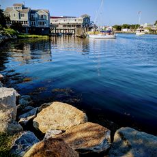
Mystic River Historic District, Historic district in Mystic, Connecticut, US

Description

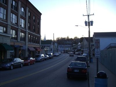
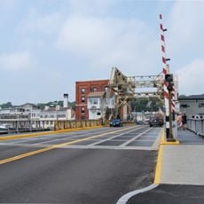
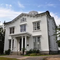
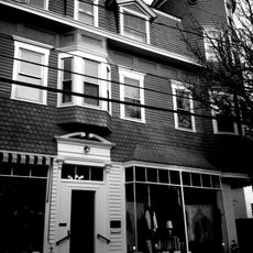
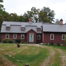
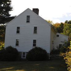
Mystic River Historic District is a protected area that spreads along Route 1, West Mystic Avenue, High Street, Pearl Street, and Cliff Street in Connecticut. It contains roughly 265 residential buildings representing different building styles from the 1800s.

History

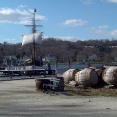
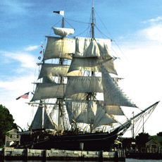
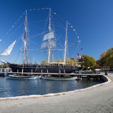
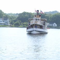
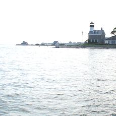
The area developed as a settlement around the Mystic River during the 1800s, attracting merchants and craftspeople who built their homes there. Fort Rachel, located within the boundaries, mounted a defense against a British attack in 1814.

Culture

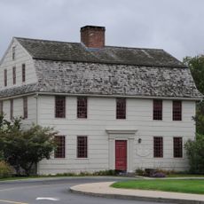
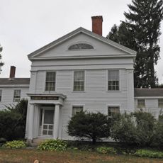
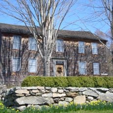
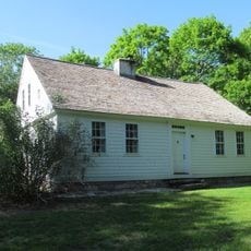
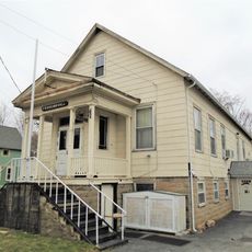
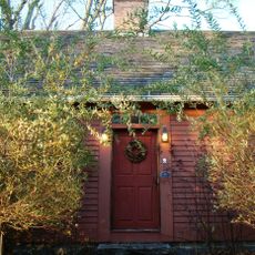
The neighborhood displays residential architecture from the 1800s featuring Greek Revival, Italianate, and Queen Anne styles that reflect the building traditions of that era. Walking through the streets, you encounter these homes as lived-in places that shaped how the community developed.

Practical

You can explore the district on foot by walking along the main streets such as Route 1 and High Street to view the buildings up close. It works well to visit in early morning hours when streets are quieter, allowing you to observe the architecture more clearly.

Did you know?

The old train depot from West Mystic still stands within the district, telling the story of how rail connections shaped the community. This former transportation hub is often overlooked by visitors, yet it reveals how important trains once were to the area's growth.

Location
Elevation above the sea
46 m
GPS coordinates
41.35417,-71.97500
Latest update
December 14, 2025 18:47

AroundUs brings together thousands of curated places, local tips, and hidden gems, enriched daily by 60,000 contributors worldwide. Discover all places nearby (Mystic).

Around this place
Mystic Seaport
United States of America

Mystic Seaport

1.2 km
Charles W. Morgan
United States of America

Charles W. Morgan

1.3 km
Mystic Aquarium & Institute for Exploration
United States of America

Mystic Aquarium & Institute for Exploration

2.9 km
Mystic River Bascule Bridge
United States of America

Mystic River Bascule Bridge

537 m
Bluff Point State Park
United States of America

Bluff Point State Park

5.5 km
Mystic Seaport Museum
United States of America

Mystic Seaport Museum

1.2 km
Emma C. Berry
United States of America

Emma C. Berry

943 m
L. A. Dunton
United States of America

L. A. Dunton

876 m
Sabino
United States of America

Sabino

986 m
Stonington Harbor Light
United States of America

Stonington Harbor Light

6.5 km
Mystic Seaport Light
United States of America

Mystic Seaport Light

1.1 km
Haley Farm State Park
United States of America

Haley Farm State Park

3.8 km
Capt. Nathaniel B. Palmer House
United States of America

Capt. Nathaniel B. Palmer House

5.8 km
Mystic Bridge Historic District
United States of America

Mystic Bridge Historic District

957 m
Mystic River Railroad Bridge
United States of America

Mystic River Railroad Bridge

706 m
James Merrill House
United States of America

James Merrill House

6.1 km
Morgan Point Light
United States of America

Morgan Point Light

4.3 km
Whitehall Mansion
United States of America

Whitehall Mansion

3 km
Burnett's Corner, Connecticut
United States of America

Burnett's Corner, Connecticut

3.8 km
Pequotsepos Manor
United States of America

Pequotsepos Manor

2.4 km
Mystic Museum of Art
United States of America

Mystic Museum of Art

353 m
Jabez Smith House
United States of America

Jabez Smith House

4.6 km
Rossie Velvet Mill Historic District
United States of America

Rossie Velvet Mill Historic District

1 km
Noank Historic District
United States of America

Noank Historic District

3.5 km
Edward Yeomans House
United States of America

Edward Yeomans House

3.6 km
John Palmer House
United States of America

John Palmer House

5.8 km
William Noyes Farmstead
United States of America

William Noyes Farmstead

6.1 km
Thompson Exhibition Building
United States of America

Thompson Exhibition Building

1.4 km
Show the full map
« Mystic River Historic District - Historic district in Mystic, Connecticut, US » is provided by Around Us (aroundus.com). Images and texts are derived from Wikimedia project under a Creative Commons license. You are allowed to copy, distribute, and modify copies of this page, under the conditions set by the license, as long as this note is clearly visible.

Discover hidden gems everywhere you go!

From secret cafés to breathtaking viewpoints, skip the crowded tourist spots and find places that match your style. Our app makes it easy with voice search, smart filtering, route optimization, and insider tips from travelers worldwide. Download now for the complete mobile experience.

Around Us App Screenshot

A unique approach to discovering new places

Le Figaro

All the places worth exploring

France Info

A tailor-made excursion in just a few clicks

20 Minutes

Around Us
Travel Guide & Maps
Download

Send to your phone

QR Code
1

Open the camera app on your mobile.

2

Point at the QR code with your camera. A notification will appear.

3

Tap the notification to open the link.