Enable Location

We need your location to show you interesting places around you

Discover nearby places

Find interesting locations and hidden gems around you

Precise directions

Get accurate directions and distances to places

Your location is never shared with other users. It's only used when you tap the location button.

Oyster Bay National Wildlife Refuge

Log in to your account

Start exploring — it's free

Trusted by 65,219 travelers worldwide

Continue with Google
Continue with Apple
or

We will send you a code to connect

By continuing, you accept our Terms and Conditions and our Privacy Policy

Check your inbox

We've sent a pincode in your inbox. Please enter the code below.

Oyster Bay National Wildlife Refuge
Discussion Reviews 1 Photos
3k Popularity

Oyster Bay National Wildlife Refuge, Marine wildlife sanctuary in Nassau County, United States.

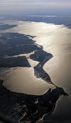
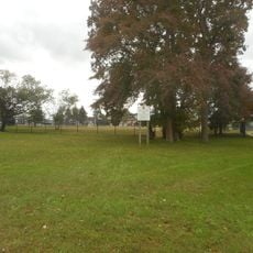
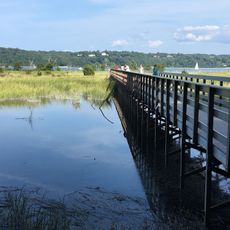
Oyster Bay National Wildlife Refuge is a marine protected area on the north shore of Long Island, New York, covering salt marshes, tidal flats, and estuarine waters. It sits near the historic Sagamore Hill estate and offers one of the few largely undeveloped stretches of coastline in this part of the state.

The refuge was founded in 1968 after the Town of Oyster Bay transferred the land to the federal government to protect the marine environment surrounding Theodore Roosevelt's former estate. It has since been managed by the U.S. Fish and Wildlife Service as part of a national network of protected lands.

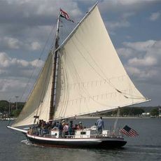
The waters here are home to one of the last working oyster farming operations on Long Island, a tradition tied closely to the coastal identity of the area. Visitors on the water can spot the floating oyster cages and small boats that keep this old practice going.

The refuge can only be reached by boat, as there are no roads or parking areas leading directly to it. Anyone planning to enter the shallow water zones should obtain a permit from the Town of Oyster Bay before visiting.

From October to April, more than 20,000 waterfowl gather here at the same time, including black ducks, scaup, and canvasback. The concentration is so dense during peak weeks that the water can appear nearly covered from a distance.

The community of curious travelers

AroundUs brings together thousands of curated places, local tips, and hidden gems, enriched daily by 60,000 contributors worldwide.

Start exploring
Location
Inception
1968
GPS coordinates
40.89180,-73.50790
Latest update
March 3, 2026 13:52
Around this place
Youngs Memorial Cemetery
United States of America

Youngs Memorial Cemetery

2.4 km
Caumsett State Historic Park
United States of America

Caumsett State Historic Park

5 km
Sagamore Hill
United States of America

Sagamore Hill

1.1 km
Raynham Hall Museum
United States of America

Raynham Hall Museum

3 km
Theodore Roosevelt Memorial Park
United States of America

Theodore Roosevelt Memorial Park

2.8 km
Christeen
United States of America

Christeen

3.1 km
United States of America

Bayville Bridge

3.6 km
Cold Spring Harbor Whaling Museum
United States of America

Cold Spring Harbor Whaling Museum

5 km
Cold Spring Harbor Light
United States of America

Cold Spring Harbor Light

2.8 km
Fort Hill Estate
United States of America

Fort Hill Estate

3.3 km
Fort Massapeag Archeological Site
United States of America

Fort Massapeag Archeological Site

3.5 km
Sagamore Hill
United States of America

Sagamore Hill

900 m
Moore's Building
United States of America

Moore's Building

2.8 km
Cold Spring Harbor Library
United States of America

Cold Spring Harbor Library

4.5 km
Hood A.M.E. Zion Church
United States of America

Hood A.M.E. Zion Church

3 km
Wilson House
United States of America

Wilson House

2.8 km
Seely/Wright House
United States of America

Seely/Wright House

3 km
Council Rock
United States of America

Council Rock

3.5 km
Derby-Hall Bandstand
United States of America

Derby-Hall Bandstand

2.9 km
Main Street Historic District
United States of America

Main Street Historic District

4.9 km
Charles Homer Davis House
United States of America

Charles Homer Davis House

4.5 km
Oyster Bay Bank Building
United States of America

Oyster Bay Bank Building

2.9 km
Shore Road Historic District
United States of America

Shore Road Historic District

4.4 km
Fleet's Hall
United States of America

Fleet's Hall

2.6 km
Ludlam Building
United States of America

Ludlam Building

2.9 km
Roosevelt Museum at Old Orchard
United States of America

Roosevelt Museum at Old Orchard

1.2 km
Lillian Sefton Dodge Estate
United States of America

Lillian Sefton Dodge Estate

4.6 km
Joseph Lloyd House
United States of America

Joseph Lloyd House

3.5 km
Show the full map
Reviews
Share your experience

No review yet

Discussions
Start a discussion...

No discussion yet

« Oyster Bay National Wildlife Refuge - Marine wildlife sanctuary in Nassau County, United States » is provided by Around Us (aroundus.com). Images and texts are derived from Wikimedia project under a Creative Commons license. You are allowed to copy, distribute, and modify copies of this page, under the conditions set by the license, as long as this note is clearly visible.

Discover hidden gems everywhere you go!

From secret cafés to breathtaking viewpoints, skip the crowded tourist spots and find places that match your style. Our app makes it easy with voice search, smart filtering, route optimization, and insider tips from travelers worldwide. Download now for the complete mobile experience.

Around Us App Screenshot

A unique approach to discovering new places

Le Figaro

All the places worth exploring

France Info

A tailor-made excursion in just a few clicks

20 Minutes

Around Us
Travel Guide & Maps
Download

Send to your phone

QR Code
1

Open the camera app on your mobile.

2

Point at the QR code with your camera. A notification will appear.

3

Tap the notification to open the link.