Enable Location

We need your location to show you interesting places around you

Discover nearby places

Find interesting locations and hidden gems around you

Precise directions

Get accurate directions and distances to places

Your location is never shared with other users. It's only used when you tap the location button.

Plummers Island

Log in to your account

Start exploring — it's free

Trusted by 62,370 travelers worldwide

Continue with Google
Continue with Apple
or

We will send you a code to connect

By continuing, you accept our Terms and Conditions and our Privacy Policy

Check your inbox

We've sent a pincode in your inbox. Please enter the code below.

Plummers Island

Plummers Island, River island in Montgomery County, Maryland, US.

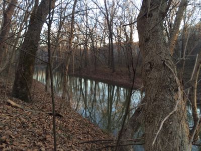
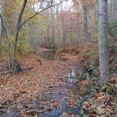
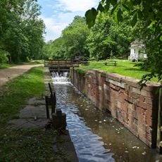
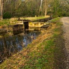
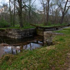
Plummers Island is a small island in the Potomac River between Little Falls and Great Falls in Montgomery County, Maryland. It provides researchers with a natural laboratory where thousands of plant and insect species can be observed in their natural habitat.

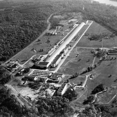
A research club purchased the island in the early 1900s to conduct scientific observations. Since then, it has developed into one of the oldest biological research sites in the country.

The place has developed special meaning for scientists as a research station where the diversity of plants and insects has been systematically observed for over a century. This continuous documentation has made it an archive of local ecosystems, showing how nature changes in this region.

The island is reachable only by boat, so visitors need to arrange water access beforehand. Those wishing to visit should coordinate with the researchers, as this is not a public tourist destination.

The island is known for the systematic documentation of its inhabitants, showing which animals and plants thrive in the Potomac River's forest areas. These records come from one of the earliest continuous ecological monitoring projects in North America.

The community of curious travelers

AroundUs brings together thousands of curated places, local tips, and hidden gems, enriched daily by 60,000 contributors worldwide.

Start exploring
Location
GPS coordinates
38.96940,-77.17640
Latest update
December 21, 2025 16:05
Around this place
Kryptos
United States of America

Kryptos

3.3 km
George Bush Center for Intelligence
United States of America

George Bush Center for Intelligence

3.4 km
CIA Memorial Wall
United States of America

CIA Memorial Wall

3.2 km
Hickory Hill
United States of America

Hickory Hill

3.1 km
Congressional Country Club
United States of America

Congressional Country Club

3 km
United States of America

Project CHATTER

7.9 km
David Taylor Model Basin
United States of America

David Taylor Model Basin

1.5 km
CIA Museum
United States of America

CIA Museum

3.2 km
TPC Potomac at Avenel Farm
United States of America

TPC Potomac at Avenel Farm

4.4 km
American Legion Memorial Bridge
United States of America

American Legion Memorial Bridge

291 m
Claude Moore Colonial Farm
United States of America

Claude Moore Colonial Farm

2.8 km
Union Arch Bridge
United States of America

Union Arch Bridge

2.5 km
Robert Llewellyn Wright House
United States of America

Robert Llewellyn Wright House

4.3 km
Scott's Run Nature Preserve
United States of America

Scott's Run Nature Preserve

2 km
Cabin John Creek
United States of America

Cabin John Creek

2.6 km
Virginia State Route 193
United States of America

Virginia State Route 193

2.4 km
Langley Fork Historic District
United States of America

Langley Fork Historic District

3 km
Seymour Krieger House
United States of America

Seymour Krieger House

3.6 km
Chautauqua Tower
United States of America

Chautauqua Tower

3.3 km
Carderock Springs Historic District
United States of America

Carderock Springs Historic District

2.3 km
Orthodox Church in America Diocese of Washington
United States of America

Orthodox Church in America Diocese of Washington

2.1 km
Clara Barton National Historic Site
United States of America

Clara Barton National Historic Site

3.1 km
Lock 7
United States of America

Lock 7

3.3 km
Lock 10
United States of America

Lock 10

744 m
Lock 8
United States of America

Lock 8

1.4 km
Lock 9
United States of America

Lock 9

877 m
Lock 14
United States of America

Lock 14

477 m
Washington Aqueduct Bridge No. 3
United States of America

Washington Aqueduct Bridge No. 3

731 m
Show the full map
« Plummers Island - River island in Montgomery County, Maryland, US » is provided by Around Us (aroundus.com). Images and texts are derived from Wikimedia project under a Creative Commons license. You are allowed to copy, distribute, and modify copies of this page, under the conditions set by the license, as long as this note is clearly visible.

Discover hidden gems everywhere you go!

From secret cafés to breathtaking viewpoints, skip the crowded tourist spots and find places that match your style. Our app makes it easy with voice search, smart filtering, route optimization, and insider tips from travelers worldwide. Download now for the complete mobile experience.

Around Us App Screenshot

A unique approach to discovering new places

Le Figaro

All the places worth exploring

France Info

A tailor-made excursion in just a few clicks

20 Minutes

Around Us
Travel Guide & Maps
Download

Send to your phone

QR Code
1

Open the camera app on your mobile.

2

Point at the QR code with your camera. A notification will appear.

3

Tap the notification to open the link.