Enable Location

We need your location to show you interesting places around you

Discover nearby places

Find interesting locations and hidden gems around you

Precise directions

Get accurate directions and distances to places

Your location is never shared with other users. It's only used when you tap the location button.

Pine Hill

Log in to your account

Start exploring — it's free

Trusted by 61,799 travelers worldwide

Continue with Google
Continue with Apple
or

We will send you a code to connect

By continuing, you accept our Terms and Conditions and our Privacy Policy

Check your inbox

We've sent a pincode in your inbox. Please enter the code below.

Pine Hill

Pine Hill, Mountain summit in Massachusetts, US.

Description

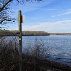
Pine Hill is a summit near Buzzards Bay that rises approximately 140 meters above the surrounding landscape. From the top, you can see across the coastline of Massachusetts and the bays beyond.

History

Ships entering Buzzards Bay used this summit as a navigation landmark from early colonial times onward. The distinct height made it a reliable reference point for seafarers traveling along this coast.

Culture

Local residents gather annually at Pine Hill for the September equinox celebration, maintaining a tradition dating back several generations.

Practical

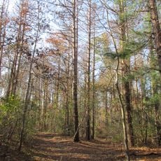
The hike starts from a parking area on the west side and follows marked trails that take roughly 45 minutes to reach the summit. The ground is easier to traverse in dry conditions, especially after rain when the paths can become slippery.

Did you know?

The rocks at the summit show clear signs of coastal erosion that help geologists understand long-term changes to the coastline. Close observation of the layered formations reveals how the shoreline has shifted over time.

Location
Part of
Buzzards Bay
GPS coordinates
41.70872,-70.56559
Latest update
December 12, 2025 07:53

AroundUs brings together thousands of curated places, local tips, and hidden gems, enriched daily by 60,000 contributors worldwide. Discover all places nearby (Massachusetts).

Around this place
Cape Cod Canal
United States of America

Cape Cod Canal

6.2 km
Sagamore Bridge
United States of America

Sagamore Bridge

7.7 km
Bourne Bridge
United States of America

Bourne Bridge

4.8 km
Cape Cod Canal Railroad Bridge
United States of America

Cape Cod Canal Railroad Bridge

5.4 km
Heritage Museums and Gardens
United States of America

Heritage Museums and Gardens

6.6 km
Sandwich Glass Museum
United States of America

Sandwich Glass Museum

7.8 km
Hoxie House
United States of America

Hoxie House

7.6 km
Massachusetts National Cemetery
United States of America

Massachusetts National Cemetery

4.2 km
Fort Banks
United States of America

Fort Banks

2 km
Shawme-Crowell State Forest
United States of America

Shawme-Crowell State Forest

6.6 km
Lowell Holly Reservation
United States of America

Lowell Holly Reservation

8.7 km
Doran Park
United States of America

Doran Park

4.1 km
First Church, Sandwich Massachusetts
United States of America

First Church, Sandwich Massachusetts

7.7 km
Wing's Neck Light
United States of America

Wing's Neck Light

8.4 km
Mashpee Wampanoag Indian Museum
United States of America

Mashpee Wampanoag Indian Museum

9.3 km
Jonathan Bourne Public Library
United States of America

Jonathan Bourne Public Library

4.6 km
Bourne Town Hall
United States of America

Bourne Town Hall

5.3 km
North Falmouth Village Historic District
United States of America

North Falmouth Village Historic District

8.2 km
Jarvesville Historic District
United States of America

Jarvesville Historic District

8.2 km
John and Mary Waterman Jarves House
United States of America

John and Mary Waterman Jarves House

8 km
Gypsy
United States of America

Gypsy

8.6 km
Avant House
United States of America

Avant House

9.3 km
George I. Briggs House
United States of America

George I. Briggs House

4.6 km
Spring Hill Historic District (Sandwich, Massachusetts)
United States of America

Spring Hill Historic District (Sandwich, Massachusetts)

8.9 km
Elnathan Nye House
United States of America

Elnathan Nye House

9.3 km
Town Hall Square Historic District
United States of America

Town Hall Square Historic District

7.7 km
Old Bourne High School building
United States of America

Old Bourne High School building

4.4 km
Cataumet Schoolhouse
United States of America

Cataumet Schoolhouse

5.6 km
Show the full map
« Pine Hill - Mountain summit in Massachusetts, US » is provided by Around Us (aroundus.com). Images and texts are derived from Wikimedia project under a Creative Commons license. You are allowed to copy, distribute, and modify copies of this page, under the conditions set by the license, as long as this note is clearly visible.

Discover hidden gems everywhere you go!

From secret cafés to breathtaking viewpoints, skip the crowded tourist spots and find places that match your style. Our app makes it easy with voice search, smart filtering, route optimization, and insider tips from travelers worldwide. Download now for the complete mobile experience.

Around Us App Screenshot

A unique approach to discovering new places

Le Figaro

All the places worth exploring

France Info

A tailor-made excursion in just a few clicks

20 Minutes

Around Us
Travel Guide & Maps
Download

Send to your phone

QR Code
1

Open the camera app on your mobile.

2

Point at the QR code with your camera. A notification will appear.

3

Tap the notification to open the link.